Geographical centre of Ireland
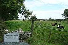
Farm at Carnagh East
Geographical centre of Ireland
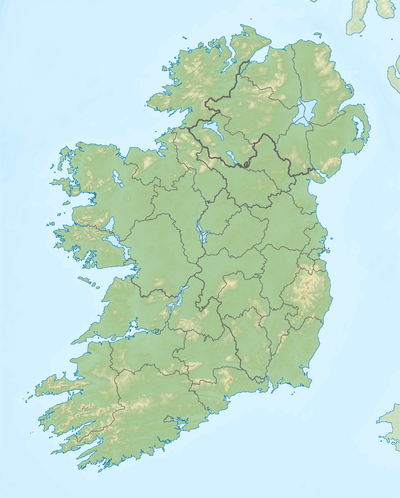
The geographical centre of Ireland is in the townland of Carnagh East (Irish: An Charnach Thoir), County Roscommon on the western shore of Lough Ree, where the 8° Meridian West meets the 53°30' North Latitude. It is opposite the Cribby Islands and 8.85 kilometres NNW of Athlone Town.[1] Lecarrow is the closest population centre.
In Irish mythology, The Hill of Uisneach (which is on the road from Mullingar to Athlone, about 17.7 kilometres west of Mullingar and two kilometres from the village of Loughanavally) was generally considered to be the ceremonial centre of Ireland, though at times the Hill of Tara was also regarded in a similar manner. Up to 2007, a fire was lit every May Day and a Mass was celebrated on the hill of Uisneach.[2]
References
- ↑ Irish Ordnance Survey faq Archived February 28, 2012, at the Wayback Machine.
- ↑ Geography of Ireland; facts
This article is issued from
Wikipedia.
The text is licensed under Creative Commons - Attribution - Sharealike.
Additional terms may apply for the media files.