Cormainville
| Cormainville | |
|---|---|
| Commune | |
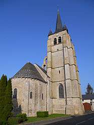 | |
 Cormainville Location within Centre-Val de Loire region  Cormainville | |
| Coordinates: 48°08′17″N 1°36′28″E / 48.1381°N 1.6078°ECoordinates: 48°08′17″N 1°36′28″E / 48.1381°N 1.6078°E | |
| Country | France |
| Region | Centre-Val de Loire |
| Department | Eure-et-Loir |
| Arrondissement | Châteaudun |
| Canton | Voves |
| Intercommunality | Beauce d'Orgères |
| Government | |
| • Mayor (2008–2014) | Jean-Luc Legrand |
| Area1 | 17.83 km2 (6.88 sq mi) |
| Population (2008)2 | 227 |
| • Density | 13/km2 (33/sq mi) |
| Time zone | UTC+1 (CET) |
| • Summer (DST) | UTC+2 (CEST) |
| INSEE/Postal code | 28108 /28140 |
| Elevation |
113–138 m (371–453 ft) (avg. 139 m or 456 ft) |
|
1 French Land Register data, which excludes lakes, ponds, glaciers > 1 km2 (0.386 sq mi or 247 acres) and river estuaries. 2 Population without double counting: residents of multiple communes (e.g., students and military personnel) only counted once. | |
Cormainville is a commune in the Eure-et-Loir department in northern France.
Population
| Historical population | ||
|---|---|---|
| Year | Pop. | ±% |
| 1962 | 285 | — |
| 1968 | 312 | +9.5% |
| 1975 | 290 | −7.1% |
| 1982 | 219 | −24.5% |
| 1990 | 185 | −15.5% |
| 1999 | 192 | +3.8% |
| 2008 | 227 | +18.2% |
Economy

See also
References
- ↑ "Cormainville windfarm, France". World Wind Power Database. Retrieved 2008-12-02.
| Wikimedia Commons has media related to Cormainville. |
This article is issued from
Wikipedia.
The text is licensed under Creative Commons - Attribution - Sharealike.
Additional terms may apply for the media files.