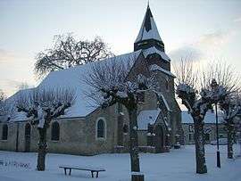
Berchères-sur-Vesgre
| Berchères-sur-Vesgre | ||
|---|---|---|
| Commune | ||
 | ||
| ||
 Berchères-sur-Vesgre Location within Centre-Val de Loire region  Berchères-sur-Vesgre | ||
| Coordinates: 48°50′31″N 1°32′29″E / 48.8419°N 1.5414°ECoordinates: 48°50′31″N 1°32′29″E / 48.8419°N 1.5414°E | ||
| Country | France | |
| Region | Centre-Val de Loire | |
| Department | Eure-et-Loir | |
| Arrondissement | Dreux | |
| Canton | Anet | |
| Intercommunality | Les Villages du Drouais | |
| Government | ||
| • Mayor (2008–2014) | Pascal Philippot | |
| Area1 | 11.99 km2 (4.63 sq mi) | |
| Population (2008)2 | 840 | |
| • Density | 70/km2 (180/sq mi) | |
| Time zone | UTC+1 (CET) | |
| • Summer (DST) | UTC+2 (CEST) | |
| INSEE/Postal code | 28036 /28260 | |
| Elevation |
77–167 m (253–548 ft) (avg. 167 m or 548 ft) | |
|
1 French Land Register data, which excludes lakes, ponds, glaciers > 1 km2 (0.386 sq mi or 247 acres) and river estuaries. 2 Population without double counting: residents of multiple communes (e.g., students and military personnel) only counted once. | ||
.svg.png)
Berchères-sur-Vesgre is a commune in the Eure-et-Loir department in northern France.
Population
| Historical population | ||
|---|---|---|
| Year | Pop. | ±% |
| 1962 | 361 | — |
| 1968 | 428 | +18.6% |
| 1975 | 485 | +13.3% |
| 1982 | 648 | +33.6% |
| 1990 | 684 | +5.6% |
| 1999 | 712 | +4.1% |
| 2008 | 840 | +18.0% |
See also
References
External links
| Wikimedia Commons has media related to Berchères-sur-Vesgre. |
This article is issued from
Wikipedia.
The text is licensed under Creative Commons - Attribution - Sharealike.
Additional terms may apply for the media files.