Pontgouin
| Pontgouin | ||
|---|---|---|
| Commune | ||
 | ||
| ||
 Pontgouin Location within Centre-Val de Loire region  Pontgouin | ||
| Coordinates: 48°28′52″N 1°09′43″E / 48.4811°N 1.1619°ECoordinates: 48°28′52″N 1°09′43″E / 48.4811°N 1.1619°E | ||
| Country | France | |
| Region | Centre-Val de Loire | |
| Department | Eure-et-Loir | |
| Arrondissement | Chartres | |
| Canton | Illiers-Combray | |
| Intercommunality | Pays Courvillois | |
| Government | ||
| • Mayor (2008–2014) | Claudine Champion | |
| Area1 | 25.16 km2 (9.71 sq mi) | |
| Population (2088)2 | 1,015 | |
| • Density | 40/km2 (100/sq mi) | |
| Time zone | UTC+1 (CET) | |
| • Summer (DST) | UTC+2 (CEST) | |
| INSEE/Postal code | 28302 /28190 | |
| Elevation |
173–273 m (568–896 ft) (avg. 192 m or 630 ft) | |
|
1 French Land Register data, which excludes lakes, ponds, glaciers > 1 km2 (0.386 sq mi or 247 acres) and river estuaries. 2 Population without double counting: residents of multiple communes (e.g., students and military personnel) only counted once. | ||

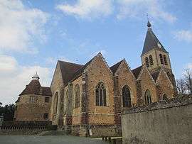
Pontgouin is a commune in the Eure-et-Loir department in northern France.
Population
| Historical population | ||
|---|---|---|
| Year | Pop. | ±% |
| 1962 | 922 | — |
| 1968 | 936 | +1.5% |
| 1975 | 1,389 | +48.4% |
| 1982 | 833 | −40.0% |
| 1990 | 854 | +2.5% |
| 1999 | 875 | +2.5% |
| 2008 | 1,015 | +16.0% |
See also
References
| Wikimedia Commons has media related to Pontgouin. |
This article is issued from
Wikipedia.
The text is licensed under Creative Commons - Attribution - Sharealike.
Additional terms may apply for the media files.