Rouvray-Saint-Denis
| Rouvray-Saint-Denis | |
|---|---|
| Commune | |
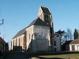 The church of Saint Denis | |
 Rouvray-Saint-Denis Location within Centre-Val de Loire region  Rouvray-Saint-Denis | |
| Coordinates: 48°16′44″N 1°56′43″E / 48.2789°N 1.9453°ECoordinates: 48°16′44″N 1°56′43″E / 48.2789°N 1.9453°E | |
| Country | France |
| Region | Centre-Val de Loire |
| Department | Eure-et-Loir |
| Arrondissement | Chartres |
| Canton | Voves |
| Intercommunality | Beauce de Janville |
| Government | |
| • Mayor (2001–2008) | Jean-Jacques Germain |
| Area1 | 19.35 km2 (7.47 sq mi) |
| Population (2008)2 | 435 |
| • Density | 22/km2 (58/sq mi) |
| Time zone | UTC+1 (CET) |
| • Summer (DST) | UTC+2 (CEST) |
| INSEE/Postal code | 28319 /28310 |
| Elevation |
129–147 m (423–482 ft) (avg. 138 m or 453 ft) |
|
1 French Land Register data, which excludes lakes, ponds, glaciers > 1 km2 (0.386 sq mi or 247 acres) and river estuaries. 2 Population without double counting: residents of multiple communes (e.g., students and military personnel) only counted once. | |
Rouvray-Saint-Denis is a commune in the Eure-et-Loir department in northern France.
History
It has long been thought that it was the site of the Battle of the Herrings in 1429, when Sir John Fastolf beat off an attack on an English convoy taking supplies to the siege of Orléans; but in his biography of Fastolf, The Real Falstaff, Stephen Cooper argues that the battle is more likely to have taken place at Rouvray-Sainte-Croix.
Population
| Historical population | ||
|---|---|---|
| Year | Pop. | ±% |
| 1962 | 385 | — |
| 1968 | 358 | −7.0% |
| 1975 | 308 | −14.0% |
| 1982 | 309 | +0.3% |
| 1990 | 326 | +5.5% |
| 1999 | 359 | +10.1% |
| 2008 | 435 | +21.2% |
See also
References
| Wikimedia Commons has media related to Rouvray-Saint-Denis. |
This article is issued from
Wikipedia.
The text is licensed under Creative Commons - Attribution - Sharealike.
Additional terms may apply for the media files.