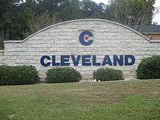
Cleveland, Texas
| Cleveland | |
|---|---|
| City | |
| City of Cleveland | |
 | |
| Nickname(s): C Town | |
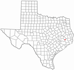 Location in the state of Texas | |
 | |
| Coordinates: 30°20′42″N 95°05′01″W / 30.34500°N 95.08361°WCoordinates: 30°20′42″N 95°05′01″W / 30.34500°N 95.08361°W | |
| Country | United States |
| State | Texas |
| County | Liberty |
| Incorporated | 1935 |
| Area | |
| • Total | 4.8 sq mi (12.5 km2) |
| • Land | 4.8 sq mi (12.5 km2) |
| • Water | 0.0 sq mi (0.0 km2) |
| Elevation | 150 ft (45.7 m) |
| Population (2000)[1] | |
| • Total | 7,605 |
| • Density | 615.8/sq mi (238.9/km2) |
| Time zone | UTC-6 (CST) |
| • Summer (DST) | UTC-5 (CDT) |
| ZIP codes | 77327-77328 |
| Area code(s) | 281/346/713/832 |
| FIPS code | 48-15436[2] |
| GNIS feature ID | 1381199[3] |
| Website | Official website |
Cleveland is a city in the U.S. state of Texas, within Houston–The Woodlands–Sugar Land metropolitan area and Liberty County. The population was 7,954 at the 2010 census.
History
In 1854, a church and convent was built by Father Peter La Cour near the town's present site. The town began forming in 1878 when Charles Lander Cleveland, a local judge, donated 63.6 acres (257,000 m2) of land to the Houston East & West Texas Railway (now part of the Union Pacific Railroad) for use as a stop, requesting that the town be named for him. Since 1900 Cleveland has served as the junction of this line and the Gulf, Colorado and Santa Fe (now the BNSF Railway). The town was not incorporated until 1935.
The forests around Cleveland, including Sam Houston National Forest, which is located just to its north, are a resort for many inhabitants of the Houston area, who come to camp, hike, hunt, and fish. Cleveland has several historic sites and public recreational facilities, including two parks. The Austin Memorial Library Center offers a wide range of services to the community, and the Texan Theater and the annual livestock show and rodeo, Dairy Days, provide entertainment. Commercially, Cleveland has been a shipping point for timber, lumber, and lumber byproducts since the 1870s. A large medical community, oil, gas, cattle, farm products, and sand and gravel are important to the town's economy. The general trend toward urbanization of the entire area is reflected by the fact that in 1965 Liberty County was added to the Houston Standard Metropolitan Statistical Area. The population of Cleveland grew from 1,200 in 1930 to 7,605 according to the census[2] of 2000.
2010 rapes
Twenty-one men and boys were convicted in 2013 for the gang rape of an 11-year-old girl,[4] on at least six occasions between September 15 and December 3, 2010. Arrested in early 2011, the perpetrators were identified from cell-phone video they had recorded of the attacks;[5] the recordings were found by authorities at Cleveland High School.[4][6][7][8] After the arrests, the victim's family was harassed,[9] and residents, including relatives of the perpetrators, were quoted in media reports blaming the victim.[10][11] The New York Times was criticized for having done the same.[12][13] The newspaper subsequently published a clarification.[14]
After jury trials, one man received a life sentence and another was sentenced to 99 years. Eleven men pleaded guilty to sexual assault of a child and received 15-year sentences.[4] One pleaded guilty to indecency with a child by exposure and received a seven-year sentence.[15] Seven male juveniles entered guilty pleas and received seven years' probation.[4][15]
Geography and climate
According to the United States Census Bureau, the city has a total area of 4.8 square miles (12 km2), all land. Cleveland's northern boundary is made by the Sam Houston National Forest. The climate is characterized by hot, humid summers and generally mild to cool winters. According to the Köppen Climate Classification system, Cleveland has a humid subtropical climate, abbreviated "Cfa" on climate maps.[16]
Demographics
| Historical population | |||
|---|---|---|---|
| Census | Pop. | %± | |
| 1930 | 1,422 | — | |
| 1940 | 1,783 | 25.4% | |
| 1950 | 5,183 | 190.7% | |
| 1960 | 5,838 | 12.6% | |
| 1970 | 5,627 | −3.6% | |
| 1980 | 5,977 | 6.2% | |
| 1990 | 7,124 | 19.2% | |
| 2000 | 7,605 | 6.8% | |
| 2010 | 7,675 | 0.9% | |
| Est. 2016 | 8,127 | [17] | 5.9% |
| U.S. Decennial Census[18] | |||


As of the 2010 census Cleveland had a population of 7,675. The racial and ethnic makeup of the population was 45.7% non-Hispanic white, 23.7% non-Hispanic black, 1.3% Asian, 13.0% some other race, 2.5% from two or more races and 27.8% Hispanic or Latino.[19]
As of the census[2] of 2000, there were 7,605 people, 2,645 households, and 1,758 families residing in the city. The population density was 1,580.5 people per square mile (610.5/km²). There were 2,976 housing units at an average density of 618.5 per square mile (238.9/km²). The racial makeup of the city was 58.65% White, 27.13% African American, 0.33% Native American, 0.59% Asian, 11.58% from other races, and 1.72% from two or more races. Hispanic or Latino of any race were 20.51% of the population.
There were 2,645 households out of which 34.0% had children under the age of 18 living with them, 42.4% were married couples living together, 19.0% had a female householder with no husband present, and 33.5% were non-families. 29.2% of all households were made up of individuals and 13.9% had someone living alone who was 65 years of age or older. The average household size was 2.63 and the average family size was 3.27.
In the city, the population was spread out with 27.4% under the age of 18, 10.7% from 18 to 24, 29.6% from 25 to 44, 18.3% from 45 to 64, and 14.0% who were 65 years of age or older. The median age was 33 years. For every 100 females, there were 101.0 males. For every 100 females age 18 and over, there were 101.7 males.
The median income for a household in the city was $24,164, and the median income for a family was $28,527. Males had a median income of $28,385 versus $17,889 for females. The per capita income for the city was $13,562. About 19.3% of families and 22.4% of the population were below the poverty line, including 31.8% of those under age 18 and 16.1% of those age 65 or over.
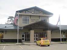
Government
Cleveland operates under the Council-Manager form of government. Under this system, the Mayor and five Council members appoint the city manager, who acts as the chief executive officer of the government. The city manager carries out policy and administers city programs. All department heads, including the city attorney, police chief and fire chief, are ultimately responsible to the city manager. All city council positions are officially nonpartisan. The city operates and maintains the following divisions:
- Administration
- Police
- Fire/EMS
- Water and Sewer Utilities
- Streets
- Building Inspection and Code Enforcement
- Library
- Parks
- Airport
- Cemetery
The Cleveland Unit, a prison for men privately operated by the GEO Group, Inc. on behalf of the Texas Department of Criminal Justice, is in the city, 0.25 miles (0.40 km) from downtown Cleveland.[20]
Education
The city served by the Cleveland Independent School District. The Tarkington Independent School District, located east southeast of the city of Cleveland, also has a Cleveland zipcode.
Transportation
Highways
The major route traveling through Cleveland is U.S. Highway 59, soon to be renamed Interstate 69, traveling southwest towards Houston and northeast into East Texas. U.S. 59 goes through the cities of Livingston, Lufkin, and Nacogdoches, and onward to Texarkana, Texas. US 59 is designated as the TTC-I-69 Corridor. U.S. Highway 59 Business is the original route of US 59, which runs north and south through the center of Cleveland, known locally as Washington Avenue and Loop 573. A current limited access bypass for US 59 was created due to traffic densities in downtown Cleveland that rivaled those of many large cities. SH 105 travels east and west, and Cleveland is roughly the halfway point between Beaumont and Navasota. SH 105 runs concurrently with SH 321 until SH 105 splits, going eastbound to Beaumont; while SH 321 continues roughly 20 miles (32 km) further south into Dayton. Construction was recently completed on a loop coming off SH 105 near Pin Oak Road, along the southern side of Cleveland, crossing I 69 and FM 1010, and terminating at SH 321 near New Salem Road.
Railroads
Cleveland is the meeting point of two rail lines. One is a north/south Union Pacific line that closely follows the path of IH 69. The other is an east/west Burlington Northern Santa Fe line that roughly follows FM 787 to the east, and SH 105 west towards Conroe. Union Tank Car Company has a tank repair/maintenance facility along the BNSF line on the outskirts of Cleveland off of FM 787.
Airports
Cleveland Municipal Airport, a general aviation airport, is in Cleveland. George Bush Intercontinental Airport in Houston is the closest airport with commercial airline service.
Notable people
- Gib Lewis, a Speaker of the Texas House of Representatives, spent his formative years in Cleveland. He graduated from Cleveland High School in 1955 and enrolled at Sam Houston State College ( Sam Houston State University ) in Huntsville, Texas located in East Texas' Walker County. Elected Speaker for the first time in 1983, Lewis became the first to hold that office for five terms.
- Jason Grimsley was born in Cleveland and went to school in Tarkington ISD, just east of town on State Hwy 321. Grimsley pitched for the following teams: Philadelphia Phillies, Cleveland Indians, Anaheim Angels, New York Yankees, Kansas City Royals, Baltimore Orioles and Arizona Diamondbacks.
- Danny Roberts was born and reared in Cleveland. He graduated from Cleveland High School in 1960, where he set state records in shot put and discus. Roberts enrolled at Texas A&M University in College Station, Texas located about 90 miles northwest of Houston. A track letterman in 1962, 1963 and 1964, Roberts won two Southwest Conference shot put titles and two discus crowns. Named the athlete of year in 1963, he was also dubbed the team’s most valuable athlete in 1962 and 1963. Voted team captain in 1964, Roberts went on to win the national indoor Masters titles in shot put and weight throw. Roberts was inducted into the Texas A&M Hall of Fame in 1989.
References
- ↑ "US Census Bureau Population Finder: Baytown city, TX". factfinder.census.gov. Retrieved 2007-07-01.
- 1 2 3 "American FactFinder". United States Census Bureau. Archived from the original on 2013-09-11. Retrieved 2008-01-31.
- ↑ "US Board on Geographic Names". United States Geological Survey. 2007-10-25. Retrieved 2008-01-31.
- 1 2 3 4 Horswell, Cindy (October 11, 2013). "21st assailant sentenced in Cleveland gang rape". Houston Chronicle.
- ↑ McKinley, James C. and Goode, Erica (March 28, 2011). "3-Month Nightmare Emerges in Rape Inquiry". The New York Times.
- ↑ Edecio Martinez (April 5, 2011). "Cleveland, Texas gang rape suspects appear in court". CBS News.
- ↑ James C. McKinley Jr. (March 8, 2011). "Vicious Assault Shakes Texas Town". The New York Times. Retrieved March 10, 2011.
- ↑ "Gang Rape of 11-year-old Girl Recorded on Cell Phones". Los Angeles Times. March 9, 2011. Retrieved March 10, 2011.
- ↑ Cindy Horswell (March 7, 2011). "Girl's sex assault rocks Cleveland". Houston Chronicle. Retrieved March 10, 2011.
- ↑ Cindy Horswell (March 12, 2011). "Attorney: Suspects knew rape victim was 11". Houston Chronicle. Retrieved May 28, 2011.
- ↑ Juan Lozano (Associated Press) (March 11, 2011). "Some in Texas town blaming young girl in assault". Houston Chronicle. Retrieved March 17, 2011.
- ↑ Mac McClelland (March 9, 2011). "The New York Times' Rape-Friendly Reporting". Mother Jones. Retrieved March 10, 2011.
- ↑ Libby Copeland (March 9, 2011). "Reporting on a Gang Rape in East Texas". Slate. Retrieved March 10, 2011.
- ↑ Arthur S. Brisbane (11 March 2011). "Gang Rape Story Lacked Balance". The New York Times.
- 1 2 Angelica Leicht (December 19, 2014). "Why Does Quanell X Support Some Rape Victims But Shame Others?". Houston Press. Retrieved December 13, 2016.
- ↑ Climate Summary for Cleveland, Texas
- ↑ "Population and Housing Unit Estimates". Retrieved June 9, 2017.
- ↑ "Census of Population and Housing". Census.gov. Archived from the original on May 12, 2015. Retrieved June 4, 2015.
- ↑ 2010 general profile of population and housing characteriticis from the US census for Cleveland
- ↑ "Cleveland Unit Archived 2010-07-25 at the Wayback Machine.." Texas Department of Criminal Justice. Retrieved on May 10, 2010.
External links
| Counties | 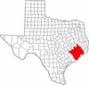 | |
|---|---|---|
| "Principal" cities | ||
| Other cities |
For a complete listing, see list of cities and towns in Houston–The Woodlands–Sugar Land MSA | |
| Unincorporated areas | ||
| Bodies of water | ||
Municipalities and communities of Liberty County, Texas, United States | ||
|---|---|---|
| Cities |  | |
| Town | ||
| CDPs | ||
| Other unincorporated communities | ||
| Footnotes | ‡This populated place also has portions in an adjacent county or counties | |