Chevy Chase Village, Maryland
| Chevy Chase Village, Maryland | |
|---|---|
| Town | |
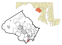 Location of Chevy Chase Village within Montgomery County, Maryland (click to enlarge). | |
| Coordinates: 38°58′10″N 77°4′44″W / 38.96944°N 77.07889°WCoordinates: 38°58′10″N 77°4′44″W / 38.96944°N 77.07889°W | |
| Country |
|
| State |
|
| County |
|
| Incorporated | 1910[1] |
| Government | |
| • Village Manager | Shana Davis-Cook |
| Area[2] | |
| • Total | 0.42 sq mi (1.09 km2) |
| • Land | 0.42 sq mi (1.09 km2) |
| • Water | 0 sq mi (0 km2) |
| Elevation | 341 ft (104 m) |
| Population (2010)[3] | |
| • Total | 1,953 |
| • Estimate (2016)[3] | 2,062 |
| • Density | 4,700/sq mi (1,800/km2) |
| Time zone | UTC-5 (EST) |
| • Summer (DST) | UTC-4 (EDT) |
| Area code(s) | 301 |
| FIPS code | 24-16787 |
| GNIS feature ID | 1669429 |
| Website |
www |
Chevy Chase Village, Maryland is an incorporated municipality in Montgomery County, Maryland, bordering Washington, D.C. It is made up of sections 1, 1a, and 2 of Chevy Chase, Maryland, as originally designated by The Chevy Chase Land Company.[4] The United States Census Bureau estimates its population to be 2,062 as of July 1, 2016.[3] The town is the richest in Maryland, with a median income of "over $250,000", the highest income bracket listed by the census bureau, and a median home value of $1,823,800.[5]
Chevy Chase Village includes 721 homes.[6] It is known for its speed limit enforcement actions, which produce 24% of its annual revenue.[7] The population has historically been over 95% white, while the non-white residents are mostly transient.[8] Chevy Chase Village also includes Chevy Chase Club, a private country club with an initiation fee of over $50,000.[8]
Geography
Chevy Chase Village is located at 38°58′10″N 77°4′44″W / 38.96944°N 77.07889°W (38.969560, -77.078967).[2] and has a total area of 0.42 square miles (1.09 km2), all of it land.
History
Chevy Chase Village was created in 1890 as a streetcar suburb. In 1914, it became a special taxing area. It was incorporated in 1951.[6]
Government
The village is managed by a board of managers, which consists of 7 elected officials.[9]
The village has its own police department.[9]
Approximately 46% of the village's revenue is from income taxes, 20% is from property taxes, and 24% is from citations from speed limit enforcement.[7]
Demographics
| Historical population | |||
|---|---|---|---|
| Census | Pop. | %± | |
| 1960 | 2,405 | — | |
| 1970 | 2,265 | −5.8% | |
| 1980 | 2,118 | −6.5% | |
| 1990 | 749 | −64.6% | |
| 2000 | 2,043 | 172.8% | |
| 2010 | 1,953 | −4.4% | |
| Est. 2016 | 2,062 | [3] | 5.6% |
2010 census
As of the census of 2010,[3] there were 1,953 people, 697 households, and 609 families residing in the town. The population density was 4,650.0 inhabitants per square mile (1,795.4/km2). There were 726 housing units at an average density of 1,728.6 per square mile (667.4/km2). The racial makeup of the town was 95.9% White, 0.6% African American, 0.2% Native American, 1.6% Asian, 0.5% from other races, and 1.3% from two or more races. Hispanic or Latino of any race were 2.8% of the population.
There were 697 households of which 36.9% had children under the age of 18 living with them, 82.2% were married couples living together, 3.9% had a female householder with no husband present, 1.3% had a male householder with no wife present, and 12.6% were non-families. 11.2% of all households were made up of individuals and 7% had someone living alone who was 65 years of age or older. The average household size was 2.80 and the average family size was 2.99.
The median age in the town was 49.1 years. 26.4% of residents were under the age of 18; 3.6% were between the ages of 18 and 24; 13.5% were from 25 to 44; 36.3% were from 45 to 64; and 20% were 65 years of age or older. The gender makeup of the town was 48.5% male and 51.5% female.
2000 census
As of the census[3] of 2000, there were 2,043 people, 704 households, and 601 families residing in the town. The population density was 4,943.6 people per square mile (1,923.9/km²). There were 718 housing units at an average density of 1,737.4 per square mile (676.1/km²). The racial makeup of the town was 95.64% White, 0.69% African American, 1.62% Asian, 0.59% from other races, and 1.47% from two or more races. Hispanic or Latino of any race were 1.71% of the population.
There were 704 households out of which 43.3% had children under the age of 18 living with them, 79.5% were married couples living together, 4.7% had a female householder with no husband present, and 14.5% were non-families. 12.5% of all households were made up of individuals and 8.9% had someone living alone who was 65 years of age or older. The average household size was 2.90 and the average family size was 3.11 people per household.
In the town, the population was spread out with 29.0% under the age of 18, 4.0% from 18 to 24, 14.5% from 25 to 44, 38.2% from 45 to 64, and 14.2% who were 65 years of age or older. The median age was 46 years. For every 100 females, there were 98.7 males. For every 100 females age 18 and over, there were 90.2 males.
The median income for a household in the town was in excess of $200,000, as is the median income for a family. Males had a median income of over $100,000 versus $76,067 for females. The per capita income for the town was $95,174. About 1.3% of families and 2.0% of the population were below the poverty line, including 2.8% of those under age 18 and none of those age 65 or over.
Education
Chevy Chase Village is served by the Montgomery County Public Schools system.
Residents are zoned to Rosemary Hills Elementary School (PreK-2) (Unincorporated Montgomery County) and Chevy Chase Elementary School (3-6) (in the town of Chevy Chase). Some residents are zoned to Somerset Elementary School (K-5) (in Somerset, Maryland.
All residents are zoned to Westland Middle School and Bethesda-Chevy Chase High School, located in unincorporated Montgomery County.
Notable residents
Current residents
- Ann Brashares - author[8]
- Chris Matthews - commentator
- George Will - conservative commentator[8]
- Jerome Powell - Chairman of the Federal Reserve Board of Governors
- John Roberts - Chief Justice of the United States [8]
- Mark Shields - political columnist[8]
- Marvin Kalb - journalist[8]
Former residents
- David Brinkley - journalist[10]
- Sandra Day O'Connor - United States Supreme Court Justice; lived in Chevy Chase Village until 2005
References
- ↑ "Chevy Chase Village". Government of Maryland.
- 1 2 "US Gazetteer files: 2010, 2000, and 1990". United States Census Bureau. February 12, 2011.
- 1 2 3 4 5 6 "FactFinder: Chevy Chase Village". United States Census Bureau.
- ↑ "Village History - Chevy Chase Village Section 3".
- ↑ Quinn, Morgan (June 14, 2017). "The wealthiest city in each US state". Business Insider.
- 1 2 "About the Village". Chevy Chase Village.
- 1 2 "General Funds and SafeSpeed Budgets Proposed for Board Adoption on April 17, 2017". Chevy Chase Village.
- 1 2 3 4 5 6 7 Neate, Rupert (December 4, 2015). "Chevy Chase, Maryland: the super-rich town that has it all – except diversity". The Guardian.
- 1 2 "Village Government". Chevy Chase Village.
- ↑ Lerner, Michele (June 10, 2010). "Luxury home: Brinkley's Chevy Chase estate impresses". The Washington Times.
External links
| Wikimedia Commons has media related to Chevy Chase Village, Maryland. |
Municipalities and communities of Montgomery County, Maryland, United States | ||
|---|---|---|
| Cities | 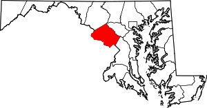 | |
| Towns | ||
| Villages & Special Tax Districts | ||
| CDPs |
| |
| Unincorporated communities | ||
| Footnotes | ‡This populated place also has portions in an adjacent county or counties | |