Spencerville, Maryland
| Spencerville, Maryland | |
|---|---|
| census-designated place | |
 | |
| Coordinates: 39°06′51″N 76°58′42″W / 39.11417°N 76.97833°WCoordinates: 39°06′51″N 76°58′42″W / 39.11417°N 76.97833°W | |
| Country |
|
| State |
|
| County |
|
| Area[1] | |
| • Total | 1.560 sq mi (4.04 km2) |
| • Land | 1.557 sq mi (4.03 km2) |
| • Water | 0.003 sq mi (0.008 km2) |
| Elevation | 499 ft (152 m) |
| Population [1] | |
| • Total | 1,594 |
| • Density | 1,000/sq mi (390/km2) |
| Time zone | UTC−5 (Eastern (EST)) |
| • Summer (DST) | UTC−4 (EDT) |
| ZIP code | 20868 |
| Area code(s) | 240 & 301 |
| GNIS feature ID | 591326[2] |
Spencerville is an unincorporated community and census-designated place in Montgomery County, Maryland, United States. Spencerville is 1 mile (1.6 km) north of Cloverly. Spencerville has a post office with ZIP code 20868.[3]
References
| Wikimedia Commons has media related to Spencerville, Maryland. |
- 1 2 "U.S. Gazetter Files". US Census Bureau. Retrieved 6 December 2013.
- ↑ U.S. Geological Survey Geographic Names Information System: Spencerville, Maryland
- ↑ "Free ZIP Code Lookup with area code, county, geocode, MSA/PMSA, population". www.zipinfo.com.
Municipalities and communities of Montgomery County, Maryland, United States | ||
|---|---|---|
| Cities | 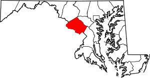 | |
| Towns | ||
| Villages & Special Tax Districts | ||
| CDPs |
| |
| Unincorporated communities | ||
| Footnotes | ‡This populated place also has portions in an adjacent county or counties | |
This article is issued from
Wikipedia.
The text is licensed under Creative Commons - Attribution - Sharealike.
Additional terms may apply for the media files.