Chevy Chase (town), Maryland
| Chevy Chase, Maryland | |
|---|---|
| Town | |
| Town of Chevy Chase | |
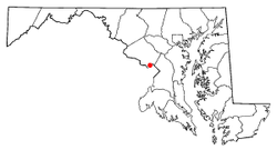 Location of Chevy Chase, Maryland | |
| Coordinates: 38°58′50″N 77°5′2″W / 38.98056°N 77.08389°WCoordinates: 38°58′50″N 77°5′2″W / 38.98056°N 77.08389°W | |
| Country |
|
| State |
|
| County |
|
| Incorporated | 1918[1] |
| Named for | Chevy Chase Land Company |
| Government | |
| • Mayor | Barney Rush |
| Area[2] | |
| • Total | 0.47 sq mi (1.22 km2) |
| • Land | 0.47 sq mi (1.22 km2) |
| • Water | 0 sq mi (0 km2) |
| Population (2010)[3] | |
| • Total | 2,824 |
| • Estimate (2016)[4] | 2,989 |
| • Density | 6,000/sq mi (2,300/km2) |
| Time zone | UTC-5 (Eastern (EST)) |
| • Summer (DST) | UTC-4 (EDT) |
| ZIP codes | 20813, 20815, 20825 |
| Area code(s) | 301 |
| FIPS code | 24-16620 |
| Website | Town of Chevy Chase |
Chevy Chase is an incorporated town in Montgomery County, Maryland, United States. The population was 2,824 at the 2010 census.
Geography
The town of Chevy Chase is located at 38°58′50″N 77°5′1″W / 38.98056°N 77.08361°W (38.98061, -77.083822).[5]
According to the United States Census Bureau, the town of Chevy Chase has a total area of 0.47 square miles (1.22 km2), all of it land.[2]
Demographics
| Historical population | |||
|---|---|---|---|
| Census | Pop. | %± | |
| 1950 | 1,971 | — | |
| 1960 | 2,243 | 13.8% | |
| 1970 | 2,266 | 1.0% | |
| 1980 | 2,903 | 28.1% | |
| 1990 | 2,675 | −7.9% | |
| 2000 | 2,726 | 1.9% | |
| 2010 | 2,824 | 3.6% | |
| Est. 2016 | 2,989 | [4] | 5.8% |
| U.S. Decennial Census[6] | |||
2010 census
As of the census[3] of 2010, there were 2,824 people, 1,003 households, and 835 families residing in the town. The population density was 6,008.5 inhabitants per square mile (2,319.9/km2). There were 1,042 housing units at an average density of 2,217.0 per square mile (856.0/km2). The racial makeup of the town was 92.1% White, 1.0% African American, 0.1% Native American, 3.9% Asian, 0.7% from other races, and 2.2% from two or more races. Hispanic or Latino of any race were 4.7% of the population.
There were 1,003 households of which 41.5% had children under the age of 18 living with them, 75.0% were married couples living together, 6.2% had a female householder with no husband present, 2.1% had a male householder with no wife present, and 16.7% were non-families. 13.6% of all households were made up of individuals and 7.6% had someone living alone who was 65 years of age or older. The average household size was 2.82 and the average family size was 3.06.
The median age in the town was 46.3 years. 27.5% of residents were under the age of 18; 4.7% were between the ages of 18 and 24; 15.8% were from 25 to 44; 37.5% were from 45 to 64; and 14.4% were 65 years of age or older. The gender makeup of the town was 48.1% male and 51.9% female.
2000 census
As of the census[7] of 2000, there were 2,726 people, 987 households, and 802 families residing in the town. The population density was 5,822.9 people per square mile (2,239.4/km²). There were 1,024 housing units at an average density of 2,187.3 per square mile (841.2/km²). The racial makeup of the town was 95.01% White, 0.88% Black or African American, 0.04% Native American, 2.20% Asian, 0.04% Pacific Islander, 0.51% from other races, and 1.32% from two or more races. Hispanic or Latino of any race were 3.37% of the population.
There were 987 households out of which 42.1% had children under the age of 18 living with them, 73.6% were married couples living together, 6.1% had a female householder with no husband present, and 18.7% were non-families. 14.9% of all households were made up of individuals and 7.3% had someone living alone who was 65 years of age or older. The average household size was 2.76 and the average family size was 3.04.
In the town, the population was spread out with 28.5% under the age of 18, 2.7% from 18 to 24, 22.3% from 25 to 44, 32.5% from 45 to 64, and 13.9% who were 65 years of age or older. The median age was 43 years. For every 100 females, there were 86.3 males. For every 100 females age 18 and over, there were 87.1 males.
The median income for a household in the town was $160,331, and the median income for a family was $167,790. Males had a median income of $100,000 versus $66,705 for females. The per capita income for the town was $70,325. About 0.9% of families and 2.1% of the population were below the poverty line, including 1.8% of those under age 18 and 3.9% of those age 65 or over.
Education
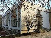
The town of Chevy Chase sends students to the Montgomery County Public Schools.
Residents are zoned to Rosemary Hills Elementary School (PreK-2) (unincorporated Montgomery County), North Chevy Chase Elementary School, Chevy Chase Elementary School (3-6) (in the town of Chevy Chase), Westland Middle School (unincorporated Montgomery County) and Bethesda-Chevy Chase High School (unincorporated Montgomery County).
See also
References
- ↑ "Town of Chevy Chase". Maryland Manual. Retrieved 27 June 2017.
- 1 2 "US Gazetteer files 2010". United States Census Bureau. Archived from the original on 2012-01-24. Retrieved 2013-01-25.
- 1 2 "American FactFinder". United States Census Bureau. Retrieved 2013-01-25.
- 1 2 "Population and Housing Unit Estimates". Retrieved June 9, 2017.
- ↑ "US Gazetteer files: 2010, 2000, and 1990". United States Census Bureau. 2011-02-12. Retrieved 2011-04-23.
- ↑ "Census of Population and Housing". Census.gov. Archived from the original on May 12, 2015. Retrieved June 4, 2015.
- ↑ "American FactFinder". United States Census Bureau. Archived from the original on 2013-09-11. Retrieved 2008-01-31.
External links
| Wikimedia Commons has media related to Chevy Chase (town), Maryland. |
Municipalities and communities of Montgomery County, Maryland, United States | ||
|---|---|---|
| Cities | 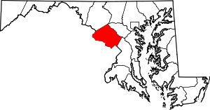 | |
| Towns | ||
| Villages & Special Tax Districts | ||
| CDPs |
| |
| Unincorporated communities | ||
| Footnotes | ‡This populated place also has portions in an adjacent county or counties | |