Catonsville, Maryland
| Catonsville, Maryland | |
|---|---|
| Census-designated place | |
 Frederick Road in Downtown Catonsville. | |
| Nickname(s): "Music City, Maryland", "Cville" | |
| Motto(s): "Life is great in 21228"[1] | |
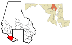 Location of Catonsville, Maryland | |
| Coordinates: 39°16′26″N 76°44′17″W / 39.27389°N 76.73806°WCoordinates: 39°16′26″N 76°44′17″W / 39.27389°N 76.73806°W | |
| Country |
|
| State |
|
| County |
|
| Established | January 20, 1831[2] |
| Area | |
| • Total | 14.0 sq mi (36.3 km2) |
| • Land | 14.0 sq mi (36.3 km2) |
| • Water | 0.0 sq mi (0.0 km2) |
| Elevation | 479 ft (146 m) |
| Population (2010) | |
| • Total | 41,567 |
| • Density | 3,000/sq mi (1,100/km2) |
| Time zone | UTC−5 (Eastern (EST)) |
| • Summer (DST) | UTC−4 (EDT) |
| ZIP codes | 21228, 21229, 21250 |
| Area code(s) | 410 |
| FIPS code | 24-14125 |
| GNIS feature ID | 0583624 |
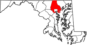
Catonsville is a census-designated place (CDP) in Baltimore County, Maryland, United States. The population was 41,567 at the 2010 census.[3] The community lies to the west of Baltimore along the city's border. Catonsville contains the majority of the University of Maryland, Baltimore County (UMBC), a major public research university with close to 14,000 students.
History
Before European colonists settled in present-day Catonsville, the area was occupied by the Piscataway tribe. These Native Americans had good relations with the first European settlers in the area, but wars and diseases caused their population to decline. The remainder of the tribe’s population gradually dispersed. In the early 1700s, colonists slowly settled in the area, and roads were built. The first of these settlements in the present-day Catonsville area was Johnnycake Town, settled in the 1720s.[4] Johnnycake Town was named after the kind of cornbread sold to travelers at the local tavern. Although Johnnycake Town has since disappeared from maps, its main roads, Johnnycake Road, Old Frederick Road, and Rolling Road still exist today.[5] Rolling Road was used to transport tobacco from plantations south to the Patapsco River on horse-drawn wagons. In 1787, the Ellicott family built a road, called the Frederick Turnpike, to transport goods from their flour mill, Ellicott Mills, to the Baltimore harbor. The turnpike was built just south of where Johnnycake Town was. Charles Carroll, who was the last surviving signer of the Declaration of Independence, owned land next to the newly built road. He instructed his son-in-law, Richard Caton, to develop the area along the road. He gave his name to the community and called it “Catonville”, although the name was changed to “Catonsville” in the 1830s. For decades, the village remained as a quiet farming community. Businesses sprang up along the Frederick Turnpike to cater to travelers traveling from Ellicott City to the Baltimore harbor. Naturally, Catonsville served as a layover stop for the travelers, and the town increasingly grew and developed.[4] The pleasant surroundings attracted wealthy Baltimorean merchants, who, eager to escape the summer heat, built large Victorian and colonial summer homes there. Many of these homes still stand today.[6] Starting in 1862, horsecar services connected Catonsville to Baltimore, and in 1884, the Catonsville Short Line railroad was built, providing 8 roundtrip trains to Baltimore daily. This allowed people to live in Catonsville but commute to work in Baltimore. Commuter traffic exploded in the 1890s with the construction of electric streetcar lines and fancy housing developments. Catonsville had become one of the first commuter suburbs in the United States. Baltimore had tried to annex Catonsville, although their attempts have all been failures. Their last attempt was in 1918. Homes of all sizes were being constructed rapidly until the 1950s when much of land around the Frederick Turnpike had been converted into housing.
A new and modern business district opened along the newly built Baltimore National Pike, which is north, but parallel to the older Frederick Turnpike.
Catonsville was briefly made quite famous during the 1968 protest by the "Catonsville Nine", during which draft records were burned by Catholic anti-war activists.
In 2002, the Maryland legislature issued a proclamation declaring Catonsville to be "Music City, Maryland", because of the concentration of musical retail stores, venues and educational facilities in the area.
In 2007, Money' magazine ranked Catonsville the 49th best place to live in the United States and the third best in Maryland and Virginia.
Geography
Catonsville is located at 39°16′26″N 76°44′17″W / 39.27389°N 76.73806°W (39.273756, −76.738012).[7] According to the United States Census Bureau, the CDP has a total area of 14.0 square miles (36 km2), all of it land.
It is centered along Frederick Road (Maryland Route 144), formerly the main road from Baltimore leading to points west. Johnnycake Road and Academy Road form the northern and northeastern borders of Catonsville. Catonsville is bordered by Woodlawn to the north, Baltimore to the east, by Arbutus to the southeast, by Ilchester to the southwest, and by Ellicott City to the west.
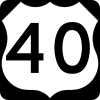
In addition to Frederick Road (Exit 13), Interstate 695 (the Baltimore Beltway) services Wilkens Avenue (Maryland Route 372), Edmondson Avenue and the Baltimore National Pike (U.S. Route 40) via Exits 12, 14 and 15, respectively, with the latter two thoroughfares later converging in Baltimore City to the east. The main north-south roads in the area are Rolling Road (which is also Maryland Route 166 south of Frederick Road), Ingleside Avenue and Bloomsbury Avenue.
Catonsville is a terminus of the Trolley Line Number 9 Trail and the Short Line Railroad Trail.
Transportation
Public transit
The Maryland Transit Administration provides bus service to the Catonsville area via the Purple CityLink route with service to Downtown Baltimore, LocalLink routes 37 and 77, and Express BusLink 150 to Columbia. MARC Train provides commuter train service at the nearby Halethorpe station in Arbutus.
Roads
Major north-south routes in Catonsville include:


Major east-west routes in Catonsville include:


Neighborhoods
- Academy Heights, a residential community surrounding Mount de Sales Academy.
- College Hills, a newer residential community surrounding the Community College of Baltimore County and the University of Maryland, Baltimore County.
- Colonial Gardens, a residential neighborhood along Edmondson Avenue.
- Ingleside, home to Ingleside Shopping Center on Baltimore National Pike.
- Paradise, located east of Downtown Catonsville.
- Summit Park, located northwest above Frederick Road adjacent to the Baltimore County Public Library
- Westchester, located at the crossroads of Westchester and Rockwell Avenues.
- Western Hills, located north of Downtown Catonsville along North Rolling Road.
- Winters Lane, bordered to the north by Route 40, to the south by Edmondson Avenue, to the east by Beltway and to the west by Rolling Road, an Historically African-American residential neighborhood
- Oak Forest Park, located west of Downtown Catonsville.
- Arden Parke, a small residential area owned by Richmond American Homes.
Demographics
| Historical population | |||
|---|---|---|---|
| Census | Pop. | %± | |
| 1960 | 37,872 | — | |
| 1970 | 54,812 | 44.7% | |
| 1980 | 33,208 | −39.4% | |
| 1990 | 35,233 | 6.1% | |
| 2000 | 39,820 | 13.0% | |
| 2010 | 41,567 | 4.4% | |
| source:[3][8] | |||
In 2010 Catonsville had a population of 41,567. The ethnic and racial composition of the population was 73.4% non-Hispanic white, 14.3% non-Hispanic black, 0.3% Native American, 6.3% Asian, 0.1% Pacific Islander, 0.2% non-Hispanic from some other race, 2.4% from two or more races and 3.4% Hispanic or Latino from any race.[9]
As of the census[10] of 2000, there were 39,820 people, 15,503 households, and 9,255 families residing in the CDP. The population density was 2,843.9 people per square mile (1,098.2/km²). There were 16,054 housing units at an average density of 1,146.6 per square mile (442.7/km²). The racial makeup of the CDP was 82.28% White, 11.83% African American, 0.22% Native American, 3.61% Asian, 0.04% Pacific Islander, 0.59% from other races, and 1.43% from two or more races. Hispanic or Latino of any race were 1.87% of the population.
There were 15,503 households out of which 25.7% had children under the age of 18 living with them, 46.7% were married couples living together, 9.9% had a female householder with no husband present, and 40.3% were non-families. 33.8% of all households were made up of individuals and 17.4% had someone living alone who was 65 years of age or older. The average household size was 2.30 and the average family size was 2.98.
In the CDP, the population was spread out with 19.9% under the age of 18, 12.0% from 18 to 24, 27.2% from 25 to 44, 20.7% from 45 to 64, and 20.2% who were 65 years of age or older. The median age was 39 years. For every 100 females, there were 86.0 males. For every 100 females age 18 and over, there were 81.9 males.
The median income for a household in the CDP was $53,061, and the median income for a family was $67,005. Males had a median income of $44,705 versus $33,420 for females. The per capita income for the CDP was $25,254. About 2.8% of families and 4.6% of the population were below the poverty line, including 3.3% of those under age 18 and 4.1% of those age 65 or over. The medium house value for the CDP was $141,300 in the 2000.
Education
Primary and secondary education
Public schools

Residents are zoned to schools in the Baltimore County Public Schools. Catonsville High School, Woodlawn Senior High School (center for science and pre engineering),and Western School of Technology and Environmental Science, formerly Western Vocational Technical Center, serve the area.
Private schools
- Mount de Sales Academy is a Catholic all-girls high school in Catonsville.
- Saint Mark School and Parish can be found in Catonsville on Melvin Avenue, just off of Frederick Road.
- Al-Rahmah School is an Islamic school in Northern Catonsville, on Johhnycake Road.
Higher education
- The University of Maryland, Baltimore County (UMBC) is located in Catonsville.
- The Community College of Baltimore County, formerly known as Catonsville Community College, has a campus in Catonsville across the street from Catonsville High School.
Attractions
Arts and entertainment
- Earl and Darielle Linehan Concert Hall
- Lurman Woodland Theatre
- Retriever Activities Center
Museums
Parks and recreation
- Catonsville Community Park
- Conservation and Environmental Research Areas of UMBC
- George F.Bragg Nature Study Center and Horticulture Center
- Gliston Park
- Joseph Beuys Sculpture Park
- Benjamin Banneker Historical Park
- Patapsco Valley State Park
- Short Line Railroad Trail
- Trolley Line Number 9 Trail
- Western Hills Community Park (Crosby Park)
- Westview Recreation Area
U.S. National Register of Historic Places
Natives and residents of note
- Benjamin Banneker, African-American inventor, scientist and mathematician
- Daniel Berrigan and Philip Berrigan, peace activists
- John Wilkes Booth, actor; assassin of President Abraham Lincoln, attended St. Timothy's Hall, an Episcopal military academy in Catonsville, from age 13-14
- Charles S. Roberts, known as "The Father of Wargaming"
- James Cardinal Stafford, an American cardinal of the Catholic Church who served as Major Penitentiary of the Apostolic Penitentiary, President of the Pontifical Council for the Laity, Archbishop of Denver, Bishop of Memphis, and Auxiliary Bishop of Baltimore
- Keegan F. Walchak, known to be the mountain bike god of Catonsville. His skills and prowess influenced many other young legends such as Quinn C. Griffith, Drew Dicolaus, KiKi Reese, Ryan Roche, and Bam bower
- Donald I. Mohler III - 13th Baltimore County Executive
Arts and media
- Louis S. Diggs, Baltimore County historian
- Duff Goldman, star of food Network's Ace of Cakes, and owner of Charm City Cakes
- David Hasselhoff, actor
- Emily Spencer Hayden, photographer
- Elaine Hamilton, abstract expressionist painter
- Juliana Luecking, recording artist and filmmaker
- Shelley Puhak, poet [11]
- Kathleen Turner, actor
- Steve Yeager, filmmaker
- Nan Agle, children's book author
Music
- Andy Stack (musician), drummer, keyboardist for the band Wye Oak
- John Christ, guitarist for the band Danzig
- Greg Kihn, rock musician
- Pat DeMent, lead guitarist for Kix, SR-71, and Cinder Road
- Ric Ocasek, lead singer of 1980s band The Cars
Sports
- Doug Flutie, former American and Canadian football quarterback
- Ken Dixon, former pitcher, Baltimore Orioles
- Brian Jozwiak, former West Virginia University lineman, and former professional football player for the National Football League's Kansas City Chiefs
- Charlie Maisel, former Major League Baseball player, St. Louis Browns
- Fritz Maisel, known as the "Catonsville Flash," former Major League Baseball player, of the New York Highlanders, now known as the New York Yankees
- George Maisel, former Major League Baseball player, Baltimore Terrapins
- Don Matthews, professional football coach, Canadian Football League, Baltimore Stallions
- John Miller, former pitcher, Baltimore Orioles
- Jeff Nelson, former major league baseball pitcher
Sports teams
- Chesapeake Bayhawks, former professional men's lacrosse team
- Baltimore Tribe, former professional lacrosse team
- Maryland Bays, former professional soccer team
- UMBC Retrievers, collegiate athletic division for the University of Maryland, Baltimore County
- Spring Grove Baseball Club semi-professional baseball team
- Team Dirt Nasty, professional mountain bike team/goon squad
References
- ↑ "We Love Catonsville". Facebook.com. Retrieved 2 July 2018.
- ↑ "Wayback Machine" (PDF). Web.archive.org. 18 May 2014. Retrieved 2 July 2018.
- 1 2 "Profile of General Population and Housing Characteristics: 2010 Demographic Profile Data (DP-1): Catonsville CDP, Maryland". U.S. Census Bureau, American Factfinder. Archived from the original on September 11, 2013. Retrieved February 22, 2012.
- 1 2 "History of Catonsville, Maryland". U-s-history.com. Retrieved 2 July 2018.
- ↑ "Maryland Historical Trust" (PDF). Mht.maryland.gov. Retrieved 2 July 2018.
- ↑ "Catonsville at the Turn of the 20th Century - Baltimore County Public Library". Collections.digitalmaryland.org. Retrieved 2 July 2018.
- ↑ "US Gazetteer files: 2010, 2000, and 1990". United States Census Bureau. 2011-02-12. Retrieved 2011-04-23.
- ↑ "CENSUS OF POPULATION AND HOUSING (1790-2000)". U.S. Census Bureau. Retrieved 2010-07-17.
- ↑ 2010 general population and housing profile of Catonsville from the US Census
- ↑ "American FactFinder". United States Census Bureau. Archived from the original on 2013-09-11. Retrieved 2008-01-31.
- ↑ Yockel, Michael. "Pen Is Mightier". Baltimore. Retrieved 17 April 2014.
External links
| Wikimedia Commons has media related to Catonsville, Maryland. |
- Catonsville Historical Society
- Greater Catonsville Chamber of Commerce
- Catonsville, Maryland at Curlie (based on DMOZ)
 |
Windsor Mill |
Woodlawn |
Edmondson, Baltimore |
| |||
| Oella, Ellicott City |
Irvington, Baltimore | ||||||
| Ichester Thistle Road, S. Hilltop Road South |
Elkridge, BWI Airport |
Arbutus, Halethorpe |