Cable House and Station
|
Cable House and Station | |
|
Alaska Heritage Resources Survey
| |
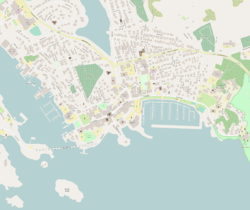  | |
| Location | 2 Lincoln Street, Sitka, Alaska |
|---|---|
| Coordinates | 57°02′55″N 135°20′21″W / 57.04866°N 135.33911°WCoordinates: 57°02′55″N 135°20′21″W / 57.04866°N 135.33911°W |
| Area | 1.76 acres (0.71 ha) |
| NRHP reference # | 79000412[1] |
| AHRS # | SIT-212 |
| Significant dates | |
| Added to NRHP | June 4, 1979 |
| Designated AHRS | October 12, 1977 |
The Cable House and Station, also known as the Communications Center and Quarters, is a historic telecommunications building on Lincoln Street at Harbor Road in Sitka, Alaska. It is a modest two-story building, about 40 feet (12 m) square, with a hip roof. The building housed the telecommunications hub of the Washington-Alaska Military Cable and Telegraph System (WAMCATS), a military communications network established in the first decade of the 20th century, during the period of the Alaska boundary dispute with neighboring Canada.[2]
The building was listed on the National Register of Historic Places in 1979.[1]
See also
References
- 1 2 National Park Service (2010-07-09). "National Register Information System". National Register of Historic Places. National Park Service.
- ↑ "NRHP nomination for Cable House and Station". National Park Service. Retrieved 2014-10-06.
 | Boroughs | .svg.png) | |
Census areas | |||
There are no sites listed on the National Register of Historic Places in Kusilvak Census Area. | |||
| Topics | |
|---|---|
| Lists by states |
|
| Lists by insular areas | |
| Lists by associated states | |
| Other areas | |
| |
This article is issued from
Wikipedia.
The text is licensed under Creative Commons - Attribution - Sharealike.
Additional terms may apply for the media files.