District line
| District line | |
|---|---|
|
| |
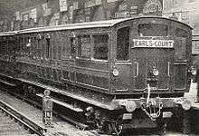
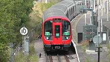
.jpg) A District line train at Earl's Court with a service to Wimbledon | |
| Overview | |
| Type | Sub-surface |
| System | London Underground |
| Stations | 60 |
| Ridership | 208 million (2011/12)[1] passenger journeys |
| Colour on map | Green |
| Website | tfl.gov.uk |
| Operation | |
| Opened | 1868 |
| Depot(s) | Upminster, Ealing Common, Hammersmith |
| Rolling stock | S7 |
| Technical | |
| Line length | 64 km (40 mi) |
| Track gauge | 4 ft 8 1⁄2 in (1,435 mm) |
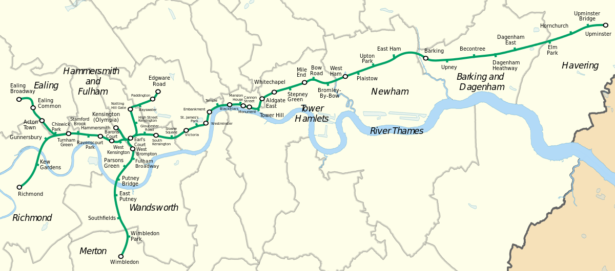
The District line is a London Underground line that runs from Upminster in the east to Earl's Court in west London, where it splits into a number of branches. One branch runs to Wimbledon in south-west London, one runs north to Edgware Road, and a short weekends-only branch runs for one stop to Kensington (Olympia). The main route continues west from Earl's Court to Turnham Green after which it divides again into two western branches, to Richmond and Ealing Broadway.
Coloured green on the Tube map, the line serves 60 stations over 40 miles (64 km), and with bridges across the River Thames on the Wimbledon and Richmond branches it is the only Underground line to cross the river in this way.[2] The track and stations between Barking and Aldgate East are shared with the Hammersmith & City line, and between Tower Hill and Gloucester Road and on the Edgware Road branch they are shared with the Circle line. Some of the stations between South Kensington and Ealing Common are shared with the Piccadilly line. Unlike London's deep-level lines, the railway tunnels are just below the surface, and the trains are of a similar size to those on British main lines.
The District line is the busiest of the sub-surface lines and the fifth-busiest line overall on the Underground, with over 208 million passenger journeys recorded in 2011/12.
The original Metropolitan District Railway (as it was then called) opened in December 1868 from South Kensington to Westminster as part of a plan for a below-ground "inner circle" connecting London's main line termini. At first, services were operated using wooden carriages hauled by steam locomotives. Electrification was financed by the American Charles Yerkes, and electric services began in 1905. The railway was absorbed by the London Passenger Transport Board in 1933. In the first half of the 1930s the Piccadilly line took over the Uxbridge and Hounslow branches, although a peak-hour District line service ran on the Hounslow branch until 1964. Kensington (Olympia) has been served by the District line since 1946, and a short branch to South Acton closed in 1959 (this is now part of London Overground). The trains carried guards until one-person operation was introduced in 1985.
The signalling system is being upgraded, and the previous D Stock trains were replaced by seven-car S Stock trains in 2017.
History
District Railway
The Metropolitan District Railway (commonly known as the District Railway) was formed to build and operate part of an underground 'inner circle' connecting London's railway termini. The first line opened in December 1868, with services from South Kensington to Westminster; these were operated by the Metropolitan Railway using wooden carriages hauled by steam locomotives. By 1871, when the District began operating its own trains, the railway had extended to West Brompton and a terminus at Mansion House.[3] A curve from Earl's Court onto the West London Railway was used by the London & North Western Railway (L&NWR) for a service to Broad Street and the Great Western Railway for a service to Moorgate via Paddington.[4] Hammersmith was reached from Earl's Court, services were extended to Richmond over the tracks of the London and South Western Railway (L&SWR), and branches reached Ealing Broadway, Hounslow and Wimbledon. As part of the project that completed the Circle line in October 1884, the District began to serve Whitechapel.[5] Services began running to Upminster in 1902, after a link to the London, Tilbury & Southend Railway (LT&SR) had been built.[6]
At the start of the 20th century the District was seeing increased competition from the new electric underground tube lines and trams, and the use of steam locomotives underground led to unpopular smoke-filled stations and carriages.[6] The American Charles Yerkes, who was later to form the Underground Electric Railways of London, financed the needed electrification of the railway and the first electric services ran from Ealing to South Harrow in 1903.[7] Electric multiple-units were introduced on other services in 1905, and East Ham became the eastern terminus. Electric locomotives were used on the L&NWR services from Mansion House to Earl's Court, and in later years exchanged for a steam locomotive on LT&SR services from Southend to Ealing Broadway at Barking.[6]
Hounslow and Uxbridge were served by 2 or 3-car shuttles from Mill Hill Park (now Acton Town); some trains also served South Acton and central London in the peaks.[8] Services were extended again to Barking in 1908 and Upminster in 1932.[9] In 1932 Piccadilly line trains were extended from Hammersmith to South Harrow, taking over the District service from Acton Town to South Harrow, although the District continued to provide a shuttle from South Harrow to Uxbridge.[10] In 1933 Piccadilly trains reached to Hounslow West, the District continuing to run services with an off-peak shuttle from South Acton to Hounslow.[11]
London Transport
On 1 July 1933 the District Railway amalgamated with other Underground railways, tramway companies and bus operators to form the London Passenger Transport Board, and from 23 October 1933 Piccadilly line trains ran through to Uxbridge and the District line shuttle withdrawn.[12] Most of the trailer cars on the District line were the 1904–05 B Stock type with wooden bodies, but motor cars were less than fifteen years old. The 1935–40 New Works Programme saw the Q Stock formed from these motor cars, upgraded with electro-pneumatic brakes and guard controlled air-operated doors, and the trailers replaced with new vehicles.[13] The off-peak District line services on the Hounslow branch were withdrawn on 29 April 1935 and South Acton served by a shuttle to Acton Town.[11]
The London, Midland and Scottish Railway (LMS) had taken over the L&NWR railway's service from Earl's Court and by the Second World War this had been cut back to an electric Earl's Court to Willesden Junction shuttle.[11] Following bombing of the West London Line in 1940 the LMS and the Metropolitan line services over the West London Line were both suspended. This left the Olympia exhibition centre without a railway service, so after the war the Kensington Addison Road station was renamed Kensington (Olympia) and served by a District line shuttle from Earl's Court.[14] R Stock, composed of new cars and the Q Stock trailers that had been built in 1938, replaced the trains with hand-operated sliding doors that remained.[15] The new trains were built between 1949 and 1959,[16] and after 1952 trains were constructed from aluminium, saving weight. One train was left unpainted as an experiment and considered a success, so between 1963–68 trains were left unpainted or painted white or grey to match.[17] The transfer of CO/CP Stock from the Metropolitan line in the early 1960s allowed some of the Q stock to be scrapped.[18] The slow tracks on the former LT&SR line to Upminster were shared with steam locomotive hauled goods and passenger services, until 1961 when the District took over exclusive use of the DC electrified lines.[19]
The South Acton shuttle was withdrawn on 28 February 1959, followed by the peak hour District line through service to Hounslow on 9 October 1964.[20] In the 1970s the Hounslow branch became the Heathrow branch when it was extended to serve Heathrow Airport, first on 19 July 1975 to serve Hatton Cross, and then on 16 December 1977 when Heathrow Central opened.[21] The whole District line service could not run through Aldgate East as this station was also served by Hammersmith & City trains, so some trains terminated at a bay platform at Mansion House, leaving the line east to Tower Hill overcrowded. Tower Hill station was also cramped, so the station was rebuilt with three platforms on a new site. This opened in 1967 and a year later trains reversed at the new station.[22]
Services were operated with 6 cars off-peak and 8 cars during peak hours until 1971, when trains were reformed as fixed 7-car trains, and some 6-car trains for the Edgware Road branch.[23] The CO/CP and R Stock were replaced in the late 1970s by new trains with unpainted aluminium bodies.[24] A shorter train was needed on the Edgware Road branch due to the platform lengths so more of the C stock units, then already in use on the Circle and Hammersmith and City lines, were built.[25] The rest of the District line could use longer trains and new D Stock trains were introduced between 1979 and 1983.[24] One person operation of the trains was proposed in 1972, but due to conflict with the trade unions was not introduced on the District line until 1985.[26] In 2003, the infrastructure of the District line was partly privatised in a public–private partnership, managed by the Metronet consortium. Metronet went into administration in 2007 and the local government body Transport for London took over responsibilities.[27]
Route
Map
Railway line
District line | |||||||||||||||||||||||||||||||||||||||||||||||||||||||||||||||||||||||||||||||||||||||||||||||||||||||||||||||||||||||||||||||||||||||||||||||||||||||||||||||||||||||||||||||||||||||||||||||||||||||||||||||||||||||||||||||||||||||||||||||||||||||||||||||||||||||||||||||||||||||||||||||||||||||||||||||||||||||||||||||||||||||||||||||||||||||||||||||||||||||||||||||||||||||||||||||||||||||||||||||||||||||||||||||||||||||||||||||||||||||||||||||||||||||||||||||||||||||||||||||||||||||||||||||||||||||||||||||||||||||||||||||||||||||||||||||||||||||||||||||||||||||||||||||||||||||||||||||||||||||||||||||||||||||||||||||||||||||||||||||||||||||||||||||||||||||||
|---|---|---|---|---|---|---|---|---|---|---|---|---|---|---|---|---|---|---|---|---|---|---|---|---|---|---|---|---|---|---|---|---|---|---|---|---|---|---|---|---|---|---|---|---|---|---|---|---|---|---|---|---|---|---|---|---|---|---|---|---|---|---|---|---|---|---|---|---|---|---|---|---|---|---|---|---|---|---|---|---|---|---|---|---|---|---|---|---|---|---|---|---|---|---|---|---|---|---|---|---|---|---|---|---|---|---|---|---|---|---|---|---|---|---|---|---|---|---|---|---|---|---|---|---|---|---|---|---|---|---|---|---|---|---|---|---|---|---|---|---|---|---|---|---|---|---|---|---|---|---|---|---|---|---|---|---|---|---|---|---|---|---|---|---|---|---|---|---|---|---|---|---|---|---|---|---|---|---|---|---|---|---|---|---|---|---|---|---|---|---|---|---|---|---|---|---|---|---|---|---|---|---|---|---|---|---|---|---|---|---|---|---|---|---|---|---|---|---|---|---|---|---|---|---|---|---|---|---|---|---|---|---|---|---|---|---|---|---|---|---|---|---|---|---|---|---|---|---|---|---|---|---|---|---|---|---|---|---|---|---|---|---|---|---|---|---|---|---|---|---|---|---|---|---|---|---|---|---|---|---|---|---|---|---|---|---|---|---|---|---|---|---|---|---|---|---|---|---|---|---|---|---|---|---|---|---|---|---|---|---|---|---|---|---|---|---|---|---|---|---|---|---|---|---|---|---|---|---|---|---|---|---|---|---|---|---|---|---|---|---|---|---|---|---|---|---|---|---|---|---|---|---|---|---|---|---|---|---|---|---|---|---|---|---|---|---|---|---|---|---|---|---|---|---|---|---|---|---|---|---|---|---|---|---|---|---|---|---|---|---|---|---|---|---|---|---|---|---|---|---|---|---|---|---|---|---|---|---|---|---|---|---|---|---|---|---|---|---|---|---|---|---|---|---|---|---|---|---|---|---|---|---|---|---|---|---|---|---|---|---|---|---|---|---|---|---|---|---|---|---|---|---|---|---|---|---|---|---|---|---|---|---|---|---|---|---|---|---|---|---|---|---|---|---|---|---|---|---|---|---|---|---|---|---|---|---|---|---|---|---|---|---|---|---|---|---|---|---|---|---|---|---|---|---|---|---|---|---|---|---|---|---|---|---|---|---|---|---|---|---|---|---|---|---|---|---|---|---|---|---|---|---|---|---|---|---|---|---|---|---|---|---|---|---|---|---|---|---|---|---|---|---|---|---|---|---|---|---|---|---|---|---|---|---|---|---|---|---|---|---|---|---|---|---|---|---|---|---|---|---|---|---|---|---|---|---|---|---|---|---|---|---|---|---|---|---|---|---|---|---|---|---|---|---|---|---|---|---|---|---|---|---|---|---|---|---|---|---|---|---|---|---|---|---|---|---|---|---|---|---|---|---|---|---|---|---|---|---|---|---|---|---|---|---|---|---|---|---|---|---|---|---|---|---|---|---|---|---|---|---|---|---|---|---|---|
| |||||||||||||||||||||||||||||||||||||||||||||||||||||||||||||||||||||||||||||||||||||||||||||||||||||||||||||||||||||||||||||||||||||||||||||||||||||||||||||||||||||||||||||||||||||||||||||||||||||||||||||||||||||||||||||||||||||||||||||||||||||||||||||||||||||||||||||||||||||||||||||||||||||||||||||||||||||||||||||||||||||||||||||||||||||||||||||||||||||||||||||||||||||||||||||||||||||||||||||||||||||||||||||||||||||||||||||||||||||||||||||||||||||||||||||||||||||||||||||||||||||||||||||||||||||||||||||||||||||||||||||||||||||||||||||||||||||||||||||||||||||||||||||||||||||||||||||||||||||||||||||||||||||||||||||||||||||||||||||||||||||||||||||||||||||||||
The District line is 40 miles (64 km) long and serves 60 stations.[28][29] Much of the line is electrified with a four-rail DC system: a central conductor rail is now energised at –250 V and a rail outside the running rail at +500 V, giving a potential difference of 750 V. These areas are: Upminster – Putney Bridge/Olympia/Barons Court and Edgware Road – Earl's Court. Other areas; Barons Court – Ealing Broadway, still remain –210 V and a rail outside the running rail at +420 V, giving a potential difference of 630 V,.[30] Two exceptions are the sections over which main line trains run; from East Putney to Wimbledon and from Gunnersbury to Richmond, which both have the centre rail bonded to the running rails.[31] West of Earl's Court, there are four branches. At Ealing Broadway station, the District line has platforms north of the Central line and the Great Western main line out of Paddington. After about 2⁄3 mile (1.1 km), the line meets the Piccadilly line Uxbridge branch at Hanger Lane junction, and the tracks are then shared through Ealing Common station until Acton Town station, where the Piccadilly line Heathrow branch joins. From Acton Town to Barons Court, the line has four tracks, paired by use: the District line uses the outer pair and the non-stopping Piccadilly line trains use the inner pair.[32] At Richmond station, the London Overground and District line platforms are north of the Waterloo to Reading line through platforms. The two tracks which cross the Thames at Kew Railway Bridge are shared with the London Overground trains until Gunnersbury junction, after which the District line tracks join the four-track District and Piccadilly lines just before Turnham Green station.[32]
On the main line, there are cross-platform interchanges at Acton Town, Hammersmith and Barons Court stations, after which the Piccadilly line tracks descend into tunnels, while the District line becomes two tracks through West Kensington station. Before the line enters Earl's Court station, the short Kensington (Olympia) branch joins at a flat junction and the Wimbledon branch at a grade-separated junction.[32] On the Wimbledon branch, the District line at Wimbledon station is west of the South Western Main Line platforms, then the two-track line has a junction at East Putney station with the Hounslow Loop Line, before passing over the River Thames on Fulham Railway Bridge; the line continues by passing under the West London Railway and coming alongside it at West Brompton station before the junction with the main line and the four-platform Earl's Court station.[32]
East of Earl's Court there is a grade-separated junction off the main line to the Edgware Road branch. This follows the Circle line after High Street Kensington station where there are also two bay platforms for the District line. After Paddington station this branch joins the Hammersmith & City line at Praed Street junction, before terminating at the four-platform Edgware Road.[32] The main line joins the Circle line at Gloucester Road and the line and stations are in cut-and-cover tunnels, meeting the Thames at Westminster station, after which the railway is in the Victoria Embankment on the north bank of the river. At Tower Hill station, there is a bay platform.[32]
After Tower Hill, the Circle line diverges, the District line joining the Hammersmith & City line just before Aldgate East station. The line passes over the London Overground at Whitechapel station before continuing on the 2-mile (3.2 km) Whitechapel & Bow Railway to Bow Road, where the line surfaces, and Bromley-by-Bow, where the line runs alongside the London, Tilbury and Southend Railway from Fenchurch Street station. There is an interchange with this line at the next station, West Ham, as well as with the Jubilee line and the Docklands Light Railway. There is a bay platform at the next station, Plaistow, and the Hammersmith & City line terminates at Barking station.[32] The District line follows the London, Tilbury and Southend Railway for another eight stations, before terminating at Upminster station.[32]
Services
The off-peak service as of December 2012 is:
- 6 tph (trains per hour) Ealing Broadway to Upminster[33]
- 6 tph Richmond to Upminster[34]
- 6 tph Wimbledon to Tower Hill, which 3 continue onto Barking[35]
- 6 tph Wimbledon to Edgware Road[35]
- 3 tph Kensington (Olympia) to High Street Kensington at weekends, as well as seven daily trips to or from Kensington (Olympia) on weekdays.[36] A 2-trains-per-hour service operates on weekday exhibition days.
This gives a service of 18 trains per hour (a train every 3–4 minutes) between Earl's Court and Tower Hill. Together with the Circle line, there are 24 trains per hour (a train every 2.5 minutes) between Gloucester Road and Tower Hill. 208 million passenger journeys were made on the District line in 2011/12.[1]
There are additional trains during peak hours. The central section from Earl's Court to Aldgate East is in Zone 1 and to the west Ealing Broadway and Wimbledon are in Zone 3 and Richmond in Zone 4. To the east the line runs to Upminster in Zone 6.[37]
Rolling stock
S Stock
The current 7-car S Stock trains began to enter service on the line in 2013,[38] beginning with services between Olympia and West Ham, gradually replacing the C and D Stock.[39] Like the 8-car variants now in use on the Metropolitan line, these trains are part of Bombardier's Movia family, with air-conditioning, as the sub-surface tunnels (unlike those on the deep-level tube lines) are able to disperse the exhausted hot air.[40]
With a top speed of 62 mph (100 km/h),[40] a 7-car S Stock train has a capacity of 865 passengers compared to 739 for a 6-car C Stock train and 827 for a 6-car D Stock train.[41][42][43] With a length of 117 metres (384 ft), the S Stock trains are 24 metres (79 ft) longer than the 93-metre (305 ft) long C stock trains, and station platforms have been lengthened.[44] The trains have regenerative brakes, allowing them to return around 20 per cent of their energy to the network.[45] Traction voltage was increased in 2017 from nominal 630 V to 750 V to give better performance and allow the trains to return more energy to the network through their regenerative brakes. 630 V section remains Barons Court-Ealing Broadway.[43] The service was run by D78 Stock until April 2017.
Depots
The S Stock trains are maintained at Ealing Common Depot[lower-alpha 1] and Upminster Depot,.[lower-alpha 2] Ealing Common Depot was built by the District Railway when it was electrified in the early 1900s,.[46] Upminster depot was built 1956–58 when the District line tracks were segregated.[47] Trains may also be stabled in the sidings east of Barking alongside Hammersmith & City Line trains.
Upgrade programme
Together with the introduction of 7-car S Stock trains, the sub-surface track, electrical supply and signalling systems are being upgraded in a programme to increase peak-hour capacity on the District line by 24 per cent by the end of 2018.[39][48][49] A single control room for the sub-surface railway opened in Hammersmith on 6 May 2018. Trains will also be increased to 32 per hour in central London and to Barking during peak times in 2022. An automatic train control (ATC) system will replace signalling equipment installed from the 1940s.[48][50]
List of stations
Open stations
In order from west to east
| Station | Image | Opened[21] | Branch | Additional information | Position |
|---|---|---|---|---|---|
| Richmond |  | 1 October 1877 | Richmond | Connects with National Rail services. Opened by the L&SWR as Richmond New on 1 January 1869 and this amalgamated with the main line station in 1937.[51] | 51°27′47″N 000°18′00″W / 51.46306°N 0.30000°W |
| Kew Gardens |  | 1 October 1877 | Richmond | L&SWR station opened 1 January 1869[52] | 51°28′38″N 000°17′07″W / 51.47722°N 0.28528°W |
| Gunnersbury |  | 1 October 1877 | Richmond | Connects with London Overground services. Opened by L&SWR as Brentford Road 1 January 1869, renamed 1871.[53] | 51°29′30″N 000°16′30″W / 51.49167°N 0.27500°W |
| Ealing Broadway | 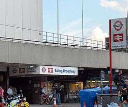 | 1 July 1879 | Ealing Broadway | Connects with National Rail services and Central line | 51°30′53″N 000°18′06″W / 51.51472°N 0.30167°W |
| Ealing Common | 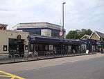 | 1 July 1879 | Ealing Broadway | Connects with Piccadilly line. Between 1886 and 1910 known as Ealing Common and West Acton[21] | 51°30′37″N 000°17′17″W / 51.51028°N 0.28806°W |
| Acton Town | 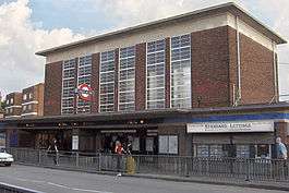 | 1 July 1879 | Ealing Broadway | Opened as Mill Hill Park, renamed 1 March 1910. Connects with Piccadilly line | 51°30′10″N 000°16′48″W / 51.50278°N 0.28000°W |
| Chiswick Park | 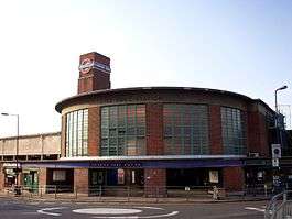 | 1 July 1879 | Ealing Broadway | Opened as Acton Green, renamed Chiswick Park and Acton Green in 1889, renamed 1910 | 51°29′41″N 000°16′04″W / 51.49472°N 0.26778°W |
| Turnham Green |  | 1 June 1877 | Main line | L&SWR station opened 1 January 1869 | 51°29′43″N 000°15′18″W / 51.49528°N 0.25500°W |
| Stamford Brook | 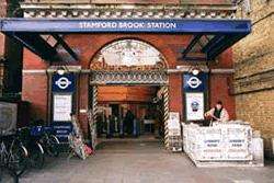 | 1 February 1912 | Main line | 51°29′42″N 000°14′45″W / 51.49500°N 0.24583°W | |
| Ravenscourt Park |  | 1 June 1877 | Main line | Opened as Shaftesbury Road by L&SWR on 1 April 1873, renamed 1 March 1888 | 51°29′39″N 000°14′09″W / 51.49417°N 0.23583°W |
| Hammersmith |  | 9 September 1874 | Main line | Connects with Piccadilly line, Hammersmith & City and Circle lines | 51°29′39″N 000°13′30″W / 51.49417°N 0.22500°W |
| Barons Court |  | 15 December 1906 | Main line | Connects with Piccadilly line | 51°29′26″N 000°12′49″W / 51.49056°N 0.21361°W |
| West Kensington | 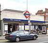 | 9 September 1874 | Main line | Opened as North End (Fulham),[54] renamed 1877 | 51°29′27″N 000°12′23″W / 51.49083°N 0.20639°W |
| Wimbledon | 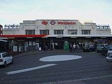 | 3 June 1889 | Wimbledon | Connects with National Rail and Tramlink services. L&SWR station opened 21 May 1838. | 51°25′24″N 000°12′15″W / 51.42333°N 0.20417°W |
| Wimbledon Park | 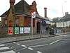 | 3 June 1889 | Wimbledon | 51°26′02″N 000°12′00″W / 51.43389°N 0.20000°W | |
| Southfields | 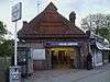 | 3 June 1889 | Wimbledon | 51°26′42″N 000°12′25″W / 51.44500°N 0.20694°W | |
| East Putney | 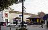 | 3 June 1889 | Wimbledon | 51°27′31″N 000°12′41″W / 51.45861°N 0.21139°W | |
| Putney Bridge | 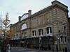 | 1 March 1880 | Wimbledon | Opened as Putney Bridge & Fulham, renamed 1 January 1902 as Putney Bridge & Hurlingham, current name from 1932 | 51°28′06″N 000°12′32″W / 51.46833°N 0.20889°W |
| Parsons Green | 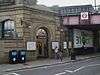 | 1 March 1880 | Wimbledon | 51°28′31″N 000°12′04″W / 51.47528°N 0.20111°W | |
| Fulham Broadway |  | 1 March 1880 | Wimbledon | Opened as Walham Green, renamed 2 March 1952 | 51°28′50″N 000°11′41″W / 51.48056°N 0.19472°W |
| West Brompton | 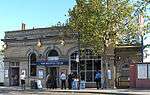 | 12 April 1869 | Wimbledon | Connects with National Rail and London Overground services. | 51°29′12″N 000°11′45″W / 51.48667°N 0.19583°W |
| Kensington (Olympia) |  | 20 December 1946 | Olympia | Connects with National Rail and London Overground services. The L&SWR opened a Kensington station on the West London Railway briefly in 1844. This station was opened on 2 June 1862 and was renamed Kensington Addison Road in 1868[55] and served by L&NWR, GWR, Metropolitan and other railways until services were withdrawn in 1940. Reopened as a branch of the District line in 1946.[56] | 51°29′55″N 000°12′39″W / 51.49861°N 0.21083°W |
| Earl's Court |  | 30 October 1871 | Main line | Connects with Piccadilly line and all other District line services | 51°29′29″N 000°11′41″W / 51.49139°N 0.19472°W |
| High Street Kensington | 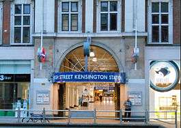 | 1 October 1868 | Edgware Road | Opened as Kensington (High Street) and name gradually changed by 1880.[21] Connects with the Circle line. | 51°30′03″N 000°11′33″W / 51.50083°N 0.19250°W |
| Notting Hill Gate | 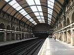 | 1 October 1868 | Edgware Road | Connects with Central line. | 51°30′32″N 000°11′49″W / 51.50889°N 0.19694°W |
| Bayswater | 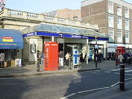 | 1 October 1868 | Edgware Road | Opened as Bayswater, renamed Bayswater (Queen's Road) & Westbourne Grove in 1923, Bayswater (Queen's Road) in 1933 and Bayswater (Queensway) in 1946, after which the suffix was gradually dropped.[21] | 51°30′43″N 000°11′17″W / 51.51194°N 0.18806°W |
| Paddington |  | 1 October 1868 | Edgware Road | Opened as Paddington (Praed Street), renamed in 1948.[21] Connects with Bakerloo line and Paddington main line station. | |
| Edgware Road |  | 1 October 1863 | Edgware Road | Connects with Circle and Hammersmith & City lines | 51°31′12″N 000°10′04″W / 51.52000°N 0.16778°W |
| Gloucester Road | 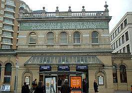 | 1 October 1868 | Main line | Opened as Brompton (Gloucester Road), renamed in 1907.[21] Connects with Piccadilly and Circle lines | 51°29′41″N 000°10′59″W / 51.49472°N 0.18306°W |
| South Kensington | 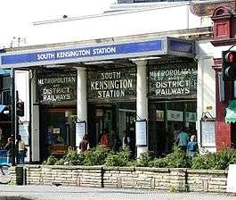 | 24 December 1868 | Main line | Connects with Piccadilly line | 51°29′39″N 000°10′26″W / 51.49417°N 0.17389°W |
| Sloane Square |  | 24 December 1868 | Main line | 51°29′33″N 000°09′24″W / 51.49250°N 0.15667°W | |
| Victoria |  | 24 December 1868 | Main line | Connects with Victoria line and National Rail services. | 51°29′48″N 000°08′41″W / 51.49667°N 0.14472°W |
| St James's Park | 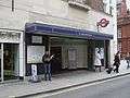 | 24 December 1868 | Main line | 51°29′58″N 000°08′04″W / 51.49944°N 0.13444°W | |
| Westminster | 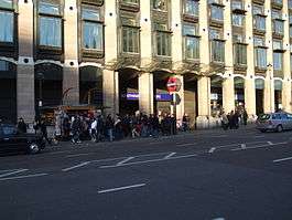 | 24 December 1868 | Main line | Opened as Westminster Bridge, renamed in 1907.[21] Connects with Jubilee line | 51°30′04″N 000°07′30″W / 51.50111°N 0.12500°W |
| Embankment | 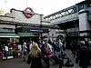 | 30 May 1870 | Main line | Opened as Charing Cross, renamed Charing Cross Embankment in 1974 and to the current name from 1976.[21] Connects with Bakerloo and Northern lines and Charing Cross National Rail station | 51°30′25″N 000°07′19″W / 51.50694°N 0.12194°W |
| Temple | 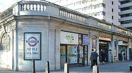 | 30 May 1870 | Main line | Opened as The Temple.[21] | 51°30′40″N 000°06′52″W / 51.51111°N 0.11444°W |
| Blackfriars | 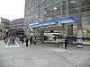 | 30 May 1870 | Main line | Connects with National Rail services. | 51°30′42″N 000°06′11″W / 51.51167°N 0.10306°W |
| Mansion House | 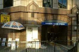 | 3 July 1871 | Main line | 51°30′44″N 000°05′39″W / 51.51222°N 0.09417°W | |
| Cannon Street | 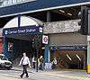 | 6 October 1884 | Main line | Connects with National Rail services. | 51°30′37″N 000°05′27″W / 51.51028°N 0.09083°W |
| Monument |  | 6 October 1884 | Main line | Opened as Eastcheap, renamed The Monument in 1884.[21] Escalator connection to Bank station giving connections with Central, Northern, Waterloo & City and DLR. | 51°30′47″N 000°05′17″W / 51.51306°N 0.08806°W |
| Tower Hill | 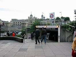 | 25 September 1882 | Main line | The Metropolitan Railway opened "Tower of London", however closed this in 1884 as the District Railway had opened "Mark Lane" nearby. This station was renamed "Tower Hill" in 1946 and moved to the site of the "Tower of London" station in 1967.[21][57] Connects with Circle line. | 51°30′36″N 000°04′34″W / 51.51000°N 0.07611°W |
| Aldgate East |  | 6 October 1884 | Main line | Connects with Hammersmith & City line. Moved to current position in 1938.[21] | 51°30′55″N 000°04′20″W / 51.51528°N 0.07222°W |
| Whitechapel |  | 6 October 1884 | Main line | Connects with London Overground services. Opened as Whitechapel (Mile End), renamed in 1901. | 51°31′08″N 000°03′40″W / 51.51889°N 0.06111°W |
| Stepney Green |  | 23 June 1902 | Main line | 51°31′19″N 000°02′47″W / 51.52194°N 0.04639°W | |
| Mile End | 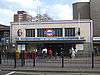 | 2 June 1902 | Main line | Cross platform interchange with Central line. | 51°31′30″N 000°01′59″W / 51.52500°N 0.03306°W |
| Bow Road | 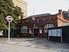 | 11 June 1902 | Main line | 51°31′38″N 000°01′29″W / 51.52722°N 0.02472°W | |
| Bromley-by-Bow |  | 2 June 1902 | Main line | Opened as LT&SR station in 1894. First served as Bromley, LT&SR station closed in 1940 and renamed in 1967.[21][58] | 51°31′26″N 000°00′41″W / 51.52389°N 0.01139°W |
| West Ham | 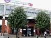 | 2 June 1902 | Main line | Connects with Jubilee line, Docklands Light Railway and National Rail services. Named West Ham (Manor Road) from 1924–69, Metropolitan service began in 1941 and LT&SR station closed 1994.[21][59] | 51°31′41″N 000°00′14″E / 51.52806°N 0.00389°E |
| Plaistow | 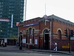 | 2 June 1902 | Main line | LT&SR station opened in 1858.[60] | 51°31′53″N 000°01′02″E / 51.53139°N 0.01722°E |
| Upton Park | 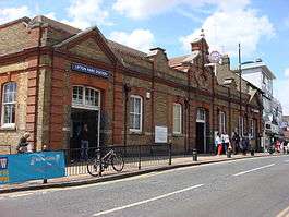 | 2 June 1902 | Main line | LT&SR station opened in 1877.[61] | 51°32′06″N 000°02′04″E / 51.53500°N 0.03444°E |
| East Ham |  | 2 June 1902 | Main line | LT&SR station opened in 1858.[62] | 51°32′20″N 000°03′06″E / 51.53889°N 0.05167°E |
| Barking |  | 2 June 1902 | Main line | Connects with National Rail and London Overground. LT&SR station opened in 1854.[63] District Railway service withdrawn 1905–8.[21] | 51°32′21″N 000°04′54″E / 51.53917°N 0.08167°E |
| Upney |  | 12 September 1932 | Main line | 51°32′19″N 000°06′05″E / 51.53861°N 0.10139°E | |
| Becontree | 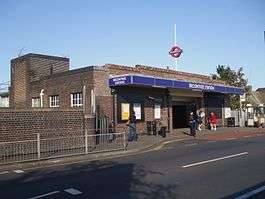 | 12 September 1932 | Main line | 51°32′25″N 000°07′37″E / 51.54028°N 0.12694°E | |
| Dagenham Heathway |  | 12 September 1932 | Main line | Opened as Heathway, renamed 1949 | 51°32′30″N 000°08′49″E / 51.54167°N 0.14694°E |
| Dagenham East | 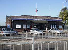 | 2 June 1902 | Main line | Opened as Dagenham in 1885,[64] District line service withdrawn 1905 to 1932 and station renamed 1949[21] | 51°32′40″N 000°09′56″E / 51.54444°N 0.16556°E |
| Elm Park | 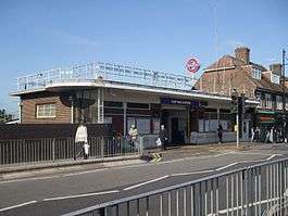 | 13 May 1935 | Main line | 51°32′59″N 000°11′52″E / 51.54972°N 0.19778°E | |
| Hornchurch |  | 2 June 1902 | Main line | LT&SR station opened 1885,[65] District line service withdrawn 1905 to 1932. | 51°33′11″N 000°13′08″E / 51.55306°N 0.21889°E |
| Upminster Bridge | 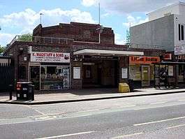 | 17 December 1934 | Main line | 51°33′29″N 000°14′03″E / 51.55806°N 0.23417°E | |
| Upminster |  | 2 June 1902 | Main line | LT&SR station opened 1885,[66] District line service withdrawn 1905 to 1932. Connects with National Rail and London Overground services. | 51°33′32″N 000°15′04″E / 51.55889°N 0.25111°E |
Closed and fictional stations
Now on the Piccadilly line, Hounslow Town was a terminus station between 1 May 1883 and 1 May 1909, when it was replaced by the station currently known as Hounslow East.[21][67] Between Whitechapel and Aldgate East was St. Mary's station from 3 March 1884 to 30 April 1938, closing when Aldgate East station moved.[21][68]
Walford East is a fictional District line station in the BBC television soap opera EastEnders,[69] and since February 2010 episodes have used Computer-generated imagery (CGI) of District line trains running into the station.[70]
In the Sherlock episode "The Empty Hearse", a fictional unopened terminus station called Sumatra Road (situated underneath the Houses of Parliament as a disused branch line from Westminster Station) was created for the episode's story of a terrorism plot. The station was actually filmed at Aldwych with ex-Northern line 1972 stock which caused continuity errors as deep-level trains and tunnels were used when the District line is sub-surface.[71]
See also
Notes and references
Notes
- ↑ Location of Ealing Common Depot: 51°30′24″N 000°17′07″W / 51.50667°N 0.28528°W
- ↑ Location of Upminster Depot: 51°33′38″N 000°15′52″E / 51.56056°N 0.26444°E
References
- 1 2 "Performance: LU Performance Data Almanac". Transport for London. 2011–2012. Archived from the original on 14 February 2013. Retrieved 17 January 2013.
- ↑ Bayman, Bob (2000). Underground Official Handbook. Capital Transport. p. 43.
- ↑ Green 1987, pp. 8–10.
- ↑ Horne 2006, p. 15.
- ↑ Green 1987, p. 12.
- 1 2 3 Green 1987, p. 28.
- ↑ Green 1987, pp. 24–27.
- ↑ Horne 2006, p. 44.
- ↑ Horne 2006, pp. 45, 61.
- ↑ Horne 2006, p. 58.
- 1 2 3 Horne 2006, p. 60.
- ↑ Horne 2006, p. 65.
- ↑ Bruce 1983, p. 36, 83, 96.
- ↑ Horne 2006, p. 73.
- ↑ Horne 2006, pp. 74–75.
- ↑ Horne 2006, p. 75.
- ↑ Bruce 1983, pp. 100–101.
- ↑ Bruce 1983, p. 97.
- ↑ Horne 2006, pp. 80–82.
- ↑ Horne 2006, p. 88.
- 1 2 3 4 5 6 7 8 9 10 11 12 13 14 15 16 17 18 19 Rose 2007.
- ↑ Horne 2006, pp. 88–89.
- ↑ Bruce 1983, pp. 103, 118.
- 1 2 "Rolling Stock Information Sheets" (PDF). London Underground. Archived from the original (PDF) on 4 October 2013. Retrieved 26 November 2012.
- ↑ Bruce 1983, p. 117.
- ↑ Croome, Desmond F.; Jackson, Alan Arthur (1993). Rails Through the Clay: A History of London's Tube Railways. Capital Transport. p. 468. ISBN 978-1-85414-151-4.
- ↑ "PPP Performance Report" (PDF). Transport for London. 2009–2010. pp. 7–8. Archived from the original (PDF) on 26 April 2012. Retrieved 7 March 2012.
- ↑ "District line facts". Transport for London. Retrieved 1 December 2012.
- ↑ "Key facts". Transport for London. Archived from the original on 29 May 2007. Retrieved 1 December 2012.
- ↑ Martin, Andrew (26 April 2012). Underground, Overground: A Passenger's History of the Tube. Profile Books. pp. 137–138. ISBN 978-1-84765-807-4. Retrieved 7 December 2012.
- ↑ Glover, John (2003). London's Underground. Ian Allan. p. 158. ISBN 978-0-7110-2935-4.
- 1 2 3 4 5 6 7 8 "Detailed London Transport Map". carto.metro.free.fr. Retrieved 1 December 2012.
- ↑ "Ealing Broadway to Upminster District line timetable". Transport for London. Retrieved 9 December 2012. In the Tube timetable – Tube station box select "Ealing Broadway" and press Get Timetable. Select District line Upminster timetable and then view timetable.
- ↑ "Richmond to Upminster District line timetable". Transport for London. Retrieved 9 December 2012. In the Tube timetable – Tube station box select "Richmond" and press Get Timetable. Select District line Upminster timetable and then view timetable.
- 1 2 "Wimbledon to Tower Hill District line timetable". Transport for London. Retrieved 9 December 2012. In the Tube timetable – Tube station box select "Wimbledon" and press Get Timetable. Select District line Tower Hill timetable and then view timetable.
- ↑ "Kensington (Olympia) to High Street Kensington District line timetable". Transport for London. Retrieved 9 December 2012. In the Tube timetable – Tube station box select "Kensington (Olympia)" and press Get Timetable. Select District line High Street Kensington timetable and then view timetable.
- ↑ "Standard Tube Map" (PDF). Transport for London. Retrieved 8 December 2012.
- ↑ "District pips Circle to the post". Modern Railways. 70 (781): 12. October 2013.
- 1 2 "Our Upgrade Plan" (PDF). London Underground. February 2011. Archived from the original (PDF) on 17 August 2012. Retrieved 7 December 2012.
- 1 2 "Metro — London, United Kingdom". Bombardier. Retrieved 27 January 2011.
- ↑ "Rolling Stock: C Stock". Transport for London. Archived from the original on 5 November 2012. Retrieved 25 November 2012.
- ↑ "Rolling Stock: D Stock". Transport for London. Archived from the original on 6 April 2013. Retrieved 29 November 2012.
- 1 2 "Rolling Stock: S stock". Transport for London. Archived from the original on 29 December 2013. Retrieved 10 January 2012.
- ↑ "'S' stock making its mark". Modern Railways. London. December 2010. p. 46.
- ↑ "Transforming the Tube" (PDF). Transport for London. July 2008. Archived from the original (PDF) on 5 June 2011. Retrieved 28 May 2009.
- ↑ Horne 2006, p. 42.
- ↑ Horne 2006, p. 81.
- 1 2 Abbott, James (January 2013). "Sub-surface renewal". Modern Railways. pp. 38–41.
- ↑ "District line Upgrade Plan". Transport for London. Retrieved 8 December 2012.
- ↑ Stewart, Rob (January 2013). "Cityflo 650 to control the SSR". Modern Railways. pp. 42–43.
- ↑ Butt 1995, p. 197.
- ↑ Butt 1995, p. 131.
- ↑ Butt 1995, pp. 43, 111.
- ↑ Forgotten Stations of Greater London by J.E.Connor and B.Halford
- ↑ Butt 1995, p. 130.
- ↑ Horne 2006, pp. 15, 73.
- ↑ Jackson 1986, p. 110.
- ↑ Butt 1995, p. 45.
- ↑ Butt 1995, p. 245.
- ↑ Butt 1995, p. 186.
- ↑ Butt 1995, p. 238.
- ↑ Butt 1995, p. 88.
- ↑ Butt 1995, p. 27.
- ↑ Butt 1995, p. 75.
- ↑ Butt 1995, p. 123.
- ↑ Butt 1995, p. 237.
- ↑ Horne 2006, pp. 21, 42, 47.
- ↑ Horne 2006, pp. 25, 68.
- ↑ "Underground Eastenders". underground-history.co.uk. 27 April 2005. Retrieved 15 February 2013.
- ↑ "Get your anoraks on ... trains are coming!". BBC Online. 3 February 2010. Retrieved 15 February 2013.
- ↑ Waterson, Jim. "The London Underground Lines In "Sherlock" Are All Wrong". Buzzfeed. Retrieved 3 January 2014.
Bibliography
- Bruce, J Graeme (1983). Steam to Silver. A history of London Transport Surface Rolling Stock. Capital Transport. ISBN 0-904711-45-5.
- Butt, R. V. J. (1995). The Directory of Railway Stations: details every public and private passenger station, halt, platform and stopping place, past and present (1st ed.). Patrick Stephens Ltd. ISBN 1-85260-508-1.
- Green, Oliver (1987). The London Underground: An illustrated history. Ian Allan. ISBN 0-7110-1720-4.
- Horne, Mike (2006). The District Line. Capital Transport. ISBN 1-85414-292-5.
- Jackson, Alan (1986). London's Metropolitan Railway. David & Charles. ISBN 0-7153-8839-8.
- Rose, Douglas (December 2007) [1980]. The London Underground: A Diagrammatic History (8th ed.). Capital Transport. ISBN 978-1-85414-315-0.
Further reading
External links
| Wikimedia Commons has media related to: |
Route map:
- "District line facts". Transport for London. Retrieved 11 July 2008.
- "District Dave's London Underground Site". Retrieved 11 July 2008.
- "District Line". Clive's UndergrounD Line Guides. 15 April 2008. Retrieved 11 July 2008.
- District line on Twitter

| Stations |
| ||||||||||
|---|---|---|---|---|---|---|---|---|---|---|---|
| Rolling stock | |||||||||||
| History |
| ||||||||||
| Depots | |||||||||||
| See also |
| ||||||||||
| |||||||||||