Bridgewater, Virginia
| Bridgewater, Virginia | ||
|---|---|---|
| Town | ||
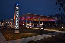 Generations Park in Bridgewater, Virginia | ||
| ||
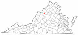 Location in Virginia | ||
| Coordinates: 38°23′12″N 78°58′11″W / 38.38667°N 78.96972°WCoordinates: 38°23′12″N 78°58′11″W / 38.38667°N 78.96972°W | ||
| Country | United States | |
| State | Virginia | |
| County | Rockingham | |
| Founded | 1835 | |
| Government | ||
| • Mayor | Ted Flory | |
| Area | ||
| • Total | 2.4 sq mi (6.2 km2) | |
| • Land | 2.4 sq mi (6.2 km2) | |
| • Water | 0.0 sq mi (0.0 km2) | |
| Elevation | 1,178 ft (359 m) | |
| Population (2010) | ||
| • Total | 5,644 | |
| • Density | 2,227.3/sq mi (860.0/km2) | |
| Time zone | UTC−5 (Eastern (EST)) | |
| • Summer (DST) | UTC−4 (EDT) | |
| ZIP code | 22812 | |
| Area code(s) | 540 | |
| FIPS code | 51-09656[1] | |
| GNIS feature ID | 1492628[2] | |
| Website | Official website | |
Bridgewater is an incorporated town in Rockingham County, Virginia, United States. The population was 5,644 at the 2010 census. It is included in the Harrisonburg, Virginia Metropolitan Statistical Area. Bridgewater is also home to Bridgewater College.
History
William Magill first settled along the North River in 1746, and the area became known as Magill's Ford.[3] The first bridge across the North River was built in 1820, and for a time the young community was known as Bridgeport.[3] The Town received its charter from the Virginia General Assembly on February 7, 1835, then incorporated as Bridgewater.[4] Every February 7, the Town holds an annual Charter Day celebration with fireworks.
Bridgewater College is located within the Town, and was first established in 1880.[5] The college has grown along with the Town, now enrolling more than 1,800 students.[6]
Since the creation of the Town in 1835, Bridgewater has endured six major floods, including a devastating flood in 1949 that claimed two lives.[7][8] As a result, the US Army Corps of Engineers constructed a long earthen levee to protect large portions of the Town against future flooding.[9]
Since the mid-1990s, the Town has held a "Summer's End Celebration" on Labor Day each year.[10] The event has grown to include a 5k race, carnival rides, and live music and is attended by thousands of people.[11]
Geography
According to the United States Census Bureau, the town has a total area of 2.4 square miles (6.2 km²), all of it land. Most of the town is located within a bend of the North River. Floods have wrecked the town occasionally. The northern areas are partly shielded from flooding with an Army Corps of Engineers dam. The wooded monadnock called Round Hill (elevation approx. 1750 feet) dominates the town's western skyline.
Demographics
| Historical population | |||
|---|---|---|---|
| Census | Pop. | %± | |
| 1880 | 390 | — | |
| 1900 | 384 | — | |
| 1910 | 859 | 123.7% | |
| 1920 | 914 | 6.4% | |
| 1930 | 951 | 4.0% | |
| 1940 | 993 | 4.4% | |
| 1950 | 1,537 | 54.8% | |
| 1960 | 1,815 | 18.1% | |
| 1970 | 2,828 | 55.8% | |
| 1980 | 3,289 | 16.3% | |
| 1990 | 3,918 | 19.1% | |
| 2000 | 5,203 | 32.8% | |
| 2010 | 5,644 | 8.5% | |
| Est. 2016 | 6,048 | [12] | 7.2% |
| U.S. Decennial Census[13] | |||
As of the 2010 census,[1] 5,644 people, 1,995 households, and 1,278 families resided in the town. The population density was 2,227.3 people per square mile (860.0/km²). The racial makeup of the town was 92.2% White, 2.4% African American, 0.3% Native American, 0.5% Asian, 2.7% from other races, and 1.9% from two or more races. Hispanic or Latino of any race were 4.9% of the population.
Of 1,995 households, 27.9% had children under the age of 18 living with them, 50.9% were married couples living together, and 35.9% were not families. About 31.3% of all households were made up of individuals and 18.7% had someone living alone who was 65 years of age or older. The average household size was 2.26 and the average family size was 2.84.
In Bridgewater, the population was distributed as 17.2% under the age of 18, 24.3% from 18 to 24, 17.8% from 25 to 44, 20.8% from 45 to 64, and 19.8% who were 65 years of age or older. The median age was 35.2 years. For every 100 females, there were 78.9 males. For every 100 females age 18 and over, there were 75.5 males age 18 and over.
According to the 2011-2015 American Community Survey 5-year estimates,[1] the median income for a household in the town was $55,205, and for a family was $62,483. Males had a median income of $45,533 versus $36,919 for females. The per capita income for the town was $24,854. About 4.7% of families and 5.4% of the population were below the poverty line, including 6.7% of those under age 18 and 3.8% of those age 65 or over.
Transportation
_at_Green_Street_in_Bridgewater%2C_Rockingham_County%2C_Virginia.jpg)
The main highways providing access to Bridgewater are Virginia State Route 42 and Virginia State Route 257. These two highways overlap from Bridgewater northwards to Dayton. SR 42 runs north-south and connects with U.S. Route 33 in Harrisonburg. SR 257 runs east west and connects with Interstate 81 near Mount Crawford.
See also
References
- 1 2 3 "American FactFinder". United States Census Bureau. Retrieved 2017-11-14.
- ↑ "US Board on Geographic Names". United States Geological Survey. 2007-10-25. Retrieved 2008-01-31.
- 1 2 Holton, Bob F.; Loveless, Carleen (2010). Bridgewater. Charleston, SC: Arcadia Publishing. p. 10. ISBN 0738586501.
- ↑ "Charter - Bridgewater". law.lis.virginia.gov. Commonwealth of Virginia. Retrieved 14 May 2018.
- ↑ "History of Bridgewater College". Bridgewater College. Retrieved 2017-11-28.
- ↑ "About Bridgewater". Bridgewater College. Retrieved 2017-11-28.
- ↑ Holton & Loveless 2010, p.7.
- ↑ "College Town Surveys Losses". Daily News-Record. 106 (36). Harrisonburg, VA. 1949-06-20. p. 1.
- ↑ Harter, Dale (Summer 2008). "The Flood of 1949 in Bridgewater" (PDF). The Harrisonburg-Rockingham Historical Society Newsletter. 30 (3): 4. Retrieved 14 May 2018.
- ↑ Vanderhoek, Mark (2003-08-29). "Town Prepares To Celebrate Summer's End". Daily News-Record. Harrisonburg, VA.
- ↑ Potter, Ellie (2017-09-04). "Celebrating Summer's End". Daily News-Record. Harrisonburg, VA.
- ↑ "Population and Housing Unit Estimates". Retrieved June 9, 2017.
- ↑ "Census of Population and Housing". Census.gov. Archived from the original on May 12, 2015. Retrieved June 4, 2015.
External links
| Wikimedia Commons has media related to Bridgewater, Virginia. |
Municipalities and communities of Rockingham County, Virginia, United States | ||
|---|---|---|
| Towns | 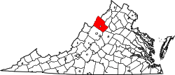 | |
| CDPs | ||
| Unincorporated communities |
| |
| Footnotes | ‡This populated place also has portions in an adjacent county or counties | |