Breuillet, Essonne
| Breuillet | ||
|---|---|---|
| Commune | ||
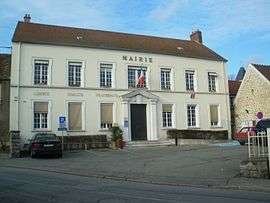 The town hall of Breuillet | ||
| ||
 Breuillet Location within Île-de-France region  Breuillet | ||
| Coordinates: 48°33′57″N 2°10′14″E / 48.5658°N 2.1706°ECoordinates: 48°33′57″N 2°10′14″E / 48.5658°N 2.1706°E | ||
| Country | France | |
| Region | Île-de-France | |
| Department | Essonne | |
| Arrondissement | Palaiseau | |
| Canton | Dourdan | |
| Intercommunality | CA Cœur d'Essonne | |
| Government | ||
| • Mayor (2008–2014) | Bernard Sprotti (PR) | |
| Area1 | 6.69 km2 (2.58 sq mi) | |
| Population (2006)2 | 8,270 | |
| • Density | 1,200/km2 (3,200/sq mi) | |
| Time zone | UTC+1 (CET) | |
| • Summer (DST) | UTC+2 (CEST) | |
| INSEE/Postal code | 91105 /91650 | |
| Elevation | 50–116 m (164–381 ft) | |
|
1 French Land Register data, which excludes lakes, ponds, glaciers > 1 km2 (0.386 sq mi or 247 acres) and river estuaries. 2 Population without double counting: residents of multiple communes (e.g., students and military personnel) only counted once. | ||
.svg.png)
Breuillet is a commune in the Essonne department in Île-de-France in northern France.
It is located between Arpajon and Dourdan.
Inhabitants of Breuillet are known as Breuilletois.
Twin towns
Breuillet has town twinning and cooperation agreement with:
See also
References
- INSEE
- Mayors of Essonne Association (in French)
External links
| Wikimedia Commons has media related to Breuillet (Essonne). |
- Official website (in French)
- Mérimée database - Cultural heritage (in French)
- Land use (IAURIF) (in English)
This article is issued from
Wikipedia.
The text is licensed under Creative Commons - Attribution - Sharealike.
Additional terms may apply for the media files.