Boigneville
| Boigneville | |
|---|---|
| Commune | |
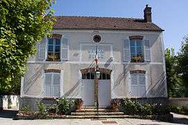 The town hall of Boigneville | |
 Boigneville Location within Île-de-France region  Boigneville | |
| Coordinates: 48°20′06″N 2°22′15″E / 48.3351°N 2.3707°ECoordinates: 48°20′06″N 2°22′15″E / 48.3351°N 2.3707°E | |
| Country | France |
| Region | Île-de-France |
| Department | Essonne |
| Arrondissement | Évry |
| Canton | Mennecy |
| Government | |
| • Mayor (2008–2014) | Jean-Jacques Boussaingault |
| Area1 | 15.80 km2 (6.10 sq mi) |
| Population (2006)2 | 426 |
| • Density | 27/km2 (70/sq mi) |
| Time zone | UTC+1 (CET) |
| • Summer (DST) | UTC+2 (CEST) |
| INSEE/Postal code | 91069 /91720 |
| Elevation | 67–143 m (220–469 ft) |
|
1 French Land Register data, which excludes lakes, ponds, glaciers > 1 km2 (0.386 sq mi or 247 acres) and river estuaries. 2 Population without double counting: residents of multiple communes (e.g., students and military personnel) only counted once. | |
Boigneville is a commune in the Essonne department in Île-de-France in northern France.
Inhabitants of Boigneville are known as Boignevillois.
See also
References
- INSEE
- Mayors of Essonne Association (in French)
External links
| Wikimedia Commons has media related to Boigneville. |
This article is issued from
Wikipedia.
The text is licensed under Creative Commons - Attribution - Sharealike.
Additional terms may apply for the media files.