Limours
| Limours | ||
|---|---|---|
| Commune | ||
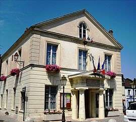 The town hall in Limours | ||
| ||
 Limours Location within Île-de-France region  Limours | ||
| Coordinates: 48°38′45″N 2°04′38″E / 48.6458°N 2.0771°ECoordinates: 48°38′45″N 2°04′38″E / 48.6458°N 2.0771°E | ||
| Country | France | |
| Region | Île-de-France | |
| Department | Essonne | |
| Arrondissement | Palaiseau | |
| Canton | Dourdan | |
| Intercommunality | Pays de Limours | |
| Government | ||
| • Mayor (2008–2014) | Jean-Raymond Hugonet (NC) | |
| Area1 | 14.25 km2 (5.50 sq mi) | |
| Population (2006)2 | 6,486 | |
| • Density | 460/km2 (1,200/sq mi) | |
| Time zone | UTC+1 (CET) | |
| • Summer (DST) | UTC+2 (CEST) | |
| INSEE/Postal code | 91338 /91470 | |
| Elevation | 100–177 m (328–581 ft) | |
|
1 French Land Register data, which excludes lakes, ponds, glaciers > 1 km2 (0.386 sq mi or 247 acres) and river estuaries. 2 Population without double counting: residents of multiple communes (e.g., students and military personnel) only counted once. | ||
.svg.png)
Limours is a commune the Essonne department in Île-de-France in northern France.
Inhabitants of Limours are known as Limouriens.
Geography
Limours is located 30 km (19 mi) from Paris.
See also
References
- INSEE
- Mayors of Essonne Association (in French)
External links

- Limours city council website (in French)
- Mérimée database - Cultural heritage (in French)
- Land use (IAURIF) (in English)
| Authority control |
|---|
This article is issued from
Wikipedia.
The text is licensed under Creative Commons - Attribution - Sharealike.
Additional terms may apply for the media files.