Saint-Pierre-du-Perray
| Saint-Pierre-du-Perray | ||
|---|---|---|
| Commune | ||
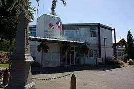 The town hall in Saint-Pierre-du-Perray | ||
| ||
 Saint-Pierre-du-Perray Location within Île-de-France region  Saint-Pierre-du-Perray | ||
| Coordinates: 48°36′44″N 2°29′43″E / 48.6123°N 2.4952°ECoordinates: 48°36′44″N 2°29′43″E / 48.6123°N 2.4952°E | ||
| Country | France | |
| Region | Île-de-France | |
| Department | Essonne | |
| Arrondissement | Évry | |
| Canton | Épinay-sous-Sénart | |
| Intercommunality | CA Grand Paris Sud Seine-Essonne-Sénart | |
| Government | ||
| • Mayor (2008–2014) | Pierre De Rus | |
| Area1 | 11.59 km2 (4.47 sq mi) | |
| Population (2006)2 | 7,914 | |
| • Density | 680/km2 (1,800/sq mi) | |
| Time zone | UTC+1 (CET) | |
| • Summer (DST) | UTC+2 (CEST) | |
| INSEE/Postal code | 91573 /91280 | |
| Elevation | 32–93 m (105–305 ft) | |
|
1 French Land Register data, which excludes lakes, ponds, glaciers > 1 km2 (0.386 sq mi or 247 acres) and river estuaries. 2 Population without double counting: residents of multiple communes (e.g., students and military personnel) only counted once. | ||
.svg.png)
Saint-Pierre-du-Perray is a commune in the Essonne department in Île-de-France in northern France.
Inhabitants of Saint-Pierre-du-Perray are known as Saint-Perreyens.
See also
References
- INSEE
- Mayors of Essonne Association (in French)
External links
| Wikimedia Commons has media related to Saint-Pierre-du-Perray. |
- Official website (in French)
- Land use (IAURIF) (in English)
This article is issued from
Wikipedia.
The text is licensed under Creative Commons - Attribution - Sharealike.
Additional terms may apply for the media files.