Chalou-Moulineux
| Chalou-Moulineux | ||
|---|---|---|
| Commune | ||
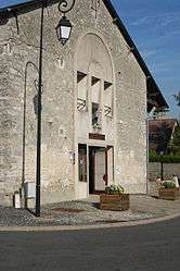 The town hall of Chalou-Moulineux | ||
| ||
 Chalou-Moulineux Location within Île-de-France region  Chalou-Moulineux | ||
| Coordinates: 48°23′02″N 2°01′20″E / 48.3839°N 2.0222°ECoordinates: 48°23′02″N 2°01′20″E / 48.3839°N 2.0222°E | ||
| Country | France | |
| Region | Île-de-France | |
| Department | Essonne | |
| Arrondissement | Étampes | |
| Canton | Étampes | |
| Government | ||
| • Mayor (2008–2014) | Patrick Fourré | |
| Area1 | 10.47 km2 (4.04 sq mi) | |
| Population (2006)2 | 408 | |
| • Density | 39/km2 (100/sq mi) | |
| Time zone | UTC+1 (CET) | |
| • Summer (DST) | UTC+2 (CEST) | |
| INSEE/Postal code | 91131 /91740 | |
| Elevation | 96–148 m (315–486 ft) | |
|
1 French Land Register data, which excludes lakes, ponds, glaciers > 1 km2 (0.386 sq mi or 247 acres) and river estuaries. 2 Population without double counting: residents of multiple communes (e.g., students and military personnel) only counted once. | ||
.svg.png)
Chalou-Moulineux is a commune in the Essonne department in Île-de-France in northern France.
Inhabitants of Chalou-Moulineux are known as Calo-Moulinotins.
See also
References
- INSEE
- Mayors of Essonne Association (in French)
External links
| Wikimedia Commons has media related to Chalou-Moulineux. |
- Mérimée database - Cultural heritage (in French)
- Land use (IAURIF) (in English)
This article is issued from
Wikipedia.
The text is licensed under Creative Commons - Attribution - Sharealike.
Additional terms may apply for the media files.