Bedford Avenue
Route map:
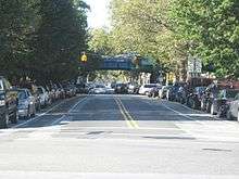
Bedford Avenue is the longest[1] street in Brooklyn, New York City, stretching 10.2 miles (16.4 km) and 132 blocks from Manhattan Avenue in Greenpoint south to Emmons Avenue in Sheepshead Bay, and passing through the neighborhoods of Williamsburg, Bedford-Stuyvesant, Crown Heights, Flatbush, Midwood, Marine Park, and Sheepshead Bay.
Automobile traffic flows in two directions south of Grant Square at Dean Street, and one-way northbound north of that location. The northernmost block of Bedford Avenue, between the intersections of Lorimer Street/Nassau Avenue and Manhattan Avenue in Greenpoint, was formerly bidirectional. In July 2018, this block was made one-way eastbound, with all traffic on northbound Bedford Avenue being forced to turn onto eastbound Nassau Avenue at the Lorimer Street intersection.[2]
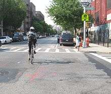
Northbound and southbound bicycle lanes are painted on the avenue south of Grant Square.[3] There are two New York City Subway stations named after the avenue: the Bedford Avenue (L train) station at Bedford Avenue and North 7th Street in Williamsburg, and the Bedford–Nostrand Avenues (G train) station at Bedford Avenue and Lafayette Avenue in Bedford-Stuyvesant. The B44 bus runs on a large part of the avenue.[4]
The many different building types common in Brooklyn are evident at some point on the avenue, from attached and detached single-family houses in Sheepshead Bay and Midwood, to brownstone rowhouses in Crown Heights and Bedford-Stuyvesant, to medium and large apartment buildings in Williamsburg and Greenpoint. In addition, the avenue passes through neighborhoods representative of Brooklyn's famous cultural and ethnic diversity. African-American, Hasidic, Hispanic, Russian, and Polish neighborhoods are all found along the avenue.
Bedford Road, passing through Bedford Pass, was an important north-south route in the 18th century for traffic between the farming village of Flatbush and the headwaters of Newtown Creek. In the 19th century it was extended south to the shore, and late in the century became one of the earliest paved roads in the rapidly growing eastern suburbs of the City of Brooklyn. Designated landmarks include the Studebaker Building and the 23d Regiment Armory.
References
- ↑ Forgotten-NY Archived 2006-10-17 at the Wayback Machine.
- ↑ "BEDFORD AVE – NASSAU AVE Presentation to Brooklyn Community Board 1" (PDF). New York City Department of Transportation. June 12, 2018. Retrieved 2018-07-21.
- ↑ "Bicycle Maps" (PDF). NYC.gov. New York City Department of Transportation. 2018. Retrieved 2018-07-21.
- ↑ "Brooklyn Bus Map" (PDF). Metropolitan Transportation Authority. November 2017. Retrieved April 24, 2018.