Linden Boulevard
Route map:
| |
|---|---|
| Central Avenue (former) | |
| Route information | |
| Maintained by NYCDOT and Valley Stream | |
| Length |
12.7 mi[1][2][3] (20.4 km) Combined length of three segments |
| Component highways |
|
| Major junctions | |
| West end | Flatbush Avenue in East Flatbush |
|
| |
| East end |
|
| Location | |
| Counties | Kings, Queens, Nassau |
| Highway system | |

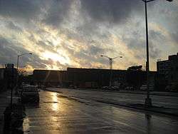
Linden Boulevard is a boulevard in New York City. It starts off at Flatbush Avenue in Brooklyn as a one-way street to Caton Avenue, where it becomes a two-way boulevard, and stretches through both Brooklyn and Queens. This boulevard, especially the area of Cambria Heights between Springfield Boulevard and the Nassau County line represents a smaller version of shopping centers located on Jamaica Avenue and Queens Boulevard. Linden Boulevard also continues into Nassau County to Valley Stream where it turns into Central Avenue; this was one of several former names of the street in Queens.
Description
Linden Boulevard runs through both Brooklyn and Queens, but is interrupted by Aqueduct Racetrack in Queens. The street's character is very different in each borough.
In Queens, it is mostly a simple two-lane, two-way residential street, no wider than the numbered avenues it parallels, and hardly busier until it reaches Cambria Heights, where it serves as a main commercial strip. Between Aqueduct Racetrack and Cross Bay Boulevard, there is a seven-block section of the boulevard that is mostly residential but is the only road between Rockaway Boulevard and Conduit Avenue on which traffic can flow east of the elevated railroad. One block west of Cross Bay Boulevard, contained within one block, are two short sections (each less than half a block), that are dead ends. One is off Desarc Road, and the other is located at the intersection of Sitka Street and Pitkin Avenue.[4]
Conduit Avenue in Queens interrupts Linden Boulevard. The majority of its traffic merges into the Nassau Expressway, which starts just east of the Linden Boulevard/Conduit Avenue intersection. Linden Boulevard becomes a dead-end street at Pitkin Avenue; another dead-end stretch of the boulevard is at Desarc Road, one block east of Pitkin Avenue. Linden Boulevard then resumes at Cross Bay Boulevard one block east of the dead-end stretches, is interrupted by Aqueduct Racetrack, resumes at Rockaway Boulevard in South Ozone Park, and continues into Nassau County from there.
In Brooklyn, between the intersection with Kings Highway and Remsen Avenue, and the intersection with 79th Street and South Conduit Avenue one block east of the Brooklyn–Queens border, it is one of the widest boulevards in the entire city, being a multi-median divided, 10-lane wide boulevard, similar to Queens' Woodhaven Boulevard and Queens Boulevard. While the speed limit on the other sections of Linden Boulevard is 25 miles per hour, in line with the city speed limit, this section of Linden Boulevard is signed at 35 miles per hour (with speed limit camera enforcement). It is also one of Brooklyn's busiest streets, carrying many trucks, as it is the only direct route for commercial vehicles between Long Island and the Verrazano-Narrows Bridge since commercial traffic isn't allowed on the Belt Parkway. The stretch of Linden Boulevard from Caton Avenue to Conduit Avenue is part of New York State Route 27.
In Brooklyn, the B20 bus runs on Linden Boulevard between Ashford Street and Elderts Lane in East New York. The B8 runs on Linden Boulevard between Rockaway Avenue and Church Ave. In Queens, the Q4 bus line serves Linden Boulevard between Merrick Boulevard and the Nassau County border. The Q9 also serves a small stretch of Linden Boulevard in Richmond Hill.
Linden Boulevard in Brooklyn, between Flatbush Avenue and Sapphire Street, is 6.0 miles (9.7 km) long. The five Queens stretches are a combined 6.4 miles (10.3 km) long.
A Tribe Called Quest connection
Rappers Q-Tip and Phife Dawg, the founding members of the hip-hop group A Tribe Called Quest, both grew up on Linden Boulevard in the neighborhood of St. Albans, Queens in the 1970s and 80s. They later referred to Linden Boulevard in their songs "Check the Rhime" and "Jazz (We've Got)" (from the album The Low End Theory), "Steve Biko (Stir It Up)" (from Midnight Marauders) and "1nce Again", "Mind Power" and "Get A Hold" (from Beats, Rhymes and Life). The music video for "Check the Rhime" was mostly filmed on Linden Boulevard, and showed Q-Tip and Phife Dawg rapping above a crowd on the rooftop of a dry-cleaning store on Linden and 192nd Street.[5] On July 2016, several months after Phife Dawg's death, a mural honoring A Tribe Called Quest was put up on the side of that dry cleaning store.[5] In November 2016, the section of Linden Boulevard at the corner of 192nd St. was honorarily renamed to "Malik 'Phife Dawg' Taylor Way".[6]
In other popular culture
The 1998 film Belly features Linden Boulevard.
Major intersections
| County | Location | mi[1][3] | km | Destinations | Notes | ||
|---|---|---|---|---|---|---|---|
| Brooklyn | Flatbush | 0.0 | 0.0 | Flatbush Avenue | |||
| 0.2 | 0.32 | NY 27 leaves/joins Linden Boulevard | |||||
| East Flatbush | 0.5 | 0.80 | Nostrand Avenue | ||||
| 1.9 | 3.1 | Kings Highway | No eastbound left turns; western terminus of service roads | ||||
| Brownsville | 2.5 | 4.0 | Rockaway Parkway | ||||
| East New York | 3.7 | 6.0 | Pennsylvania Avenue | ||||
| Queens | Ozone Park | 6.0 | 9.7 | Partial interchange; NY 27 continues east | |||
| Gap in route, including a 0.4-mile (0.6 km) long segment with no major intersections[2] | |||||||
| South Ozone Park | 0.0 | 0.0 | Rockaway Boulevard | ||||
| 1.1 | 1.8 | Exit 3 on I-678; access via service roads | |||||
| South Jamaica | 2.6 | 4.2 | Merrick Boulevard | ||||
| Cambria Heights | 4.4 | 7.1 | Francis Lewis Boulevard | ||||
| 4.5 | 7.2 | Springfield Boulevard | |||||
| 55 | 89 | Exit 25B on Belt / Cross Island Parkways; access via service roads | |||||
| Queens–Nassau county line | Cambria Heights– North Valley Stream line | 5.6 | 9.0 | Western terminus of unsigned CR C36 | |||
| Nassau | North Valley Stream | 5.8 | 9.3 | ||||
| 6.3 | 10.1 | Exit 13 on Southern Parkway; CR C36 continues south | |||||
1.000 mi = 1.609 km; 1.000 km = 0.621 mi
| |||||||
References
- 1 2 Google (July 2, 2018). "Linden Boulevard" (Map). Google Maps. Google. Retrieved July 2, 2018.
- 1 2 Google (July 2, 2018). "Linden Boulevard" (Map). Google Maps. Google. Retrieved July 2, 2018.
- 1 2 Google (July 2, 2018). "Linden Boulevard" (Map). Google Maps. Google. Retrieved July 2, 2018.
- ↑ Forgotten NY: Familiar roads in unfamiliar scenes
- 1 2 Diep, Eric (September 23, 2016). "Here's How A Tribe Called Quest's Latest Mural Was Created in Queens". Complex.
- ↑ Kim, Michelle (November 19, 2016). "NYC Street Is Now Officially Named After A Tribe Called Quest's Phife Dawg". The Fader.
External links
