Antigua, Fuerteventura
| Antigua | |||
|---|---|---|---|
| Municipality | |||
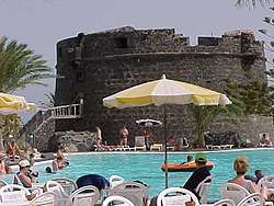 Caleta de Fuste and its castle | |||
| |||
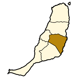 Municipal location in Fuerteventura | |||
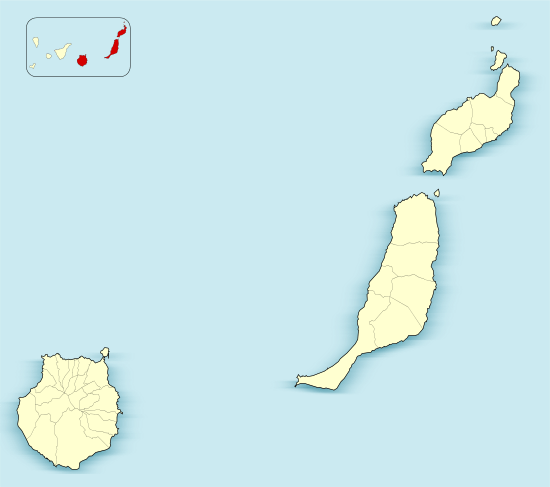 Antigua Location in the province of Las Palmas  Antigua Antigua (Canary Islands)  Antigua Antigua (Spain, Canary Islands) | |||
| Coordinates: 28°25′7″N 14°0′40″W / 28.41861°N 14.01111°WCoordinates: 28°25′7″N 14°0′40″W / 28.41861°N 14.01111°W | |||
| Country |
| ||
| Autonomous Community |
| ||
| Province | Las Palmas | ||
| Island | Fuerteventura | ||
| Government | |||
| • Mayor | Gustavo Berriel Hernandez (PP) | ||
| Area[1] | |||
| • Total | 250.56 km2 (96.74 sq mi) | ||
| Elevation (AMSL) | 254 m (833 ft) | ||
| Population (2013)[2] | |||
| • Total | 11,629 | ||
| • Density | 46/km2 (120/sq mi) | ||
| Time zone | UTC+0 (CET) | ||
| • Summer (DST) | UTC+1 (CEST (GMT +1)) | ||
| Postal code | 35630 | ||
| Area code(s) | +34 (Spain) + 928 (Las Palmas) | ||
| Website |
www | ||


Antigua is a town and a municipality in the central part of the island of Fuerteventura in the Province of Las Palmas in the Canary Islands. It has a population of 11,629 (2013),[2] and an area of 250.56 km².[1] It is situated 17 km southwest of the capital of the island Puerto del Rosario.
Main sights
- Caleta de Fuste Castle, a heritage site
- Centro Turístico Cultural Molino de Antigua (Molino de Antigua Cultural Touristic Centre): where works of major artists are exposed.
- Salinas de El Carmen, the origin of these salt mines dates back to 1800
- Paisaje Protegido del Malpaís Grande (Malpaís Grande Protected Landscape)
- Atalayita aboriginal town
- Cuchillos de Vigán, a natural Monument
- Caldera de Gairía, a national monument
See also
References
- 1 2 Instituto Canario de Estadística, area
- 1 2 Instituto Canario de Estadística Archived April 18, 2014, at the Wayback Machine., population
External links
| Wikimedia Commons has media related to Antigua (Fuerteventura). |
Places adjacent to Antigua, Fuerteventura | |
|---|---|
This article is issued from
Wikipedia.
The text is licensed under Creative Commons - Attribution - Sharealike.
Additional terms may apply for the media files.