Angmering
| Angmering | |
|---|---|
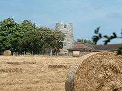 The windmill | |
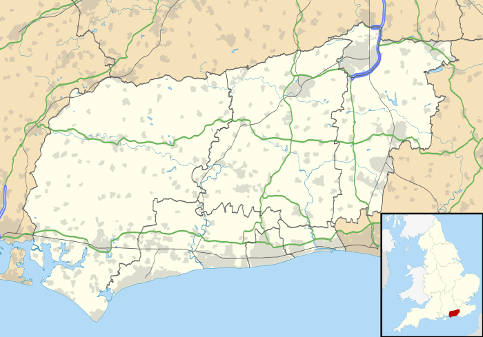 Angmering Angmering shown within West Sussex | |
| Area | 17.82 km2 (6.88 sq mi) [1] |
| Population | 7,614 (Civil Parish.2011)[2] |
| • Density | 427/km2 (1,110/sq mi) |
| OS grid reference | TQ068043 |
| • London | 49 miles (79 km) NNE |
| Civil parish |
|
| District | |
| Shire county | |
| Region | |
| Country | England |
| Sovereign state | United Kingdom |
| Post town | LITTLEHAMPTON |
| Postcode district | BN16 |
| Dialling code | 01903 |
| Police | Sussex |
| Fire | West Sussex |
| Ambulance | South East Coast |
| EU Parliament | South East England |
| UK Parliament | |
| Website | Parish Council |
Angmering is a large village and civil parish between Littlehampton and Worthing in West Sussex just to the south of the South Downs National Park, England. It is 1.5 miles (2.4 km) north of the English Channel; Worthing and Littlehampton are 3.5 miles (5.6 km) to the east and west respectively. Its roots stretch back to the Bronze Age and there is the site of a substantial Roman Villa and bath house. About two-thirds of the parish (mostly above the A27 road) fall within the South Downs National Park. In 1976, Angmering was twinned with the Normandy town of Ouistreham-Riva-Bella, the location of WW2 'Sword Beach'.[3].
Angmering railway station is 3⁄4 mile from the village centre straddling the boundaries of Angmering and East Preston. Angmering is home to the Oval Raceway or Angmering Motor Sports Centre.[4] Worthing Rugby Football Club, a national level professional rugby club, occupies extensive grounds in the east of the village.
Angmering Football Club play their home games at the Recreation Field in Decoy Drive. They play in the West Sussex Football League.
Etymology
The name "Angmering" probably derives from a Saxon farming settlement of about 600AD. It is thought that the original name was "Angenmaering" meaning Angenmaer's people. Various name changes took place over the centuries and these included Angemeringatun, Angmerengatum, Angemaeringum, Angemeringe, Aingmarying, Angmarrying, Angemare and Ameringe. Towards the end of the 9th century Alfred the Great, King of Wessex, bequeathed to his kinsman Osferthe ‘... Angmerengatum and the land that thereto longyth’.[5]
History
A large Roman villa was discovered nearby and part-excavated in the 1930s. The excavation was mainly centred on a large bath house complex comprising at least eight rooms. It may have been occupied by an important Roman citizen or a member of the Romano-British aristocracy, like the palace at Fishbourne, and dates from the same period of 65-75AD.[6]
The village's name is of an old Saxon form, meaning "the people of Angenmaer".[7]
Demography
With the recent development of the Bramley Green site, an influx of new residents has brought Angmering's electoral ward's resident population at the 2011 census to 7,788.[8] In 2001 the population was 5,639, illustrating the 38.1 per cent increase in the village's population over the last decade or so.[9]
Ethnicity
According to the Office for National Statistics based on the 2011 census 97.6 per cent of the 7,788 population of Angmering were White with 94.3 per cent being White British, 0.7 per cent White Irish and 2.6 per cent identifying as White Other. 2.4 percent of Angmering's residents are from a Black or Minority Ethnic Background.[8]
Religion
According to the 2011 Census, the largest religious grouping is Christians (66 per cent), followed by those of no religion (25.2 per cent). Angmering boasts the 12th Century, St Margaret's Church, alongside a small Catholic congregation centred on St Wilfred's Catholic Primary School, and a Baptist church.
Geography
The parish is about seven miles (10 km) long (from north to south) and two miles (3 km) wide. Its roots stretch back to the Bronze Age and it is also the site of a substantial Roman Villa.
At the top of Angmering is Highdown Hill, a National Trust property with free access for walks and picnics on the smooth grass near the still-visible slopes of a former chalk quarry.
The village has a 12th-century church (St Margaret's, re-built by Samuel Sanders Teulon in 1852, and reordered (refurbished) in 2009), three schools, several small shops, a post office and many historic houses from the 15th century onwards. It is in a semi-rural area with many farms. Following the building of the Bramley Green development, Angmering is the most populous settlement in the Arundel and South Downs (UK Parliament constituency).
Notable inhabitants
The village was the birthplace of Tom Oliver, who, after adding an l to his name to become Olliver, became the winning rider of the 1842, 1843 and 1853 Grand Nationals. Impresario Lord Bernard Delfont and record producer Norman Newell have lived in Angmering. The actor and singer Stanley Holloway lived in the parish of East Preston (Angmering-on-Sea) with his wife before his death in 1982.[10]
Portrait artist Juliet Pannett and her family lived in Angmering from the mid-1960s.[11]
Twinning
Since 1976, Angmering has been twinned with the coastal French town of Ouistreham in the Calvados department of Normandy.

Notes
- ↑ "2001 Census: West Sussex – Population by Parish" (PDF). West Sussex County Council. Archived from the original (PDF) on 8 June 2011. Retrieved 26 March 2009.
- ↑ Key Statistics; Quick Statistics: Population Density United Kingdom Census 2011 Office for National Statistics Retrieved 21 November 2013
- ↑ Angmering Village Life website www.angmeringvillage.co.uk
- ↑ Griffin, Rob (7 May 2008). "Find the right formula for family business". The Daily Express. Retrieved 10 February 2010.
- ↑ "Brief History of Angmering". Angmering Village Life. Angmering Parish Council. Retrieved 18 August 2014.
- ↑ http://www.angmeringvillage.co.uk/history/villa.htm
- ↑ Hunter Blair, Peter (1966). Roman Britain and Early England: 55 B.C. – A.D. 871. W.W. Norton & Company. p. 176. ISBN 0-393-00361-2.
- 1 2 "Ward Profiles: Angmering" (PDF). arun.gov.uk. Arun District Council. Retrieved 18 August 2014.
- ↑ "Angmering – Parish Profile: 2001". Neighbourhood Statistics: ONS. Office for National Statistics. Retrieved 18 August 2014.
- ↑ Holloway and Richards, p. 112.
- ↑ Parkinson, Justin (12 September 2005). "Obituary: Juliet Pannett". the Daily Telegraph. London.
- ↑ "National Commission for Decentralised cooperation". Délégation pour l'Action Extérieure des Collectivités Territoriales (Ministère des Affaires étrangères) (in French). Archived from the original on 27 November 2013. Retrieved 26 December 2013.
Sources
External links
| Wikimedia Commons has media related to Angmering. |
- Angmering Village Life contains extensive village history, local news, organisations, traders, photos, videos, forums, etc.
- Angmering at Curlie (based on DMOZ)
- Angmering Project has all of Angmering census returns and surrounding villages available to view.
- Further historical information and sources on GENUKI
- Angmering in the Domesday Book