Androscoggin County, Maine
| Androscoggin County, Maine | |
|---|---|
 | |
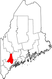 Location in the U.S. state of Maine | |
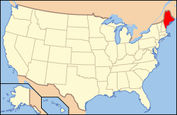 Maine's location in the U.S. | |
| Founded | March 18, 1854 |
| Named for | the Androscoggin tribe |
| Seat | Auburn |
| Largest city | Lewiston |
| Area | |
| • Total | 497 sq mi (1,287 km2) |
| • Land | 468 sq mi (1,212 km2) |
| • Water | 29 sq mi (75 km2), 5.9% |
| Population (est.) | |
| • (2016) | 107,319 |
| • Density | 230/sq mi (90/km2) |
| Congressional district | 2nd |
| Time zone | Eastern: UTC−5/−4 |
| Website |
www |
Androscoggin County is located in the State of Maine within the United States Of America. As of the 2010 census, the county's population was 107,702.[1] Its county seat is the city of Auburn.[2]
Androscoggin County comprises the Lewiston-Auburn, Maine Metropolitan Statistical Area and is partially included in the Lewiston-Auburn, Maine, Metropolitan New England City and Town Area. It is also a part of the Portland-Lewiston-South Portland, Maine Combined Statistical Area.
Bates College is in the Androscoggin County city of Lewiston.
History
Demand for a new county emerged when the residents of the rapidly growing town of Lewiston complained of the long distance they had to travel to reach Wiscasset, the county seat of Lincoln County, in which Lewiston was originally located. It was also an impractical circumstance as Lewiston's neighbor, Auburn, was part of Cumberland County. As the growing partnership of the two towns emerged, the case for the towns to be in the same county grew. Different plans were discussed, including Lewiston joining Cumberland County. Eventually, the idea of a new county came to the table. The debate then became over which town would be the center of the new county. Bath, Brunswick, and Lewiston each desired the distinction. Lewiston eventually won the debate. Androscoggin County was created in 1854 from towns originally in Cumberland County, Lincoln County, Kennebec County, and Oxford County.
The next issue centered on where to put the county seat, as both Lewiston and Auburn desired to be named the county seat. It would eventually be put to a vote, with both towns putting different offers on the table, including ideas to cut the costs of the new county buildings for surrounding towns. Auburn would eventually win a convincing victory, with the towns on each side of the river voting for the town on their side. As more people then lived to the west of the Androscoggin River, Auburn won the vote.[3]
Geography
According to the U.S. Census Bureau, the county has a total area of 497 square miles (1,290 km2), of which 468 square miles (1,210 km2) is land and 29 square miles (75 km2) (5.9%) is water.[4] It is the second-smallest county in Maine by total area
Adjacent counties
- Franklin County, Maine – north
- Kennebec County, Maine – northeast
- Sagadahoc County, Maine – southeast
- Cumberland County, Maine – south
- Oxford County, Maine – west
Demographics
| Historical population | |||
|---|---|---|---|
| Census | Pop. | %± | |
| 1860 | 29,726 | — | |
| 1870 | 35,866 | 20.7% | |
| 1880 | 45,042 | 25.6% | |
| 1890 | 48,968 | 8.7% | |
| 1900 | 54,242 | 10.8% | |
| 1910 | 59,822 | 10.3% | |
| 1920 | 65,796 | 10.0% | |
| 1930 | 71,214 | 8.2% | |
| 1940 | 76,679 | 7.7% | |
| 1950 | 83,594 | 9.0% | |
| 1960 | 86,312 | 3.3% | |
| 1970 | 91,279 | 5.8% | |
| 1980 | 99,657 | 9.2% | |
| 1990 | 105,259 | 5.6% | |
| 2000 | 103,793 | −1.4% | |
| 2010 | 107,702 | 3.8% | |
| Est. 2016 | 107,319 | [5] | −0.4% |
| U.S. Decennial Census[6] 1790–1960[7] 1900–1990[8] 1990–2000[9] 2010–2016[1] | |||
2000 census
As of the census[10] of 2000, there were 103,793 people, 42,028 households, and 27,192 families residing in the county. The population density was 221 people per square mile (85/km²). There were 45,960 housing units at an average density of 98 per square mile (38/km²). The racial makeup of the county was 96.98% White, 0.66% Black or African American, 0.27% Native American, 0.55% Asian, 0.04% Pacific Islander, 0.28% from other races, and 1.22% from two or more races. 0.95% of the population were Hispanic or Latino of any race. 24.5% were of French Canadian, 19.4% French, 14.3% English, 9.7% United States or American and 8.4% Irish ancestry. 9.6% of the population speak French and 1.5% of the population speak Spanish at home.[11]
There were 42,028 households out of which 30.90% had children under the age of 18 living with them, 49.60% were married couples living together, 10.80% had a female householder with no husband present, and 35.30% were non-families. 28.30% of all households were made up of individuals and 11.00% had someone living alone who was 65 years of age or older. The average household size was 2.38 and the average family size was 2.91.
In the county, the population was spread out with 23.90% under the age of 18, 9.10% from 18 to 24, 29.70% from 25 to 44, 22.90% from 45 to 64, and 14.40% who were 65 years of age or older. The median age was 37 years. For every 100 females there were 94.30 males. For every 100 females age 18 and over, there were 91.20 males.
The median income for a household in the county was $35,793, and the median income for a family was $44,082. Males had a median income of $31,622 versus $22,366 for females. The per capita income for the county was $18,734. About 7.50% of families and 11.10% of the population were below the poverty line, including 13.80% of those under age 18 and 11.00% of those age 65 or over.
2010 census
As of the 2010 United States Census, there were 107,702 people, 44,315 households, and 28,045 families residing in the county.[12] The population density was 230.2 inhabitants per square mile (88.9/km2). There were 49,090 housing units at an average density of 104.9 per square mile (40.5/km2).[13] The racial makeup of the county was 92.8% white, 3.6% black or African American, 0.7% Asian, 0.4% American Indian, 0.4% from other races, and 2.0% from two or more races. Those of Hispanic or Latino origin made up 1.5% of the population.[12] In terms of ancestry, 21.2% were English, 20.5% were French Canadian, 20.1% were French, 15.5% were Irish, 8.1% were German, and 5.0% were American.[14]
Of the 44,315 households, 30.2% had children under the age of 18 living with them, 45.8% were married couples living together, 12.0% had a female householder with no husband present, 36.7% were non-families, and 28.3% of all households were made up of individuals. The average household size was 2.37 and the average family size was 2.88. The median age was 39.8 years.[12]
The median income for a household in the county was $44,470 and the median income for a family was $55,045. Males had a median income of $41,554 versus $31,852 for females. The per capita income for the county was $22,752. About 9.7% of families and 14.3% of the population were below the poverty line, including 20.0% of those under age 18 and 12.4% of those age 65 or over.[15]
Media
Newspapers
- The Sun Journal prints a daily newspaper in four different editions statewide. The Sun Journal was the recipient of the 2008 New England Daily Newspaper of the Year and the 2009 Maine Press Association Newspaper of the Year.
Politics
Presidential elections
In Presidential elections, Androscoggin County has been one of the most consistently, though not always the most strongly, Democratic counties in the state. It was the only county in Maine to be won by Franklin D. Roosevelt in 1932 and George McGovern in 1972. Jimmy Carter also carried the county twice. In 1984 and 1988, it went for Republican candidates Ronald Reagan and George H.W. Bush, who also won the state of Maine. In 2016, it went for the Republican Donald Trump;[16] whereas, the state was won by Democrat Hillary Clinton.
| Year | Republican | Democratic | Third parties |
|---|---|---|---|
| 2016 | 50.8% 28,227 | 41.4% 23,009 | 7.9% 4,365 |
| 2012 | 42.1% 22,232 | 54.8% 28,989 | 3.1% 1,641 |
| 2008 | 41.3% 22,671 | 56.6% 31,017 | 2.1% 1,162 |
| 2004 | 43.7% 24,519 | 54.4% 30,503 | 1.9% 1,045 |
| 2000 | 40.5% 19,948 | 53.3% 26,251 | 6.2% 3,046 |
| 1996 | 25.8% 12,053 | 56.6% 26,428 | 17.7% 8,250 |
| 1992 | 25.7% 14,174 | 40.3% 22,247 | 34.0% 18,723 |
| 1988 | 51.7% 23,061 | 47.5% 21,165 | 0.8% 359 |
| 1984 | 57.2% 26,904 | 42.3% 19,885 | 0.5% 211 |
| 1980 | 39.9% 18,399 | 49.3% 22,715 | 10.8% 4,966 |
| 1976 | 37.4% 16,330 | 60.7% 26,484 | 2.0% 851 |
| 1972 | 49.9% 19,406 | 50.1% 19,509 | 0.0% 9 |
| 1968 | 27.5% 10,390 | 71.0% 26,820 | 1.4% 542 |
| 1964 | 19.8% 7,441 | 80.1% 30,080 | 0.0% 14 |
| 1960 | 36.0% 14,654 | 64.0% 26,097 | 0.0% 0 |
| 1956 | 56.3% 20,385 | 43.7% 15,842 | 0.0% 0 |
| 1952 | 50.6% 18,049 | 49.2% 17,560 | 0.2% 67 |
| 1948 | 39.2% 11,443 | 59.7% 17,405 | 1.1% 317 |
| 1944 | 36.4% 10,927 | 63.5% 19,078 | 0.1% 34 |
| 1940 | 35.0% 10,394 | 64.9% 19,273 | 0.1% 40 |
| 1936 | 38.1% 10,480 | 60.6% 16,657 | 1.2% 340 |
| 1932 | 40.1% 9,838 | 58.8% 14,441 | 1.2% 283 |
| 1928 | 51.6% 11,790 | 47.9% 10,940 | 0.5% 124 |
| 1924 | 59.8% 9,680 | 29.2% 4,733 | 11.0% 1,774 |
| 1920 | 60.8% 9,565 | 36.6% 5,757 | 2.6% 402 |
| 1916 | 43.7% 4,496 | 53.1% 5,464 | 3.2% 326 |
| 1912 | 8.4% 859 | 44.4% 4,516 | 47.2% 4,801 |
| 1908 | 56.1% 4,381 | 39.6% 3,095 | 4.3% 339 |
State politics
In 2012, the county voted 54% against Maine Question 1, 2012 – a measure to legalize same-sex marriage, but the referendum passed in the state by 53%.[18]
County government
Androscoggin County is governed by an elected county commission consisting of seven members representing single-member districts.[19] Currently, the county commissioners are: District 1 Noel Madore District 2 Melissa Willette District 3 Matthew P. Roy District 4 Isaiah Lary District 5 Bonney Starbird District 6 Zachary Maher District 7 Sally A. Christner
Voter registration
Voter registration
| Voter Registration and Party Enrollment as of June 2014[20] | |||||
|---|---|---|---|---|---|
| Party | Total Voters | Percentage | |||
| Unenrolled | 27,916 | 38.16% | |||
| Democratic | 24,520 | 33.52% | |||
| Republican | 17,174 | 23.47% | |||
| Green Independent | 3,534 | 4.83% | |||
| Total | 73,144 | 100% | |||
Communities
Cities
Towns
Census-designated places
See also
References
- 1 2 "State & County QuickFacts". United States Census Bureau. Retrieved March 10, 2014.
- ↑ "Find a County". National Association of Counties. Archived from the original on 2011-05-31. Retrieved 2011-06-07.
- ↑ Hodgkin, Douglas I., Frontier to Industrial City:Lewiston Town Politics 1768–1863. Just Write Books, Topsham, Maine, 2008
- ↑ "2010 Census Gazetteer Files". United States Census Bureau. August 22, 2012. Archived from the original on September 9, 2014. Retrieved September 7, 2014.
- ↑ "Population and Housing Unit Estimates". Retrieved June 9, 2017.
- ↑ "U.S. Decennial Census". United States Census Bureau. Archived from the original on May 12, 2015. Retrieved September 7, 2014.
- ↑ "Historical Census Browser". University of Virginia Library. Retrieved September 7, 2014.
- ↑ "Population of Counties by Decennial Census: 1900 to 1990". United States Census Bureau. Retrieved September 7, 2014.
- ↑ "Census 2000 PHC-T-4. Ranking Tables for Counties: 1990 and 2000" (PDF). United States Census Bureau. Retrieved September 7, 2014.
- ↑ "American FactFinder". United States Census Bureau. Archived from the original on 2013-09-11. Retrieved 2008-01-31.
- ↑ "Androscoggin County, Maine". Data Center. American Community Survey Aggregate Data, 5-Year Summary File, 2006–2010. Modern Language Association. 2006–2010. Archived from the original on 2013-08-15. Retrieved 23 Aug 2013.
- 1 2 3 "DP-1 Profile of General Population and Housing Characteristics: 2010 Demographic Profile Data". United States Census Bureau. Retrieved 2016-01-21.
- ↑ "Population, Housing Units, Area, and Density: 2010 - County". United States Census Bureau. Retrieved 2016-01-21.
- ↑ "DP02 SELECTED SOCIAL CHARACTERISTICS IN THE UNITED STATES – 2006-2010 American Community Survey 5-Year Estimates". United States Census Bureau. Retrieved 2016-01-21.
- ↑ "DP03 SELECTED ECONOMIC CHARACTERISTICS – 2006-2010 American Community Survey 5-Year Estimates". United States Census Bureau. Retrieved 2016-01-21.
- ↑ David Leip's Presidential Atlas (Maps for Maine by election)
- ↑ Leip, David. "Dave Leip's Atlas of U.S. Presidential Elections". uselectionatlas.org. Retrieved 2018-08-25.
- ↑ "State of Maine Bureau of Corporations, Elections & Commissions". Maine.gov. November 6, 2012. Retrieved 2018-08-25.
- ↑ "Androscoggin County Maine". www.androscoggincountymaine.gov. Retrieved 2018-08-25.
- ↑ "Registration and Party Enrollment Statistics as of June 10, 2014" (PDF). Maine Bureau of Corporations. Archived from the original (PDF) on October 30, 2014.
External links
Places adjacent to Androscoggin County, Maine | ||||||||||
|---|---|---|---|---|---|---|---|---|---|---|
| ||||||||||
Municipalities and communities of Androscoggin County, Maine, United States | ||
|---|---|---|
| Cities | | |
| Towns | ||
| CDPs | ||
| Other villages | ||
Augusta (capital) | |
| Topics |
|
| Society |
|
| Regions | |
| Counties | |
| Cities | |
| Largest towns | |