Powys (graafschap)
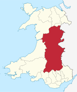
Powys is een bestuurlijk graafschap en een ceremonieel behouden graafschap in het oosten en midden van Wales. Het graafschap telt 132.000 inwoners en is qua oppervlakte het grootste graafschap van Wales.
 | |||
| Coördinaten | 52°18'0"NB, 3°25'0"WL | ||
| Algemeen | |||
| Oppervlakte | 5180,6804[1] km² | ||
| Inwoners | 132447 (2018)[2] (26 inw./km²) | ||
| Grootste plaats | Brecon | ||
| Bestuurlijke status | graafschap | ||
| Welsh sprekend | 30,1% | ||
| Overig | |||
| ISO 3166-2 | GB-POW | ||
| ONS-code | W06000023 | ||
| Officiële website | powys.gov.uk | ||
| |||
Zie ook
Rivier
Bronnen, noten en/of referenties
|
| Bestuurlijke indeling van het Verenigd Koninkrijk: principal areas van Wales | |
|---|---|
|
Graafschappen: Anglesey · Carmarthenshire · Ceredigion · Denbighshire · Flintshire · Gwynedd · Monmouthshire · Pembrokeshire · Powys County boroughs: Blaenau Gwent · Bridgend · Caerphilly · Conwy · Merthyr Tydfil · Neath Port Talbot · Rhondda Cynon Taf · Torfaen · Vale of Glamorgan · Wrexham Steden: Cardiff · Newport · Swansea Zie ook: behouden graafschappen (preserved counties) en de historische graafschappen | |
This article is issued from
Wikipedia.
The text is licensed under Creative
Commons - Attribution - Sharealike.
Additional terms may apply for the media files.