Carmarthenshire
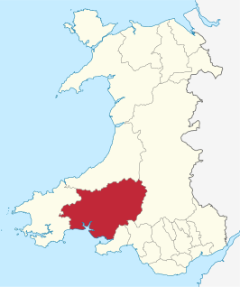
Carmarthenshire (Welsh: Sir Gaerfyrddin) is een bestuurlijke graafschap in het zuidwesten van Wales, gelegen in het ceremoniële behouden graafschap Dyfed. Carmarthenshire is tevens een historische graafschap en heeft 178.043 inwoners (2006[2]).
 | |||
| Coördinaten | 51°51'22"NB, 4°18'38"WL | ||
| Algemeen | |||
| Oppervlakte | 2370,3053[1] km² | ||
| Inwoners | 178.043 (2006[2]) (75 inw./km²) | ||
| Grootste plaats | Llanelli | ||
| Bestuurlijke status | graafschap | ||
| Welsh sprekend | 63,6% | ||
| Overig | |||
| ISO 3166-2 | GB-CMN | ||
| ONS-code | W06000010 | ||
| Officiële website | carmarthenshire.gov.uk | ||
| |||
Plaatsen
- Ammanford
- Bethlehem
- Brynamman
- Burry Port
- Carmarthen
- Llanelli
- Llanybydder
Bezienswaardigheden
Historisch
Museums
- Carmarthenshire County Museum
- Dolaucothi Gold Mines
- Dylan Thomas Boathouse
- Kidwelly Industrial Museum
- Pendine Museum of Speed (Pendine)
| Bronnen, noten en/of referenties |
| Bestuurlijke indeling van het Verenigd Koninkrijk: principal areas van Wales | |
|---|---|
|
Graafschappen: Anglesey · Carmarthenshire · Ceredigion · Denbighshire · Flintshire · Gwynedd · Monmouthshire · Pembrokeshire · Powys County boroughs: Blaenau Gwent · Bridgend · Caerphilly · Conwy · Merthyr Tydfil · Neath Port Talbot · Rhondda Cynon Taf · Torfaen · Vale of Glamorgan · Wrexham Steden: Cardiff · Newport · Swansea Zie ook: behouden graafschappen (preserved counties) en de historische graafschappen | |
| Zie de categorie Carmarthenshire van Wikimedia Commons voor mediabestanden over dit onderwerp. |
This article is issued from
Wikipedia.
The text is licensed under Creative
Commons - Attribution - Sharealike.
Additional terms may apply for the media files.