Hexham
Hexham is een civil parish in het Engelse graafschap Northumberland. De plaats telde in 2001 11.139 inwoners was tussen het bestuurlijk centrum van Tynedale van 1974 tot 2009, toen het district werd opgeheven. De dichtstbijzijnde grote stad is het ongeveer 40 km oostelijker gelegen Newcastle upon Tyne.
| Civil parish in Engeland | |||
 | |||
| Situering | |||
| Regio | North East England | ||
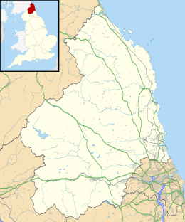
| Graafschap | Northumberland | ||
| District | Northumberland | ||
| Coördinaten | 54° 58' NB, 2° 6' WL | ||
| Algemeen | |||
| Oppervlakte | 23,9715 km² | ||
| Inwoners (2011) | 11829 (493 inw./km²) | ||
| Overig | |||
| Postcode(s) | NE46 | ||
| Netnummer(s) | 01434 | ||
| Grid code | NY937638 | ||
| Post town | HEXHAM | ||
| ONS-code | E04010804 | ||
| |||
Geschiedenis

Wilfrid van York stichtte hier in circa 674 het klooster Hexham Abbey, waarvan nu weinig meer dan de crypte resteert. De kerk die nu op deze plek staat, heeft dezelfde naam en dateert uit circa 1170-1250.
In de middeleeuwen was Hexham de hoofdstad van een bisdom, totdat dit opging in het graafschap Durham. Aan het begin van de 11e eeuw probeerde koning Hendrik I om de macht van de prins-bisschopen van Durham te breken door van Hexham ook een graafschap te maken. Dit bleef het tot 1572, toen het opging in Northumberland.
Infrastructuur
Via Station Hexham heeft de stad een treinverbinding met Carlisle en Newcastle Upon Tyne via de Tyne Valley-line (Tyne Vallei-lijn). De dienst op deze lijn wordt door dieseltreinen van Abellio (Nederlandse Spoorwegen/NS) en Serco.
Geboren
- Peter Beardsley (1961), Engels voetballer
- Pete Doherty (1979), Brits muzikant
Acklington · Acomb · Adderstone with Lucker · Akeld · Allendale · Alnham · Alnmouth · Alnwick · Alwinton · Amble by the Sea · Ancroft · Bamburgh · Bardon Mill · Bavington · Beadnell · Belford · Bellingham · Belsay · Berwick upon Tweed · Bewick · Biddlestone · Birtley · Blanchland · Bowsden · Branxton · Brinkburn · Broomhaugh and Riding · Broomley and Stocksfield · Bywell · Callaly · Capheaton · Carham · Cartington · Chatton · Chillingham · Chollerton · Coanwood · Corbridge · Cornhill on Tweed · Corsenside · Craster · Cresswell · Denwick · Doddington · Duddo · Earle · Easington · East Chevington · Edlingham · Eglingham · Ellingham · Ellington and Linton · Elsdon · Embleton · Ewart · Falstone · Featherstone · Felton · Ford · Glanton · Greenhead · Greystead · Haltwhistle · Harbottle · Hartburn · Hartleyburn · Hauxley · Haydon · Healey · Hebron · Heddon on the Wall · Hedgeley · Hedley · Henshaw · Hepple · Hepscott · Hesleyhurst · Hexham · Hexhamshire · Hollinghill · Holy Island · Horncliffe · Horsley · Humshaugh · Ilderton · Ingram · Kielder · Kilham · Kirknewton · Kirkwhelpington · Knaresdale with Kirkhaugh · Kyloe · Lesbury · Lilburn · Longframlington · Longhirst · Longhorsley · Longhoughton · Lowick · Lynemouth · Matfen · Meldon · Melkridge · Middleton · Milfield · Mitford · Morpeth · Netherton · Netherwitton · Newbrough · Newton by the Sea · Newton on the Moor and Swarland · Norham · North Sunderland · Nunnykirk · Ord · Otterburn · Ovingham · Ovington · Pegswood · Plenmeller with Whitfield · Ponteland · Prudhoe · Rennington · Rochester · Roddam · Rothbury · Rothley · Sandhoe · Shilbottle · Shoreswood · Shotley Low Quarter · Simonburn · Slaley · Snitter · Stamfordham · Stannington · Tarset · Thirlwall · Thirston · Thropton · Togston · Tritlington and West Chevington · Ulgham · Wall · Wallington Demesne · Warden · Wark · Warkworth · West Allen · Whalton · Whittingham · Whittington · Whitton and Tosson · Widdrington Station and Stobswood · Widdrington · Wooler · Wylam