Belford (Northumberland)
Belford is een civil parish in het bestuurlijke gebied Northumberland, in het Engelse graafschap Northumberland met 1258 inwoners.
Acklington · Acomb · Adderstone with Lucker · Akeld · Allendale · Alnham · Alnmouth · Alnwick · Alwinton · Amble by the Sea · Ancroft · Bamburgh · Bardon Mill · Bavington · Beadnell · Belford · Bellingham · Belsay · Berwick upon Tweed · Bewick · Biddlestone · Birtley · Blanchland · Bowsden · Branxton · Brinkburn · Broomhaugh and Riding · Broomley and Stocksfield · Bywell · Callaly · Capheaton · Carham · Cartington · Chatton · Chillingham · Chollerton · Coanwood · Corbridge · Cornhill on Tweed · Corsenside · Craster · Cresswell · Denwick · Doddington · Duddo · Earle · Easington · East Chevington · Edlingham · Eglingham · Ellingham · Ellington and Linton · Elsdon · Embleton · Ewart · Falstone · Featherstone · Felton · Ford · Glanton · Greenhead · Greystead · Haltwhistle · Harbottle · Hartburn · Hartleyburn · Hauxley · Haydon · Healey · Hebron · Heddon on the Wall · Hedgeley · Hedley · Henshaw · Hepple · Hepscott · Hesleyhurst · Hexham · Hexhamshire · Hollinghill · Holy Island · Horncliffe · Horsley · Humshaugh · Ilderton · Ingram · Kielder · Kilham · Kirknewton · Kirkwhelpington · Knaresdale with Kirkhaugh · Kyloe · Lesbury · Lilburn · Longframlington · Longhirst · Longhorsley · Longhoughton · Lowick · Lynemouth · Matfen · Meldon · Melkridge · Middleton · Milfield · Mitford · Morpeth · Netherton · Netherwitton · Newbrough · Newton by the Sea · Newton on the Moor and Swarland · Norham · North Sunderland · Nunnykirk · Ord · Otterburn · Ovingham · Ovington · Pegswood · Plenmeller with Whitfield · Ponteland · Prudhoe · Rennington · Rochester · Roddam · Rothbury · Rothley · Sandhoe · Shilbottle · Shoreswood · Shotley Low Quarter · Simonburn · Slaley · Snitter · Stamfordham · Stannington · Tarset · Thirlwall · Thirston · Thropton · Togston · Tritlington and West Chevington · Ulgham · Wall · Wallington Demesne · Warden · Wark · Warkworth · West Allen · Whalton · Whittingham · Whittington · Whitton and Tosson · Widdrington Station and Stobswood · Widdrington · Wooler · Wylam
Geplaatst op: 15-8-2010 |
Dit artikel is een beginnetje over landen & volken. U wordt uitgenodigd om op bewerken te klikken om uw kennis aan dit artikel toe te voegen. |
| Civil parish in Engeland | |||
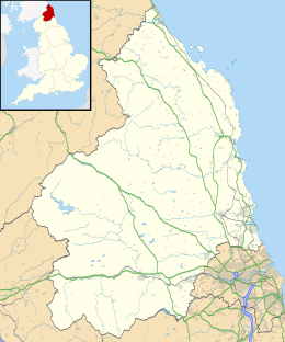 | |||
| Situering | |||
| Regio | North East England | ||
| Graafschap | Northumberland | ||
| District | Northumberland | ||
| Coördinaten | 55° 36' NB, 1° 50' WL | ||
| Algemeen | |||
| Oppervlakte | 21,1623 km² | ||
| Inwoners (2011) | 1258 (59 inw./km²) | ||
| Overig | |||
| Postcode(s) | NE70 | ||
| Netnummer(s) | 01668 | ||
| Grid code | NU108339 | ||
| Post town | BELFORD | ||
| ONS-code | E04010741 | ||
| Foto's | |||
 | |||
| High Street, Belford | |||
| |||