Wijk bij Duurstede
Wijk bij Duurstede (Dutch pronunciation: [ˈʋɛi̯ɡ bɛi̯ ˈdyːrsteːdə]) is a municipality and a city in the central Netherlands.
Wijk bij Duurstede | |
|---|---|
 Aerial view of Wijk bij Duurstede | |
 Flag  Coat of arms | |
.svg.png) Location in Utrecht | |
| Coordinates: 51°59′N 5°20′E | |
| Country | Netherlands |
| Province | Utrecht |
| Government | |
| • Body | Municipal council |
| Area | |
| • Total | 50.25 km2 (19.40 sq mi) |
| • Land | 47.56 km2 (18.36 sq mi) |
| • Water | 2.69 km2 (1.04 sq mi) |
| Elevation | 5 m (16 ft) |
| Population (January 2019)[4] | |
| • Total | 23,762 |
| • Density | 500/km2 (1,000/sq mi) |
| Time zone | UTC+1 (CET) |
| • Summer (DST) | UTC+2 (CEST) |
| Postcode | 3945–3947, 3960–3962 |
| Area code | 0343 |
| Website | www |
Population centres
Topography
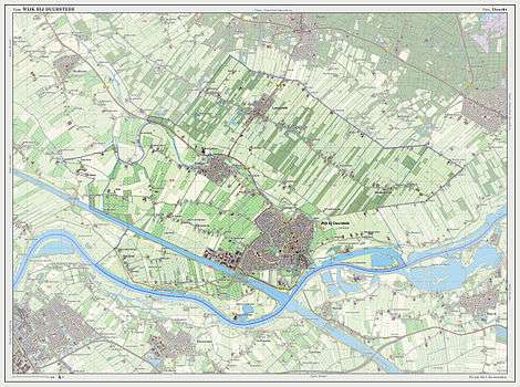
Dutch Topographic map of the municipality of Wijk bij Duurstede, 2013.
City
The city (population as of 2007: 23,377) is located on the Rhine. At Wijk bij Duurstede, the Kromme Rijn (Crooked Rhine) branches off, and the main branch is called Lek River downstream from Wijk bij Duurstede.
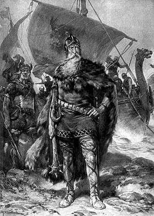
The name 'Wijk bij Duurstede' means 'Neighbourhood by Duurstede'. Duurstede is the name of the nearby castle/ruin, also called Dorestad, where the bishop of Utrecht used to live. Wijk bij Duurstede is located at the place where Dorestad used to be, an important Frisian trade settlement during Carolingian times, that was pillaged around 850 by the Vikings.
Wijk bij Duurstede has the only drive-through wind mill in the world. The mill is often confused with the mill that was made famous by Ruisdael's 1670 painting The windmill at Wijk bij Duurstede, but that mill no longer exists (its foundations can still be seen a couple of blocks away from the remaining mill). At the market place of Wijk bij Duurstede is one of the few church towers in the Netherlands with a flat roof, as built because the bishop could not afford to build a spire. Inside the tower a picture displays the planned construction of the tower. The tower was supposed to become higher than the Domtoren in Utrecht.
Wijk bij Duurstede received city rights in 1300.
Notable people
- Rorik of Dorestad (ca.810– ca.880) Danish Viking who ruled over parts of Frisia 841-873
- Dirck van Baburen (ca.1595–1624) painter of the Utrecht School
- Thomas van Rhee (1634–1701) colonial administrator, 13th Governor of Dutch Ceylon
- Dirk Fock (1858–1941) politician and diplomat, Governor-General of the Dutch East Indies 1921–1926
- Gerrit Achterberg (1905–1962) poet
- Everhardus Jacobus Ariëns (1918–2002) pharmacologist and academic
- Dick Kooijman (born 1972) footballer with 322 club caps
Gallery
 Wijk bij Duurstede, street to the churchtower
 De stuw in de rivier de Lek bij Hagestein
 Wijk bij Duurstede, windmill (molen Rijn en Lek) in the street
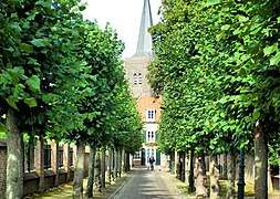 Wijk bij Duurstede
 Wijk bij Duurstede, kasteel Duurstede
 Neder-Rijn bij Wijk bij Duurstede
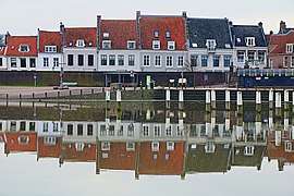 Wijk bij Duurstede, water in de Stadshaven
 Langbroek Bebouwde Brug Cor Litjens
References
- "Burgemeester Tjapko Poppens" [Mayor Tjapko Poppens] (in Dutch). Gemeente Wijk bij Duurstede. Retrieved 10 April 2014.
- "Kerncijfers wijken en buurten" [Key figures for neighbourhoods]. CBS Statline (in Dutch). CBS. 2 July 2013. Retrieved 12 March 2014.
- "Postcodetool for 3962CL". Actueel Hoogtebestand Nederland (in Dutch). Het Waterschapshuis. Retrieved 10 April 2014.
- "Bevolkingsontwikkeling; regio per maand" [Population growth; regions per month]. CBS Statline (in Dutch). CBS. 1 January 2019. Retrieved 1 January 2019.
External links

- Official website
Places adjacent to Wijk bij Duurstede | ||||||||||
|---|---|---|---|---|---|---|---|---|---|---|
| ||||||||||
Municipalities of Utrecht | ||
|---|---|---|
 | ||
| ||
| Authority control |
|
|---|