Whitemarsh Township, Montgomery County, Pennsylvania
Whitemarsh Township is a Home Rule Municipality in Montgomery County, Pennsylvania, USA. However, it maintains its former classification of "Township" in its official name. The population was 17,349 at the 2010 census.
Whitemarsh Township | |
|---|---|
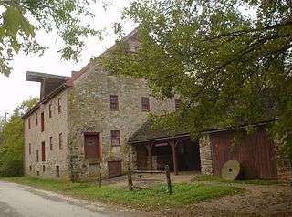 Farmar Mill, built ca.1690 | |
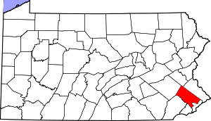
 Location of Whitemarsh Township in Montgomery County | |
| Coordinates: 40°06′00″N 75°14′58″W | |
| Country | United States |
| State | Pennsylvania |
| County | Montgomery |
| Settled | 1683 |
| Area | |
| • Total | 14.73 sq mi (38.2 km2) |
| • Land | 14.59 sq mi (37.8 km2) |
| • Water | 0.14 sq mi (0.4 km2) |
| Elevation | 220 ft (70 m) |
| Population (2010) | |
| • Total | 17,349 |
| • Estimate (2016)[2] | 17,795 |
| • Density | 1,200/sq mi (450/km2) |
| Time zone | UTC-5 (EST) |
| • Summer (DST) | UTC-4 (EDT) |
| Area code(s) | 610, 484 |
| FIPS code | 42-091-84624 |
| Website | www |
History
Whitemarsh was originally inhabited by the Lenni Lenape tribe of Native Americans. It was first settled by European colonists in 1683, as part of a tract of land purchased from William Penn by Major Jasper Farmar.[3] Though Farmar died before making the voyage to his new land, his widow and family sailed, with servants, to Philadelphia in 1685.[3] They established their homestead in Fort Washington.[3] After the Widow Farmar died sometime in the 1690s, her son Edward began to sell 100 to 200 acre pieces of the township to Quakers and German immigrants.[3]
In 1686, the discovery of limestone in Oreland in nearby Springfield and Upper Dublin townships, and subsequent discoveries of limestone in the township itself, drew settlers to Whitemarsh[3] Whitemarsh Township was incorporated in 1704 as part of Philadelphia County and was one of the 28 original communities that comprised Montgomery County when it was created in 1784. The area in the 1600s and 1700s consisted of large English estates and its famous limestone quarries.
During the American Revolutionary War, both the Battle of White Marsh and the Battle of Barren Hill took place within the township.
Geography
According to the United States Census Bureau, the township has a total area of 14.7 square miles (38.1 km2), of which, 14.6 square miles (37.8 km2) of it is land and 0.1 square miles (0.3 km2) of it (0.68%) is water.
Adjacent to the Andorra section of Philadelphia, Whitemarsh is bordered in Montgomery County by Springfield, Upper Dublin, Whitpain, and Plymouth Townships and Conshohocken Borough. It is also bordered by the Schuylkill River, which separates it from Lower Merion Township.
Communities within or partially within Whitemarsh include Barren Hill, Lafayette Hill, Miquon (shared with Springfield Township), and Spring Mill. Census designated places include Plymouth Meeting (shared with Plymouth), and Fort Washington (though mostly in Upper Dublin Township).
Demographics
| Historical population | |||
|---|---|---|---|
| Census | Pop. | %± | |
| 1850 | 2,408 | — | |
| 1860 | 3,047 | 26.5% | |
| 1870 | 3,151 | 3.4% | |
| 1880 | 3,239 | 2.8% | |
| 1890 | 3,516 | 8.6% | |
| 1900 | 3,350 | −4.7% | |
| 1910 | 3,359 | 0.3% | |
| 1920 | 3,436 | 2.3% | |
| 1930 | 4,286 | 24.7% | |
| 1940 | 4,855 | 13.3% | |
| 1950 | 5,977 | 23.1% | |
| 1960 | 12,286 | 105.6% | |
| 1970 | 15,886 | 29.3% | |
| 1980 | 14,987 | −5.7% | |
| 1990 | 14,863 | −0.8% | |
| 2000 | 16,702 | 12.4% | |
| 2010 | 17,349 | 3.9% | |
| Est. 2016 | 17,795 | [2] | 2.6% |
| Population 1850-2010 [5] | |||
As of the 2010 census, Whitemarsh Township was 90.7% White, 3.5% Black or African American, 0.1% Native American, 4.2% Asian, and 1.2% were two or more races. 1.7% of the population were of Hispanic or Latino ancestry .
As of the census[6] of 2000, there were 16,702 people, 6,179 households, and 4,597 families residing in the township. The population density was 1,143.5 people per square mile (441.4/km2). There were 6,372 housing units at an average density of 436.3 per square mile (168.4/km2). The racial makeup of the township was 93.29% White, 2.21% African American, 0.02% Native American, 3.70% Asian, 0.14% from other races, and 0.63% from two or more races. Hispanics or Latinos of any race were 0.99% of the population.
There were 6,179 households, out of which 34.4% had children under the age of 18 living with them, 64.4% were married couples living together, 7.1% had a female householder with no husband present, and 25.6% were non-families. 20.8% of all households were made up of individuals, and 7.3% had someone living alone who was 65 years of age or older. The average household size was 2.62 and the average family size was 3.06.
The age distribution was 24.3% under the age of 18, 5.0% from 18 to 24, 29.8% from 25 to 44, 25.1% from 45 to 64, and 15.7% who were 65 years of age or older. The median age was 40 years. For every 100 females there were 93.7 males. For every 100 females age 18 and over, there were 89.6 males.
The median income for a household in the township was $78,630, and the median income for a family was $91,731. Males had a median income of $58,774 versus $41,977 for females. The per capita income for the township was $39,785. About 1.6% of families and 2.9% of the population were below the poverty line, including 1.8% of those under age 18 and 3.1% of those age 65 or over.
Government
| Year | Republican | Democratic |
|---|---|---|
| 2016 | 34.2% 3,847 | 61.8% 6,960 |
| 2012 | 43.6% 4,540 | 55.5% 5,782 |
| 2008 | 40.5% 4,311 | 59.0% 6,275 |
| 2004 | 42.8% 4,336 | 56.9% 5,767 |
| 2000 | 42.4% 3,685 | 55.5% 4,822 |
| 1996 | 42.4% 3,173 | 49.4% 3,698 |
| 1992 | 43.3% 3,537 | 42.4% 3,495 |
Whitemarsh Township is governed by a five-member Board of Supervisors elected to four-year terms. As of 2019 the Board consists of the Chair, Melissa Sterling (D), and the Vice-Chair, Amy Grossman (D) with the other three members being Michael Drossner (D), Laura Boyle Nester (D) and Fran McCusker (D).[8]
Recreation
The Fort Washington State Park is a 483-acre (1.95 km2) site located in the middle of the township, along the Wissahickon Creek. Miles Park Which is located on Germantown Pike at the intersection of Joshua Road includes basketball courts, baseball fields and a walking track. It also has a snack bar and has vending machines.
Several country clubs also have grounds within the town. The Philadelphia Cricket Club has two golf courses and the Whitemarsh Valley Country Club, the ACE Club and the Green Valley Club each with one golf course.
Education
The Colonial School District provides public education to the children of Whitemarsh Township.
Transportation
The east-west Pennsylvania Turnpike (Interstate 276) and the north-south Fort Washington Expressway (Pennsylvania Route 309) run through the township. Although neither have an interchange in Whitemarsh, the turnpike has an interchange in nearby Plymouth Township, and the Route 309 expressway also has an interchange in Fort Washington which also connects with the turnpike. Arterial roads in the township include Ridge Pike, Germantown Pike, Butler Pike, Skippack Pike (Pennsylvania Route 73), Bethlehem Pike, Stenton Avenve, Pennsylvania Avenue, Joshua Road, and Morris Road.[9]
SEPTA Regional Rail serves the township along the Lansdale/Doylestown and Manayunk/Norristown rail lines. The Lansdale/Doylestown Line, which connects Bucks, Montgomery, and Philadelphia Counties has a station in Fort Washington. The Manayunk/Norristown Line, which runs along the Schuylkill River, has two stations located in Miquon and Spring Mill. SEPTA operates City Bus Routes 27 and L and Suburban Bus Routes 94, 95, 97, and 201 in the township, connecting it to Philadelphia and other suburbs.[10]
OurBus provides intercity bus service from Fort Washington section of Whitemarsh Township to Park Avenue in the Manhattan section in New York City as part of a route running from West Chester to New York City. The bus stop in Fort Washington is located adjacent to the Fort Washington station. The route started on December 21, 2017.[11][12]
Norfolk Southern Railway's Morrisville Line freight railroad line passes through Whitemarsh Township, running parallel to the south of the Pennsylvania Turnpike.[9][13]
There are no airports in Whitemarsh Township. The closest airport is the Wings Field in Whitpain Township.[9]
See also
Locale
Places adjacent to Whitemarsh Township, Montgomery County, Pennsylvania | ||||||||||
|---|---|---|---|---|---|---|---|---|---|---|
| ||||||||||
References
- "2016 U.S. Gazetteer Files". United States Census Bureau. Retrieved Aug 14, 2017.
- "Population and Housing Unit Estimates". Retrieved June 9, 2017.
- "History". Whitemarsh Township, PA - Official Website. Retrieved 30 April 2017.
- "National Register Information System". National Register of Historic Places. National Park Service. July 9, 2010.
- , U.S. Census Bureau. Accessed April 21, 2012.
- "U.S. Census website". United States Census Bureau. Retrieved 2008-01-31.
- "Montgomery County Election Results". Montgomery County, Pennsylvania. Retrieved January 16, 2017.
- "Government". Whitemarsh Township, PA - Official Website. Retrieved 11 January 2019.
- Montgomery County, Pennsylvania Highway Map (PDF) (Map). PennDOT. 2015. Retrieved January 12, 2016.
- SEPTA Official Transit & Street Map Suburban (PDF) (Map). SEPTA. Retrieved May 2, 2016.
- "Book an Intercity (Prime) Ticket". OurBus. Retrieved February 14, 2018.
- Rettew Jr., Bill (December 16, 2017). "Company plans bus service from West Chester to New York City". Daily Local News. West Chester, PA. Retrieved February 14, 2018.
- Norfolk Southern Harrisburg Region Timetable 1, August 4, 2008
External links
| Wikimedia Commons has media related to Whitemarsh Township, Montgomery County, Pennsylvania. |