Ardmore, Pennsylvania
Ardmore is an unincorporated community and census-designated place (CDP) in Delaware and Montgomery counties in the U.S. state of Pennsylvania. The population was 12,455 at the 2010 census.[1] Ardmore is a suburb on the west side of Philadelphia, within Lower Merion Township in Montgomery County and Haverford Township in Delaware County. Originally named "Athensville" in 1853, the community and its railroad station were renamed "Ardmore" in 1873 by the Pennsylvania Railroad, on whose Main Line, west out of Philadelphia, Ardmore sits at Milepost 8.5.[2]
Ardmore, Pennsylvania | |
|---|---|
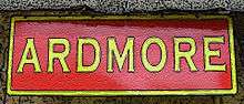
 Ardmore sign near Suburban Square shopping area | |
| Motto(s): "The Main Street of the Main Line" | |
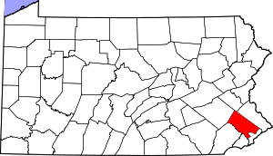
 Location in Delaware County and the U.S. state of Pennsylvania | |
| Coordinates: 40°00′24″N 75°17′07″W | |
| Country | United States |
| State | Pennsylvania |
| Counties | Delaware, Montgomery |
| Townships | Haverford, Lower Merion |
| Area | |
| • Total | 2.0 sq mi (5.1 km2) |
| • Land | 2.0 sq mi (5.1 km2) |
| • Water | 0.0 sq mi (0.0 km2) |
| Elevation | 282 ft (86 m) |
| Population (2010) | 12,455 |
| • Density | 6,322/sq mi (2,440.8/km2) |
| Time zone | UTC-5 (EST) |
| • Summer (DST) | UTC-4 (EDT) |
| ZIP code | 19003 |
| Area code(s) | 610 and 484 |
Geography
According to the United States Census Bureau, the CDP has a total area of 2.0 square miles (5.1 km2), all of it land.[1] Ardmore is adjacent to Wynnewood (east), Haverford (west), Gladwyne (north), and Havertown (southwest). Residents from South East Ardmore and Wynnewood cooperate as the ArdWood Civic Association. The Ardmore Progressive Civic Association serves the historically black section of Ardmore bordered by ArdWood Civic Association, Haverford College, Montgomery Avenue, and the Montgomery/Delaware County line. The North Ardmore Civic Association represents residents of North Ardmore and Wynnewood north of Montgomery Avenue. The South Ardmore Betterment Alliance is a community group in the southern (Haverford Township) portion of Ardmore which organizes various community activities.[3][4]
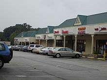
Ardmore's train station is served by SEPTA Regional Rail's Paoli/Thorndale Line (commuter) and Amtrak (intercity) passenger trains. Residents and visitors enjoy several recreation areas, including South Ardmore Park, which is located in neighboring Wynnewood, though many mistake it for Ardmore. Suburban Square, opened in 1928 as one of the earliest shopping centers in the United States, is located adjacent to the Ardmore train station.[5] Ardmore contains the nation's first suburban branch of a major department store, the former Strawbridge & Clothier which opened there in 1930;[6] the former Suburban movie theater—now Not Your Average Joe's Restaurant; the newly relocated Ardmore Farmer's Market; an Apple Store, and the usual selection of mall shops. Other landmarks within the Ardmore Progressive Civic Association borders include the Ardmore Post Office and Ardmore Public Library (part of the Lower Merion Library System) on South Ardmore Avenue; the Ardmore Ice Skating Club on Greenfield Avenue; a public swimming pool; lighted tennis/basketball courts; the community center known as "The Shack"; and two senior housing projects.[7][8]
Two sites, located in the Haverford Township section of Ardmore, the Merion Golf Club East Course and Pont Reading are listed on the National Register of Historic Places.[9]
Demographics
| Historical population | |||
|---|---|---|---|
| Census | Pop. | %± | |
| 1990 | 12,646 | — | |
| 2000 | 12,616 | −0.2% | |
| 2010 | 12,455 | −1.3% | |
As of the 2010 census, the CDP was 76.8% White, 12.9% Black or African American, 0.1% Native American, 4.1% Asian, 0.1% Native Hawaiian and Other Pacific Islander, 1.2% were Some Other Race, and 2.3% were two or more races. 4.0% of the population were of Hispanic or Latino ancestry.[10]
As of the census[11] of 2000, there were 12,616 people, 5,529 households, and 3,129 families residing in Ardmore. The population density was 6,588.5 people per square mile (2,550.3/km²). There were 5,711 housing units at an average density of 2,982.5/sq mi (1,154.5/km²). The racial makeup of the CDP was 83.51% White, 11.47% African American, 0.12% Native American, 2.58% Asian, 0.13% Pacific Islander, 0.59% from other races, and 1.60% from two or more races. Hispanic or Latino of any race were 2.05% of the population.
There were 5,529 households, out of which 23.9% included children under the age of 18, 43.0% were married couples living together, 10.7% had a female householder with no husband present, and 43.4% were non-families. 34.7% of all households were made up of individuals, and 12.5% had someone living alone who was 65 years of age or older. The average household size was 2.27 and the average family size was 2.98.
In the CDP, the population was spread out, with 20.3% under the age of 18, 7.5% from 18 to 24, 32.1% from 25 to 44, 23.1% from 45 to 64, and 17.0% who were 65 years of age or older. The median age was 38 years. For every 100 females, there were 86.9 males. For every 100 females age 18 and over, there were 84.9 males.
The median income for a household in the CDP was $60,966, and the median income for a family was $75,828. Males had a median income of $46,920 versus $40,802 for females. The per capita income for the CDP was $36,111. About 2.4% of families and 4.9% of the population were below the poverty line, including 3.1% of those under age 18 and 6.2% of those age 65 or over.
Education
Pupils living in the Lower Merion Township portion attend schools in the Lower Merion School District, while pupils living in the Haverford Township portion attend schools in the School District of Haverford Township.
Among the many notable graduates of Lower Merion High School in Ardmore are General Henry H. "Hap" Arnold (1903), Commanding General of the U.S. Army Air Forces in WWII; General Alexander M. Haig, Jr. (1942), the 59th United States Secretary of State; James H. Billington (1946), the Librarian of Congress, and; Kobe Bryant (1996), NBA Hall of Fame basketball player.
Eminent domain controversy
In 2004–2006, Ardmore's business district was the subject of a hotly contested eminent domain battle. A grassroots organization, the Save Ardmore Coalition, along with local businesses and other civic groups,[12] opposed an eminent domain/redevelopment program that would have involved the demolition of historic buildings, in favor of preserving those buildings for other commercial use. In March 2006 the Lower Merion Township Board of Commissioners adopted a resolution disavowing the use of eminent domain for the benefit of private redevelopment projects. The Ardmore battle was also instrumental in prompting the Pennsylvania General Assembly to enact legislation in 2006 restricting the use of eminent domain for private projects.[13]
Ardmore Presbyterian Church
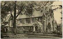
The Ardmore Presbyterian Church is a congregation of the Presbyterian Church located at the corner of Montgomery Avenue and Mill Creek Road. The Gothic exterior of the church building is gray stone, with granite trim, and the interior is hardwood.[14] The original church, now the chapel, was constructed in 1910 following the 1907 establishment of the congregation, whose 50 members worshipped at the local Masonic Hall in the meantime.[14] The first service in the new building was held in September 1910.[14] The current sanctuary, designed by Thomas, Martin & Kirkpatrick[15], was dedicated in 1924. Subsequent additions were built in 1931 and the 1950's.
J. Howard Pew served as ruling elder of the Ardmore Presbyterian Church beginning January 26, 1958.[16] Pew was president of the board of trustees of the Presbyterian Church (USA) Foundation from 1936-1971.[17] When Pew's burial service was held in the church in 1971, the Rev. Billy Graham assisted the pastor, the Rev. William Faulds, with the service.[18]
Notable people
- Richie Ashburn, Major League Baseball player, member of the Baseball Hall of Fame, outfielder and longtime broadcaster for the Philadelphia Phillies
- Henry H. "Hap" Arnold, Commanding General of the United States Army Air Forces in all theaters throughout World War II, first United States Air Force five-star general; born in Gladwyne and graduated from Lower Merion High School in Ardmore
- Kobe Bryant, National Basketball Association player, member of the Los Angeles Lakers, went to Lower Merion High School in Ardmore
- Larry Christenson, former pitcher for the Philadelphia Phillies
- Johnny Christmas, professional lacrosse player with the Philadelphia Wings and the Boston Cannons
- Kate Flannery, actress (plays Meredith on NBC prime time comedy series The Office); grew up in Ardmore
- Mark Gerban, first person to represent the State of Palestine at the World Championships in rowing; grew up in Ardmore
- Alexander Haig, United States Army general, Chairman of the Joint Chiefs of Staff, and United States Secretary of State; grew up in Bala Cynwyd and attended Lower Merion High School in Ardmore
- Owen Jones, U.S. Representative from Pennsylvania; born in Ardmore[19]
- A. Atwater Kent, prominent early radio manufacturer and philanthropist responsible for creation of the Museum of Philadelphia History on South Seventh Street in Center City Philadelphia
- Mike Pedicin, American jazz bandleader, resident of Ardmore[20]
- J. Howard Pew, son of Joseph Newton Pew, founder of Sun Oil Company; his estate "Knollbrook" is located on a tall hill barely visible above the intersection of Grays Lane and Mill Creek Road, touching Ardmore, Gladwyne, and Haverford
- Fictional
- Lieutenant Joe Cable, from the Rodgers and Hammerstein musical South Pacific
References
- "Geographic Identifiers: 2010 Demographic Profile Data (G001): Ardmore CDP, Pennsylvania". U.S. Census Bureau, American Factfinder. Archived from the original on February 13, 2020. Retrieved December 30, 2015.
- "Montgomery County: The Second Hundred Years - 1983 -2002". Lowermerionhistory.org. Retrieved 2012-05-06.
- "Civic Associations". Lower Merion, Montgomery County, Pennsylvania. Retrieved 21 July 2015.
- South Ardmore Betterment Alliance. "South Ardmore Betterment Alliance | A Neighborhood Civic Association operating in Haverford Township, Delaware County". Sabanews.org. Retrieved 2012-05-06.
- Jones, Dick, ed. The First Three Hundred: The Amazing and Rich History of Lower Merion. Ardmore: Lower Merion Historical Society, 2001.
- Ibid.
- "Description of Township Parks". Lower Merion Township. Retrieved 21 July 2015.
- "Ardmore Progressive Civic Association". Retrieved 21 July 2015.
- "National Register Information System". National Register of Historic Places. National Park Service. July 9, 2010.
- Census 2010: Pennsylvania. Usatoday.Com. Retrieved on 2013-07-21.
- "U.S. Census website". United States Census Bureau. Retrieved 2008-01-31.
- "Why the fuss about this block?". Saveardmorecoalition.org. Archived from the original on 2007-10-10. Retrieved 2008-11-19.
- "Property rights and eminent domain: Hands off our homes. A Supreme Court ruling that allows the government to seize private property has set off a fierce backlash that may yet be as potent as the anti-abortion movement". The Economist. August 15, 2005.
- "The First Presbyterian Church of Ardmore, Pa is Born", Minute for History, January 4, 2007
- "Church". Philadelphia Real Estate Record and Builders Guide. 37: 497 – via http://philageohistory.org/rdic-images/view-book-uv.cfm/PhilaBuildersGuide.
- Who Was Who in America, Historical Volume, 1607–1896. Chicago: Marquis Who's Who. 1963.
- Michael L. Pedicine tributes.com
External links
| Wikimedia Commons has media related to Ardmore, Pennsylvania. |
| Wikivoyage has a travel guide for Ardmore, Pennsylvania. |
- Ardmore Initiative, a business district authority responsible for physical and economic development in Ardmore
- Save Ardmore Coalition, a 501(c)4 civic group which played a role in the eminent domain controversy
- ArdWood Civic Association, a civic group which focuses on South Ardmore and parts of Wynnewood (surrounding South Ardmore Park)
- South Ardmore Betterment Alliance, a civic group which focuses on southern Ardmore
- First Friday, a 501(c)3 non-profit to bring art to the Main Line and revitalize the communities of Ardmore, Haverford, and Bryn Mawr
- 2006 Pennsylvania anti-eminent domain abuse statute
Municipalities and communities of Delaware County, Pennsylvania, United States | ||
|---|---|---|
| City | 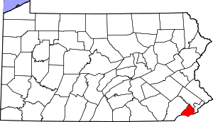 | |
| Boroughs | ||
| Townships | ||
| CDPs | ||
| Unincorporated communities |
| |
| Ghost town | ||
| Footnotes | ‡This populated place also has portions in an adjacent county or counties | |
| Authority control |
|
|---|