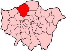
West Hendon
West Hendon is an urban area of Hendon in North West London in the London Borough of Barnet - however its Welsh Harp area is in the London Borough of Brent. It is known as the NW9 area of Hendon and is known for the West Hendon Estate, which is undergoing controversial regeneration.[1]
| West Hendon | |
|---|---|
 Edgware Road in West Hendon | |
 West Hendon Location within Greater London | |
| Population | 17,402 (2011 Census. Ward) |
| OS grid reference | TQ215885 |
| London borough | |
| Ceremonial county | Greater London |
| Region | |
| Country | England |
| Sovereign state | United Kingdom |
| Post town | LONDON |
| Postcode district | NW9 |
| Dialling code | 020 |
| Police | Metropolitan |
| Fire | London |
| Ambulance | London |
| UK Parliament | |
| London Assembly | |
History
West Hendon was a settlement within that part of the ancient parish of Hendon known as the Hyde, and is now a part of the London Borough of Barnet. It was formally known, from 1878–1890, as New Hendon, a small railway development on the Edgware Road. Before the 1830s there were three farms, Upper and Lower Guttershedge (east of the road) and Cockman's in the Wood (west of the road) and an inn, The Welsh Harp. Between 1835 and 1838, the Brent Reservoir was constructed by damming the Brent and the Silk brooks and flooding much of Cockman's Farm. The water was used to supply the Grand Union Canal. At its greatest extent, in 1853, it covered 400 acres (1.6 km²) but was dramatically reduced to 195 acres (789,000 m²) in the 1890s. Subsequently, it has been reduced to 110 acres (445,000 m²). It contains enough water to fill 3 million baths and in 1991 was believed to contain 10,000 lb (4,500 kg) of fish. The residue of Cockman's Farm became Woodfield House, home to the Roman Catholic Passioist Fathers (1852 and 1858). The house was demolished in 1940 and the site used by the Borough of Hendon and its successor the London Borough of Barnet as a plant nursery.
Originally The Harp and Horn (c1750s), The Harp was rebuilt in 1859 and again in 1937, before finally being pulled down in 1970 to make way for the M1. During the 1960s, it was known as The Lakeside Scene and hosted some of the great rock and blues bands of the day, such as the Yardbirds. From 1859 until the end of the century it was run by the Warner brothers, and the reservoir became a centre for all sorts of sporting events such as ice skating, swimming and angling; it was, until 1878, the Kingsbury Race Course and the first mechanical hare in greyhound racing was used there in 1876. By 1850, there was a second public house, the Upper Welsh Harp. At its height in the mid-1880s crowds in excess of 25,000 people could be expected on a Bank Holiday weekend.
Two railway stations were opened, both of the Midland Railway: Hendon (1868), and Welsh Harp (1870). A local builder called Bishop laid the first brick of a new terrace called Neeld Terrace (1881), which heralded the start of New Hendon. Brent Vue was built on land originally owned by the Midland Company. In 1885, the Baptists had a mission hall and their present hall was opened in 1930. By 1886, there were 200 new houses and the Anglican church of St. John's was built.
The 1896 Ordnance Survey Map shows that most of the roads had been laid out, but with little further development beyond that of the mid-1880s. In 1896 Schweppes opened a large mineral water factory, and the present Anglican church of St. John's was established in Algernon Road. With a planned tram line along the West Hendon Broadway due to open in 1904, Welsh Harp station was closed in 1903, and West Hendon became a thriving Edwardian retail district until overshadowed by Golders Green. The Ordnance Survey Map of 1913 shows the area as being fully developed.
The reservoir was an important centre for speedboat racing in the 1920s and 1930s. C Harrison broke the outboard motorboat record at 57 mph (92 km/h) in 1931. During World War II, on 13 February 1941, the Luftwaffe dropped an SC2500 Maximum Heavy Explosive bomb (equivalent to two V2 rockets), killing 80 people and destroying 40 houses in an area west of the Edgware Road. (During a very hot summer in the 1960s the water levels shrank dramatically and remains of some of the destroyed houses could be seen.) This area was completely redeveloped in the 1960s. In 1984 a small Islamic Centre was established at 135 The Broadway, and was later moved to Brent View and re-opened as Hendon Mosque on 23 August 1996. Hendon Mosque held the funeral for Nazia Hassan, a pioneer of Pakistani Pop music in 2001.
Estate regeneration
The West Hendon Estate was built in the late 1960s, originally made up of 680 homes.[2] Plans were made during the 2000s to regenerate the estate, which were eventually approved in 2013.[3] As of 2019, Marsh Drive is the only remaining original block yet to be demolished.[4]
The regeneration has been controversial: Barnet London Borough Council has faced criticism for its regeneration of the West Hendon Estate, including the use of compulsory purchase.[5] It was claimed that 400 families would be forced to move off the estate. During 2014, residents protested against the plans and blocked the entrance to the estate.[6] In 2018, Jeremy Corbyn and Mayor Sadiq Khan visited residents in the estate and were told of having been let down by Barnet council.[7] The estate has been featured on the BBC's Victoria Derbyshire show, which found that the Marsh Drive block was in poor condition.[8] In 2016 the BBC filmed a documentary called The Estate We're In for BBC One that followed tenants and homeowners of the estate who were against the regeneration.[9]
Demography
West Hendon is a more socially deprived part of Hendon and the borough of Barnet.[10]
It has a range of cultures including from Somali, Afghan and West African communities;[11] 50.6% of West Hendon ward's population was of BAME background in the 2011 census.[12] Religiously, 36% were Christian, 17% Muslim, 14% Jewish, 11% Hindu and 11% irreligious. The largest foreign languages are Polish and Gujarati, both numbering over 800 people each.[13] West Hendon differs from Hendon with more than 50.0% of the population who is from a Black, Asian or Minority Ethnic background, 27% was White British 29% Asian and 10% Black.[14]
Geography
References
- https://www.vice.com/en_uk/article/bnky9a/west-hendon-eviction-resistance-oscar-webb-022
- https://www.theguardian.com/uk-news/davehillblog/2015/nov/04/jasmin-parsons-and-the-troubled-tale-of-the-west-hendon-estate
- https://www.quod.com/news/west-hendon-regeneration-given-the-go-ahead/
- https://www.insidehousing.co.uk/news/news/residents-of-neglected-block-in-north-london-denied-secure-tenancies-64886
- The Guardian https://www.theguardian.com/society/2015/jan/20/barnet-council-social-cleansing-barratt-homes-west-hendon
- https://www.vice.com/en_uk/article/bnky9a/west-hendon-eviction-resistance-oscar-webb-022
- https://www.times-series.co.uk/news/15916343.jeremy-corbyn-and-mayor-sadiq-khan-visit-west-hendon-to-announce-new-estate-regeneration-guidelines/
- https://www.insidehousing.co.uk/news/news/residents-of-neglected-block-in-north-london-denied-secure-tenancies-64886
- https://www.bbc.co.uk/programmes/b00t0ydd
- http://s3-eu-west-2.amazonaws.com/lgbce/Reviews/Greater%20London/Barnet/Council%20Size/LGBCE%20-%20Stage%201%20-%20Council%20Size%20-%20Final%20Submission%20for%20the%20London%20Borough%20of%20Barnet.pdf
- Ordnance Survey: Landranger map sheet 176 West London (Rickmansworth & Staines) (Map). Ordnance Survey. 2012. ISBN 9780319232118.
- https://data.london.gov.uk/dataset/ward-profiles-and-atlas
- http://www.ukcensusdata.com/west-hendon-e05000062
- http://www.ukcensusdata.com/west-hendon-e05000062