Kensal Green
Kensal Green is an area in north-west London, in the London boroughs of Brent and Kensington and Chelsea. The surrounding areas are Harlesden to the west, Willesden to the north, Brondesbury and Queens Park to the east and Notting Hill and White City to the south.
| Kensal Green | |
|---|---|
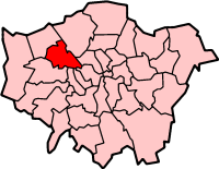
 Kensal Green Location within Greater London | |
| Population | 14,915 (2011) (Kensal Green ward) |
| OS grid reference | TQ235825 |
| London borough | |
| Ceremonial county | Greater London |
| Region | |
| Country | England |
| Sovereign state | United Kingdom |
| Post town | LONDON |
| Postcode district | NW10 |
| Postcode district | W10 |
| Dialling code | 020 |
| Police | Metropolitan |
| Fire | London |
| Ambulance | London |
| London Assembly | |
Location
Kensal Green is a residential area with good transport links to central London. Surrounding districts include Willesden to the north, Harlesden to the west, Queens Park to the east and Ladbroke Grove/Kensal Town to the south. As well as the Kensal Green ward, the area takes in the wards of Dalgarno, parts of Queens Park and College Park & Old Oak
Residents and businesses
The area has seen significant gentrification over recent years and is earning a reputation as a 'celebrity haunt-meets-Nappy Valley'.[1] In 2009, Chamberlayne Road in Kensal Rise was named by Vogue as the hippest street in Europe.[2] The area is now home to a number of noteworthy residents including musicians Paloma Faith and Rita Ora, chef Thomasina Miers,[3] film director, DJs and musicians Don Letts and Mark Rae, actress Thandie Newton, singer Lily Allen, model-turned-author Sophie Dahl, author Zadie Smith, David Cameron's ex-strategy guru Steve Hilton, the actor and writer Phoebe Waller-Bridge and Sienna Miller.[4] The area also now boasts Britain's first independent boutique cinema and social enterprise, The Lexi Cinema. It is staffed by local volunteers and its profits go to an eco-village in South Africa. In 2014, luxury goods maker Mulberry named its handbag Kensal and launched an advertising campaign with Cara Delevingne.[5]
Time Out described Kensal Green as "a cool, rebellious young upstart with torn jeans and wacky ideas about politics and marijuana and shit", highlighting pubs The Chamberlayne and Paradise by Kensal Green, cocktail bar The Shop, high-end butcher Brooks and authentic Neapolitan pizzas from Sacro Cuore.[6] Burger restaurant Benz Burgers in Kensal Green, which was set up by entrepreneur Ben Todar in 2016, was awarded second-best takeaway in Britain.[7]
It has traditionally been popular with those working in the media and creative industries. According to local estate agents, those buying properties in the area include developers, people working in the financial district of the city and others moving from nearby Notting Hill. The area also attracts Americans thanks to the American School in neighbouring St John's Wood, as well as being popular with the French, partly due to a Lycée Français opening in Brent's former town hall.[1]
Open space
Little Wormwood Scrubs is a wide open space and has various activities, Kensington memorial Park remains popular amongst locals. Queens Park and King Edwards Vll park are both within walking distance.[8]
History
Originally part of one of the 8 manors within the district of Willesden, Kensal Green is first mentioned in 1253, translating from old English meaning the King’s Holt (King's Wood). Its location marked the boundary between Willesden and the then Chelsea & Paddington, on which it remains today. It formed part of one of 10 manors, most likely Chamberlayne Wood Manor, named after Canon Richard de Camera (of the Chambers).[9] In the 15th century the then Archbishop of Canterbury Henry Chichele (1414–1443), acquired lands in Willesden and Kingsbury. In 1443 he founded All Souls' College, Oxford and endowed it with the same lands in his will. As a resultant, most of Willesden and Kensal Green remained largely agricultural until the mid-1800s, well into the Victorian era. In 1805, the construction of the Grand Junction Canal passed through the district to join the Regent's Canal at Paddington. As the combined Grand Union Canal, this allowed passage of commercial freight traffic from the Midlands to London Docks, and hence onwards to the River Thames. There were two dairy farms in Kensal Green by the early 1800s, which expanded greatly after the 1864 Act of Parliament which made it illegal to keep cattle within the City of London. Although by the late 1800s residential development had greatly reduced the farmland, still in the 1890s many sheep and pigs were raised in the district. One of the farms later became a United Dairies creamery, supplied by milk trains from Mitre Bridge Junction.[10]
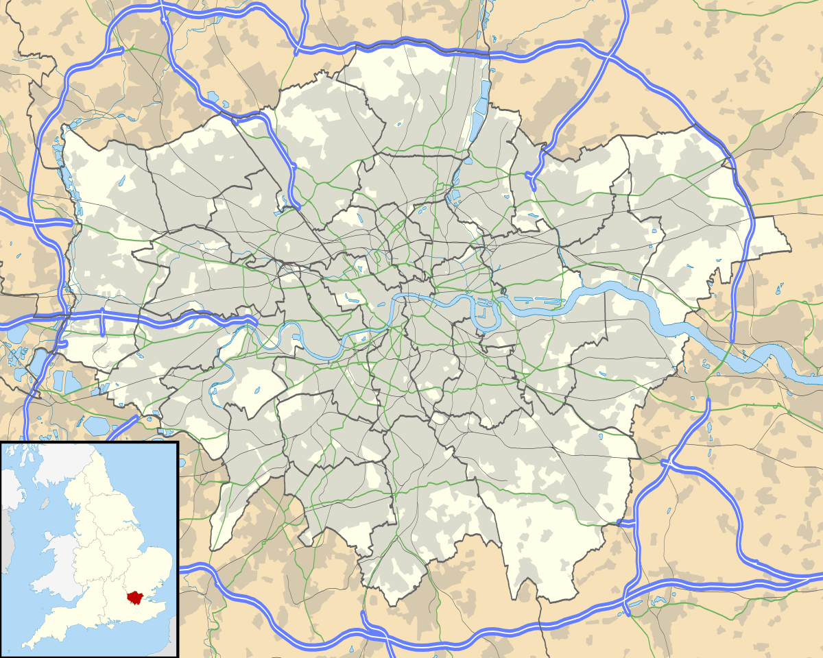
St. John's Church was built on the corner of what is now Harrow Road/Kilburn Lane in 1844 and was extensively refurbished in 2017 and fitted with new bells in anticipation of the 175th anniversary in 2019. The church was followed by a school, now Bales College, and more inns including The Plough on the opposite corner of the junction. In 1832 Kensal Green Cemetery was incorporated by Act of Parliament and opened in January 1833. This led to a revaluation of the surrounding lands, and in 1835 ecclesiastical commissioners were appointed by the Crown, who reported in 1846 that: "the larger portion of the Prebendal Estates possess, in our opinion, a value far beyond their present agricultural value."[9]
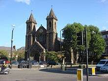
With enough people living locally to create a new parish, in 1844 St. John the Evangelist Church in Kilburn Lane was consecrated. The 1851 census records just over 800 people living in the new parish. In the 1860s, Kensal Green manor house, situated where Wakeman Road joins Harrow Road, was demolished. Rapid increase in residential development followed, firstly with land west of Kilburn High Road, followed by the sale of Banister's Farm leading to the development of Bannister Road and Mortimer Road. Unfortunately at this time Kensal Green was suffering huge social problems and had a reputation of being a slum, with 55% off its residents living in poverty and squalor, despite being neighbours to thriving Queen's Park.The rapid residential development led to local commissioners reporting in 1880 that there was inadequate drainage and sewerage facilities, with most houses having only improved access to what were the old agricultural drains. In that same year, All Souls' College started to develop its lands north-west of Kilburn Lane, including All Souls' Avenue and College Road, with adjacent roads being named after leading Fellows of the college, and the installation of new sewerage facilities across the district. The college donated lands on which to build Kensal Rise Reading Room, to commemorate the Diamond Jubilee of Queen Victoria, in 1897. Opened by American author Mark Twain in 1901, it was later extended and renamed Kensal Rise Library.[9]
The developments of the streets around Kensal Rise railway station date from the last 10 years of the 19th century and the first decade of the 20th. Although opened in April 1873 as Kensal Green at Chamberlayne Wood, then a remote dead end road; it was renamed Kensal Rise on 24 May 1890. Just north of the station the National Athletic Ground (one of the many early grounds of Queen's Park Rangers) opened in 1890. The ground which was later renamed the Kensal Rise Athletic Stadium also hosted cycling and athletics competitions before being turned over to housing in the 1920s. For a brief period before 1914 the Aeroplane Building and Flying Society had its headquarters at Kensal Rise and flew test gliders from the site. Kensal Rise also boasted the Electric Pavilion Cinema [11] which opened in November 1914 and was located on the corner of Chamberlayne Road and Bannister Road.
The construction of the Great Western Railway started in 1835, with the first 22.5 miles (36.2 km) of line, from Paddington station to Maidenhead Bridge station, opened on 4 June 1838. In 1901, its major carriage washing and servicing facilities and locomotive depot were developed at Old Oak Common, bringing further employment and more immigrants to the district. The first major immigrant population had been Irish people fleeing the Great Irish Famine, and then post-World War I. In World War II, due to the railway facilities, the district suffered greatly from German Luftwaffe bombing.[9]
After the war, the area became a refuge for the first Afro-Caribbean born contingent. In the 1960s the College disposed of many freeholds, while retaining land in Willesden. Since the 1980s, the Irish-born community has reduced in size, although the legacy of their presence remains, not least in the number of Irish pubs and organisations and the many thousands with Irish ancestry who continue to populate the area. According to statistics from the 2001 census, the area has a very high proportion of young residents (28.4% 25–44 years old) and a very high educational level (30.7% hold a first degree or better).[12]
The area has seen significant gentrification over recent years as people have been priced out of surrounding areas such as Notting Hill. In 2015 it was described as 'celebrity haunt-meets-Nappy Valley'.[1]
Demographics
The largest ethnic group in Kensal Green ward according to the 2011 census was White British, 26%. The second largest was White other, 18%, followed by Black Caribbean, 12%.[13] Neighbouring Queen's Park ward, which also covers eastern areas of Kensal Green, was 30% White British. The College Park ward, which covers the southern areas of Kensal Green, was 31.6% white British, 18.4% White other and 21.1% Black.[14] Kensal Green ward has the highest Latin American population in London.[15]
Transport
Kensal Green station (Transport for London Travelcard Zone 2) on the Bakerloo line is about 20 minutes from Oxford Circus and the West End. National Rail London Overground services also operate to London Euston, a journey that takes around 15 minutes. Trains also go to Watford Junction.
London Overground's North London Line services also operate out of Kensal Rise railway station (Transport for London Travelcard Zone 2) and provides regular services to Richmond in the west, Stratford in the east, and Clapham Junction in the south.
Extensive bus services also run from the area, including routes 18 (Sudbury - Euston), 6 (Willesden Bus Garage - Aldwych), 52 (Willesden Bus Garage - Victoria station via Notting Hill and Kensington) and 452 (Kensal Rise - Vauxhall).
There is also a canal running from Kensal Rise to Paddington, and to Kings Cross via Camden which features a cycle lane and water bus.
For a time, the London Congestion Charge extended into Kensington and Chelsea and reached as far north as Harrow Road, the southern boundary of Kensal Green. Most vehicles travelling south-east down Ladbroke Grove were liable to pay the £8 daily charge between 07.00 and 18.00 Mondays to Fridays, although a loop was created to allow continued free access to the Sainsbury's supermarket which was technically within the zone.
Following a public consultation in the autumn of 2008, the western extension of the congestion charging zone, which had bordered on Kensal Green, was scheduled to be removed. Charging on the western extension effectively ended on 24 December 2010. The effects of this on local trade have not yet been determined.
Schools
The educational charity Ark, founded by venture capitalist Arpad Busson, runs three state primary schools in the area, including Ark Franklin in Harvist Road, which replaced Kensal Rise primary in September 2013. The following state primary schools are judged to be “good”: Princess Frederica CofE in College Road; and Kenmont Primary School in Valliere Road which was built in 1883–84 to a design by the architect by Edward Robert Robson for the School Board for London and has been Grade II listed since 1984.[16]
Three state comprehensive schools are judged to be “good”, including Queens Park Community School in Aylestone Avenue, and Capital City Academy in Doyle Gardens.
There is a small choice of local private schools. The primary schools are Seacole (co-ed, ages four to 11) in Bosworth Road and The Lloyd Williamson School (co-ed, six weeks to 11) in Telford Road. Bales College is a very small independent co-ed secondary school and sixth form college, catering for ages 11 to 20 on Harrow Road.[17] Many parents use the private schools in nearby Belsize Park and Hampstead.[8]
Crossrail
At a site just to the east of Old Oak Common, Kensington and Chelsea Council has been pushing for a station at Kensal Green Gasworks[18] off Ladbroke Grove & Canal Way as a turn-back facility will have to be built in the area anyway. Siting it at Kensal Green, rather than next to Paddington itself, would provide a new station to regenerate the area.[19][20][21] Amongst the general public there is a large amount of support for the project and Mayor Boris Johnson stated that a station would be added if it did not increase Crossrail's overall cost. In response, Kensington and Chelsea Council agreed to underwrite the projected £33 million cost of a Crossrail station, which was received well by residents of the Borough.[22] TfL is conducting a feasibility study on the station and the project is backed by the National Grid, retailers Sainsbury's and Cath Kidston, and Jenny Jones (Green Party member of the London Assembly).[23]
Boris Johnson resurrected plans for a Crossrail station at the disused Kensal Gasworks site, between Acton Mainline and Paddington, in 2016. Plans are now being revisited in the hope that a development will lead to the construction of up to 5,000 homes and the creation of 2,000 jobs. The mayor commented: "We have seen across London how Crossrail is transforming vast swathes of land and acting as a catalyst for much-needed new homes and jobs. By looking again at the options for this station we firmly believe that it could have a similar impact, triggering a much-needed fillip for this part of the capital.”[24]
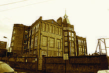
Kensal Green Cemetery
Kensal Green Cemetery is the first of the ‘Magnificent Seven’ cemeteries in London. It is the resting place of members of the royal family, including Prince George, Duke of Cambridge, and scores of figures in history including railway engineer Isambard Kingdom Brunel, Charles Babbage, William Makepeace Thackeray, Anthony Trollope and William Cavendish-Scott-Bentinck, 5th Duke of Portland. Architects who are buried at Kensal Green include Decimus Burton and the famous 19th century architectural families of Hardwick and Shaw. Philip Charles Hardwick, Philip Hardwick and John Shaw Junior are buried there, as well as Nobel Prize-winning playwright Harold Pinter. A columbarium pillar houses the ashes of Queen frontman Freddie Mercury, among others.
Cemetery directors and The Friends of Kensal Green Cemetery (a charity) have lobbied the Heritage Lottery Fund and English Heritage for funding to help preserve historical monuments at the site. The mammoth project, which involves repairs to the grade one listed Anglican Chapel and the boundary wall, is estimated to cost more than £10m.[25]
Tornado on 7 December 2006
On 7 December 2006 at 11.00am, a tornado struck Kensal Green.[26] Up to 150 houses were damaged, and six people were injured, one requiring hospital attention. Residential roads were closed off and residents had to seek temporary accommodation. Traffic was also diverted, causing disruption. The cost of the damage was estimated to be at least £2 million.
See also
Nearest places:
Nearest stations:
References
- Phillips, Caroline (4 June 2014). "Kensal Rise has risen". Evening Standard. Retrieved 8 April 2015.
- "Chamberlayne Road in London: the hippest street in Europe". The Daily Telegraph. 14 August 2009. Retrieved 28 March 2015.
- Masey, Anthea (2 September 2014). "Living in Kensal Rise: area guide to homes, schools and transport". Evening Standard. Retrieved 8 September 2015.
- Powley, Tanya (24 August 2012). "Park life". FT.com. Retrieved 28 March 2015.
- "'Great War Fashion': Ox bile, split ends and frump – what Downton didn't show you". The Daily Telegraph. 15 November 2013. Retrieved 22 March 2014.
- "13 reasons to go to Chamberlayne Road in Kensal Rise, NW10". Time Out. 6 May 2016. Retrieved 13 September 2016.
- "Family-run Thai restaurant crowned Britain's best takeaway". Evening Standard. 7 April 2017. Retrieved 4 July 2019.
- Masey, Anthea (1 September 2015). "Living in Kensal Rise: area guide to homes, schools and transport". Evening Standard. Retrieved 14 September 2015.
- "History". Kensalgreendirectory.com. Retrieved 2 February 2012.
- "Willesden: Economic history | British History Online". British-history.ac.uk. Retrieved 28 March 2015.
- "Odeon Kensal Rise in London, GB". Cinema Treasures. Retrieved 30 March 2017.
- Archived 4 March 2012 at the Wayback Machine
- Good Stuff IT Services. "Kensal Green - UK Census Data 2011". Ukcensusdata.com. Retrieved 30 March 2017.
- "Queens Park - UK Census Data 2011". Ukcensusdata.com. Retrieved 30 March 2017.
- "Demographics | Hidden London". hidden-london.com. Retrieved 4 July 2019.
- Historic England. "Kenmont Primary School (1079825)". National Heritage List for England. Retrieved 19 November 2016.
- "Bales College - GOV.UK". www.get-information-schools.service.gov.uk. Retrieved 2 April 2019.
- "The case for Kensal crossrail". Royal Borough of Kensington and Chelsea. n.d. Archived from the original on 15 May 2011. Retrieved 26 June 2011.
- "Case for a Crossrail station gains momentum" (Press release). Royal Borough of Kensington and Chelsea. 1 July 2010.
- Bloomfield, Ruth (24 August 2010). "Study to explore adding Crossrail station at Kensal Green". Building Design. London.
- "Crossrail at Kensal Rise back on the cards?". London Reconnections (blog). 27 August 2010.
- "Council to pay for Crossrail station". London Evening Standard. 25 March 2011. Archived from the original on 13 September 2012.
- Kensal Crossrail station would 'transform' the area, says deputy mayor. Regeneration + Renewal. 16 May 2011.
- Sebastian Mann (14 March 2016). "Plan for Crossrail station at Ladbroke Grove resurrected | London Evening Standard". Standard.co.uk. Retrieved 30 March 2017.
- "Royal visits Kensal Green Cemetery to support preservation campaign". Brent and Kilburn Times. 30 October 2014. Retrieved 8 April 2015.
- "Six hurt as tornado hits London". BBC News. 7 December 2006. Retrieved 7 December 2006.
External links
- Kensal Green at the Survey of London online
| Districts |
|  | ||
|---|---|---|---|---|
| Attractions |
| |||
| Parks and open spaces |
| |||
| Constituencies | ||||
| Tube and rail stations |
| |||
| Other topics | ||||
| ||||