Edgware
Edgware (/ˈɛdʒwɛər/) is a suburban town in north London, mostly in the London borough of Barnet but with a small part falling in Harrow.[2] Edgware is centred 9.5 miles (15.3 km) north-northwest of Charing Cross and has its own commercial centre. Edgware has a generally suburban character, typical of the rural-urban fringe. It was an ancient parish in the county of Middlesex directly east of the ancient Watling Street, and gives its name to the present day Edgware Road that runs from central London towards the town. The community benefits from some elevated woodland on a high ridge marking the Hertfordshire border of gravel and sand. It includes the areas of Burnt Oak, The Hale, Edgwarebury, Canons Park, and parts of Queensbury.
| Edgware | |
|---|---|
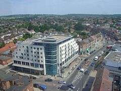 Aerial view of Edgware from Station Road; facing North towards Broadfields and Elstree. | |
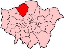
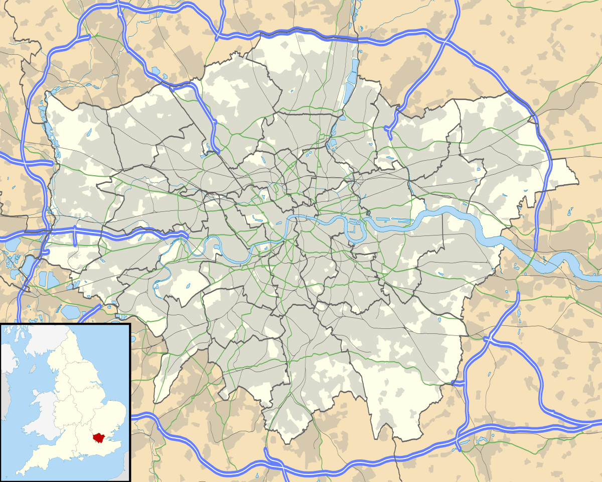 Edgware Location within Greater London | |
| Population | 76,506 (2011 Census[1] E |
| OS grid reference | TQ195925 |
| • Charing Cross | 10 mi (16 km) SE |
| London borough | |
| Ceremonial county | Greater London |
| Region | |
| Country | England |
| Sovereign state | United Kingdom |
| Post town | EDGWARE |
| Postcode district | HA8 |
| Post town | LONDON |
| Postcode district | NW7 |
| Dialling code | 020 |
| Police | Metropolitan |
| Fire | London |
| Ambulance | London |
| UK Parliament | |
| London Assembly | |
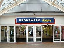
Edgware is principally a shopping and residential area, identified in the London Plan as one of the capital's 35 major centres, and one of the northern termini of the Northern line. It has a bus garage, a shopping centre called the Broadwalk Centre, a library, a hospital—Edgware Community Hospital, and two streams—Edgware Brook and Deans Brook, both tributaries of a small brook known as Silk Stream, which in turn merges with the River Brent at Brent Reservoir.
As of 2011, the town had a population of 76,506 and is made up of five wards from both Barnet and Harrow boroughs.[3]
History
| 1881 | 816 |
|---|---|
| 1891 | 864 |
| 1901 | 868 |
| 1911 | 1,233 |
| 1921 | 1,516 |
| Absorbed by Hendon parish ► | |
| source: UK census | |
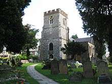
Edgware covers a relatively large medieval parish (traditionally defined area of England) of 2,089 acres (8.45 km2). It succeeds to the identity of the ancient parish in the county of Middlesex. Edgware is a Saxon name meaning Ecgi's weir. Ecgi was a Saxon and the weir relates to a pond where Ecgi's people caught fish. Edgware parish formed part of Hendon Rural District from 1894.[4] It was abolished in 1931 and formed part of the Municipal Borough of Hendon until 1965.[5] The Romans made pottery at Brockley Hill, thought by some to be the site of Sulloniacis. Canons Park, to the north-west, was developed as an estate by James Brydges, 1st Duke of Chandos and was the site of his great palace Cannons.
Origins and pre-industrial history
Edgware's early history is inferred from its Saxon place name and recorded variants. It means "Ecgi's weir". Ecgi is a Saxon name and the weir relates to a pond where his people would catch fish. A legal record of 1422 mentions "Eggeswer", in Middlesex, which, being in Latin, may have been written deliberately using an older form of the spelling.[6] Over many years the name slowly became Edgware, and Ecgi as an individual is long since forgotten. By 1489, and the beginning of the Tudor period those writing the name added the "d" and it was Edggeware.
The manor does not appear in the Domesday survey, nor has there ever been a manor-house as such. But its centre has traditionally always been Edgwarebury Farm since at least 1216. James Brydges, 1st Duke of Chandos erected a palace at Cannons Park around 1713 for £250,000 (equivalent to £37,502,613 in 2019) and was by far the wealthiest resident in its pre-20th century history. The ancient parish served by St Margaret's church was larger than the manor and included parts of Elstree in the north, but not land south of Deans Brook and Edgware Brook, or Little Stanmore parish west of the Edgware Road marking a traditional longest boundary of Edgware. The area of Edgware was little altered and was in the 1930s 3.26 square miles (8.4 km2).[7]
Edgware Road follows the same line as the ancient Watling Street, an important Roman Road, and used in the medieval period by pilgrims. The Road was improved by the Edgware-Kilburn turnpike trust in 1711, and a number of the local inns functioned as a stop for coaches. By 1867 a railway line had been built between Edgware and Finsbury Park and a station was built.
Mostly forest until the 13th century the area was mixed agriculture until the end of 16th century. Production of hay and the selling of cattle fattened and driven from other parts of England and sold locally led, by the 17th century to Edgware becoming a small market. Trades included butchers, tailors, colliers (charcoal sellers) and brewers. The market was held every week but petered out in 1790s.[8]
Edgware was associated with the highwayman Dick Turpin- the infamous scene of his worst incident, which happened on 4 February 1735, when five gang members, including Turpin, broke into a farmhouse owned by Joseph Lawrence, called Earlsbury Farm. Lawrence was at least 70 (so considered fairly old) and yet Turpin et al. beat him with their pistols and tortured him by setting him on a fire whilst naked, before announcing that they would amputate his legs. While this was going on, the leader of the gang took a servant girl upstairs and raped her.[9]
Early economic history
Industry played a minor role in the economy of Edgware. There was a cattle and pleasure fair from 1760s to 1860s with horse racing between 1834 and 1855.[10]
Gravel pits were probably being worked by 1802 and certainly by 1834, partly at least by the labour of the able-bodied poor as a parish employment, and in 1963 gravel was still being extracted on the eastern side of the parish. In 1831 there were no persons engaged in manufacturing in the parish, and in fact there were no industries until in 1900 the firm of Chas. Wright Ltd., manufacturing engineers, moved from Clerkenwell: employed for the UK government in World War I and after this it struck 2,000,000 Mons or 1914 Stars and Victory Medals. Its largest production in World War II was for the metal parts of respirator filters: making 94½ million between 1937 and 1943. In 1963 the company was chiefly engaged in the manufacture of car registration plates. There were 70 workmen employed, together with an office staff of 30. The firm of A.E.W. Ltd., founded in 1923 and established in Edgware in 1927, at the start of the 1970s employed 50 people and manufactured laboratory and industrial electric ovens and furnaces.[10]
This place, from its situation within an easy distance of the metropolis, and the excellence of the road to it through an almost uninterrupted succession of elegant villas and agreeable scenery, has become the residence of numerous opulent and respectable families.
Edgware had few residents for its size but saw some prosperous commerce: in 1870, for instance, there were six insurance agents in the village. The opening of the Great Northern Railway branch in 1867, however, seems to have had little effect on the expansion of the village, and plans to extend the railway met with strong local opposition. A Bill to establish a line from Watford to Edgware, brought before Parliament in 1896 and 1897, was opposed by residents, and it was said that the real harm of the railways was the opening up of building sites 'which are quickly covered with architectural atrocities'. In this time the parish had begun to display a tendency to split into an opulent north and a workaday south, separated by an agricultural buffer zone. By 1896 several large houses had been built in the Elstree area or along the Elstree—Barnet road, while the old village gained the post office, the infants' school, the station, and the Railway Hotel. The southern part of the parish was unable to repel the tide of suburban development, but the threatened distinction was to a large extent averted by the quality of buildings between the two world wars.[10]
Suburban transformation

The first (non-tube connected) railway accompanied a brief decline in population. By the mid 19th century the area was almost entirely for the purpose of hay production. In 1939 the overground railway passenger service ceased to run, and goods traffic ceased by 1964. A tram service began in 1904.[8] In 1921 the population was 1,516. Although much suburban development was encouraged by the opening of the tube station in 1924, the area was already attracting developers like George Cross to the area by 1919. The conurbation increased as far north as the Edgware Way. In 1932 the parish became a part of Hendon Urban District. The shopping district around Station Road developed to include the Ritz Cinema, which opened in May 1932. Following several name changes the cinema was eventually demolished in 2001 replaced by a large gym, apartments and a Caffe Nero. The Edgware Town F.C. was founded in 1939 after a predecessor team in 1915.[8]
Post-war development has been restricted by the Metropolitan Green Belt, sparing urban sprawl into the Scratch Wood and Deacons Hill areas apart from the M1 motorway. By this time the population was more than 17,000. The Mall Shopping Centre, formerly Broadwalk Shopping Centre, replaced the station pulled down in 1961, in 1990.
Edgware was identified in 2008 as a major centre for preferred development in the London Plan.[12]
In the mid 2010s, many new apartments have been built on Green Lane.[13]
Geography
Edgware town centre lies about 200 feet (60 m) above sea level. Much of Edgware is steep, particularly around Edgwarebury Park (a Site of Nature Conservation Interest) and the Broadfields Estate.
The Edgwarebury Brook, Deans Brook and Edgware Brook all flow in the area, all tributaries of the River Brent. Notable open spaces are Edgwarebury Park, Stoneyfields Park and Watling Park.
The A41 road (Watford Bypass) runs through Edgware as well as the M1 motorway.
Edgware is a post town within the HA postcode area,.[14] It is also partly within the NW postcode area.
Edgware is 10 miles (16 km) from Charing Cross in central London; 1.8 miles (2.9 km) from Stanmore, 3.5 miles (5.6 km) from Harrow, 4.1 miles (6.6 km) from Chipping Barnet, and 2.8 miles (4.5 km) from Borehamwood.
Neighbouring areas | |
|---|---|
Demography and religion

Until the 20th century there were no major rises in the population of Edgware. In the manor of Edgware in 1277 there were eight free tenants (excluding the Grand Priory of Clerkenwell) and 52 customary tenants (assumed to all be men); the survey from which these figures are taken, however, includes lands appurtenant to the manor lying in Kingsbury. In 1425–26 the manor of Edgware had three free and 29 customary tenants in the parish, and in 1525–26 the numbers were two or three free and 26 customary tenants. In 1547 there were 120 (adult or teenage) communicants in the parish. In 1597 there were between 60 and 70 houses in the parish, and 44 more in the village of Edgware but on the west side of Watling Street and therefore in the parish of Little Stanmore. In 1599 there were six free and 25 customary tenants of the manor within Edgware. In 1642 in the Civil War the protestation oath of 1641 was taken by 103 adult males. In 1664 there were 73 houses in the parish, but the hearth tax of 1672 gives only 66. During the 18th century the average numbers both of baptisms and burials declined gently but steadily; in the period 1717–26 the average number of baptisms was between 15 and 16 a year and the average number of burials 20, but by 1801–10 the figures were 11 and 9, respectively. There were said to be 69 houses in the village in 1766 and 76 houses in 1792. At the first census in 1801 the population was 412. Throughout the 19th century numbers rose slowly, except for the years between 1851 and 1871; the censuses of 1861 and 1871 show successive declines of 7 percent, attributed in 1871 to migration and to the absence of direct trains to London.[15]
Ten years later the losses had been more than made good, and in 1901 the figure of 868 had been reached. By 1921 the population had grown to 1,516, but the great infilling of the southern part of Edgware after 1924 caused the most spectacular increase. In 1931 the population was 5,352; this had increased to 17,513 by 1951 and to 20,127 by 1961.[15] As well as Christian and subsequent settling of other religious groups, Edgware's development coincided with that of its Jewish community,[16] currently forming the largest single religious group.[17] In the 2001 Census, 36% of Edgware residents give their religion as Jewish, 28% Christian, 9% Hindu and 5% Muslim.[18] The Jewish community in Edgware has constructed its own Eruv.[19]
Edgware has a strong Jewish character, and also has significant Hindu and Muslim minorities, mostly of Indian origin.[20]
According to the 2011 census:
- Edgware ward of Barnet was 60% white (47% British, 12% Other White, 1% Irish). 13% was Indian and 7% Black African. 33% of the population was Jewish, 28% Christian and 11% Muslim. The most spoken foreign language is Gujarati.[21]
- Hale ward of Barnet (east from the centre) was 59% white (45% British, 12% Other, 2% Irish) and 10% Indian. 39% was Christian and 19% Jewish. The most spoken foreign language is Gujarati followed by Persian and Romanian.[22]
This data does not represent the other wards of Canons and Edgware in Harrow and the Burnt Oak ward in Barnet.
Economy
Argonaut Games once had its head office in Edgware.[24] Green Shield Stamps was also headquartered in Edgware until its closure in 1991.
Education
- London Academy
- Beit Shvidler Primary School
- Holland House School
- Broadfields Primary School
- Deansbrook Primary School
- North London Collegiate School
- Rosh Pinah Primary School
- Edgware Junior School
- Canons High School
Transport
Tube
Like most parts of northwest London, Edgware is served very well by the London Underground and there are four stations serving the area:
Buses
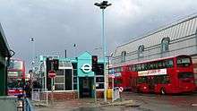
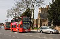
15-day London Buses serve Edgware, along with three night services, three school services, and two non-TfL routes operated by Uno.
Sport
Edgware Cricket Club, based at Canons Park, play Sunday League cricket during the summer months.[25] Edgware Town F.C. is a football club that represents Edgware, but they are currently based in Kingsbury.
Notable people
- Lee Kern – writer and comedian best known for his work on Sacha Baron Cohen series Who Is America? as well as making The Edgware Walker – a documentary about a locally famous eccentric who wandered the streets of Edgware
- Richard Russell Owner of UK Record Label, XL Recordings
- Anita Asante footballer
- Eleanor Bron — actress
- Max Bygraves — singer, comedian and actor
- Antony Costa — singer from boy band Blue
- Tony Currie — footballer
- Charlotte McDonagh — actress/television presenter/model and singer
- Shirley Eaton — actress
- Fenella Fielding — actress
- Vanessa Feltz — TV/radio presenter
- Dayan Michoel Fisher — Principal Rabbi of the Federation of Synagogues
- George Frideric Handel — composer
- Ernest George Trobridge — Architect; Blue Plaque at 19 Heather Walk
- Angharad Rees — actress
- Pat Sharp — disc jockey and television presenter
- Ben Strevens — footballer currently playing for Wycombe Wanderers
- Frank Williams — actor, most notable role: the vicar in Dad's Army
- John Bercow — former Speaker of the House of Commons and MP for Buckingham
- Nicolas Anelka — footballer, when playing for Arsenal
- Jane March — actress
- Mitchell Symons — journalist and author
- Barry Norman — television presenter and author
- Christopher Wreh — former Arsenal footballer
- Victor Feldman — jazz pianist
- George Michael — pop singer[26]
- Patrick Vieira — former Arsenal footballer
- Archie Panjabi — Emmy Award winning actress, currently portraying Kalinda Sharma on The Good Wife
- Altaf Hussain Chief and founder of Pakistan's MQM Party. Resident since 1992.
- Boz Boorer — Guitarist, producer, co-writer and musical director for Morrissey.
- Dave Mattacks — Rock and Folk drummer, best known for his work with Fairport Convention.
- Paul Chowdhry — Stand-Up comedian
- David Piper - Racing Driver
Gallery
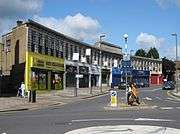 Kings Parade, Edgwarebury Lane.
 A41 Edgware Way, located north from Edgware town centre. View from Edgwarebury Lane footbridge.
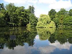 Basin Lake, located in Canons Drive to the west of Edgware. It is located in the borough of Harrow
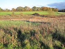 Grassland in Edgwarebury Park, taken from the A41 Edgware Way/Watford-by-Pass. This is the far north, rural area of Edgware.
 Former track of the Great Northern Railway line, which closed in 1964. View from Dean's Lane in the east of Edgware
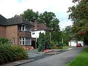 Rose Garden Close in western Edgware, near Canons Drive. This road consists of large suburban houses, near Lake Grove
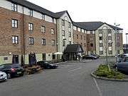 Premier Inn hotel, Edgware
References
- Edgware is made up of 3 wards in the London Borough of Barnet: Burnt Oak, Edgware, and Hale; and 2 wards in the London Borough of Harrow: Canons, and Edgware. "Archived copy". Archived from the original on 22 February 2014. Retrieved 9 June 2014.CS1 maint: archived copy as title (link)
- Both boroughs have Edgware wards, the former in the extreme west and the latter in the extreme east.
- With the addition of the Hale ward http://hidden-london.com/gazetteer/edgware/
- Vision of Britain – Hendon Rural District Archived 1 October 2007 at the Wayback Machine
- Vision of Britain – Edgware parish Archived 5 February 2008 at the Wayback Machine
- Plea Rolls of the Common Pleas; National Archives; CP 40/647;http://aalt.law.uh.edu/AALT1/H6/CP40no647/bCP40no647dorses/IMG_0495.htm; 4th entry, line 1, the home of the defendant Richard Smyth
- T F T Baker, J S Cockburn, R B Pugh (Editors), Diane K Bolton, H P F King, Gillian Wyld, D C Yaxley (1971). "Edgware: Introduction". A History of the County of Middlesex: Volume 4. Institute of Historical Research. Retrieved 5 November 2014.CS1 maint: multiple names: authors list (link)
- Edgware & Burnt Oak Archived 2014-10-15 at the Wayback Machine London Borough of Barnet
- Barlow, Derek (1973). Dick Turpin and the Gregory Gang. Phillimore. pp. 85–92. ISBN 0900592648.
- T F T Baker, J S Cockburn, R B Pugh (Editors), Diane K Bolton, H P F King, Gillian Wyld, D C Yaxley (1971). "Edgware: Economic and social history". A History of the County of Middlesex: Volume 4. Institute of Historical Research. Retrieved 5 November 2014.CS1 maint: multiple names: authors list (link)
- Lewis, S. (1848). A Topographical Dictionary of England. London: Samuel Lewis, p.145.
- Mayor of London (February 2008). "London Plan (Consolidated with Alterations since 2004)" (PDF). Greater London Authority. Archived from the original (PDF) on 2 June 2010.
- https://www.cityam.com/new-homes-hoping-entice-families-live-leafy-london/
- Royal Mail, Address Management Guide (2004)
- T F T Baker, J S Cockburn, R B Pugh (Editors), Diane K Bolton, H P F King, Gillian Wyld, D C Yaxley (1971). "Edgware: Introduction". A History of the County of Middlesex: Volume 4. Institute of Historical Research. Retrieved 5 November 2014.CS1 maint: multiple names: authors list (link)
- T F T Baker, J S Cockburn, R B Pugh (Editors), Diane K Bolton, H P F King, Gillian Wyld, D C Yaxley (1971). "Edgware: Jews". A History of the County of Middlesex: Volume 4. Institute of Historical Research. Retrieved 5 November 2014.CS1 maint: multiple names: authors list (link)
- Milmo, Cahal (3 August 2002). "Britain's first 'eruv' enclave for Jews divides local opinion". The Independent. London. Retrieved 26 February 2009.
- "see Barnet Census Profile" (PDF). Archived from the original (PDF) on 18 July 2011. Retrieved 30 June 2011.
- "The Edgware Eruv". The Edgware Eruv. 17 October 2006. Retrieved 30 June 2011.
- https://hidden-london.com/gazetteer/edgware/
- Services, Good Stuff IT. "Edgware – UK Census Data 2011". UK Census Data. Retrieved 3 April 2018.
- Services, Good Stuff IT. "Hale – UK Census Data 2011". UK Census Data. Retrieved 3 April 2018.
- "Archived copy". Archived from the original on 2 December 2015. Retrieved 5 January 2016.CS1 maint: archived copy as title (link)
- "Argonaut Contact information". Argonaut Games. 13 January 1998. Archived from the original on 13 January 1998. Retrieved 9 November 2009. "Argonaut House 369 Burnt Oak Broadway Edgware Middlesex HA8 5XZ"
- "EdgwareCricketClub". 24 March 2015. Retrieved 7 March 2017.
- MARCELA GM (19 February 2017). "🎼GEORGE MICHAEL BEHIND THE MUSIC". Retrieved 3 April 2018 – via YouTube.
External links
Further historical research
- Barnet Archives and Local Studies
- HADAS Archived Newsletters (The Hendon & District Archaeological Society)
- Victoria County History Edgware Chapter (1971)
- Maps
- 1870s Ordnance survey map
- 1785 Cary’s 15 miles around London
- Pictures
From the collection of the City of London
- St Margaret’s Church in 1792
- Atkinson’s Almshouses c1800
- Edgware Lodge c1820
From the Collection of Clive Smith
- Great Northern Railway Station c1905
- High Street c1905
- Edgware Road c1905
- Edgware Road with tram c1910
- Edgware Road c1925
- Railway Hotel c1925
- The Ritz Cinema Opened 1932
- The War Memorial
- Entry into Edgware