West Farms, New Jersey
West Farms is an unincorporated community located within Howell Township in Monmouth County, New Jersey, United States.[2][3] The settlement is centered on the intersection of West Farms Road and Casino Drive, located to the west of Farmingdale and to the north of the Manasquan Reservoir. It was once home Jewish farmers who settled there in the early 20th century.[4][5] The rural area is mostly made up of wooded areas with some houses and churches dotted along the two aforementioned roads. Numerous small farms are also located throughout the area.[6]
West Farms, New Jersey | |
|---|---|
 Intersection of Casino Drive and West Farms Road | |
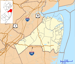 West Farms, New Jersey Location of West Farms in Monmouth County Inset: Location of county within the state of New Jersey 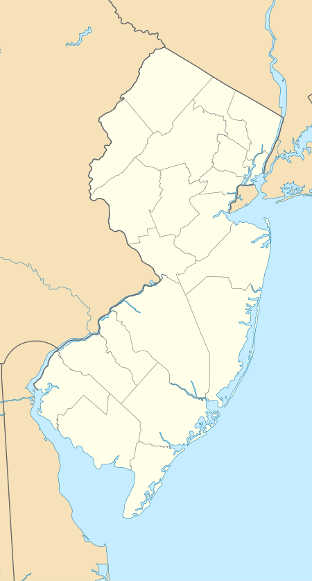 West Farms, New Jersey West Farms, New Jersey (New Jersey)  West Farms, New Jersey West Farms, New Jersey (the United States) | |
| Coordinates: 40°11′31″N 74°12′05″W | |
| Country | |
| State | |
| County | Monmouth |
| Township | Howell |
| Elevation | 79 ft (24 m) |
| Time zone | UTC-5 (Eastern (EST)) |
| • Summer (DST) | UTC-4 (EDT) |
| GNIS feature ID | 881701[1] |
References
- "West Farms". Geographic Names Information System. United States Geological Survey.
- Gannett, Henry (January 28, 1895). "A Geographic Dictionary of New Jersey". U.S. Government Printing Office – via Google Books.
- Locality Search, State of New Jersey. Accessed March 9, 2015.
- Dubrovsky, Gertrude W. (February 28, 1992). "The Land Was Theirs: Jewish Farmers in the Garden State". University of Alabama Press – via Google Books.
- Lurie, Maxine N.; Lurie, Maxine; M.D, Michael Siegel; Mappen, Marc (April 26, 2004). "Encyclopedia of New Jersey". Rutgers University Press – via Google Books.
- Google (August 31, 2016). "Aerial view of West Farms" (Map). Google Maps. Google. Retrieved August 31, 2016.

This article is issued from Wikipedia. The text is licensed under Creative Commons - Attribution - Sharealike. Additional terms may apply for the media files.