Allenhurst, New Jersey
Allenhurst is a borough in Monmouth County, New Jersey, United States named for resident Abner Allen and incorporated as a borough by an act of the New Jersey Legislature on April 26, 1897, from portions of Ocean Township. As of the 2010 United States Census, the borough's population was 496,[7][8][9] reflecting a decline of 222 (-30.9%) from the 718 counted in the 2000 Census, which had in turn declined by 41 (-5.4%) from the 759 counted in the 1990 Census.[18]
Allenhurst, New Jersey | |
|---|---|
| Borough of Allenhurst | |
.JPG) The old Allenhurst Railroad Station | |
 Map of Allenhurst in Monmouth County. Inset: Location of Monmouth County highlighted in the State of New Jersey. | |
 Census Bureau map of Allenhurst, New Jersey | |
| Coordinates: 40.235945°N 74.002417°W[1][2] | |
| Country | |
| State | |
| County | Monmouth |
| Incorporated | April 26, 1897 |
| Named for | Abner Allen |
| Government | |
| • Type | Walsh Act |
| • Body | Board of Commissioners |
| • Mayor | David J. McLaughlin (term ends May 1, 2020)[4] |
| • Administrator / Municipal clerk | Donna Campagna[5] |
| Area | |
| • Total | 0.283 sq mi (0.733 km2) |
| • Land | 0.263 sq mi (0.680 km2) |
| • Water | 0.020 sq mi (0.053 km2) 7.21% |
| Area rank | 554th of 566 in state 50th of 53 in county[1] |
| Elevation | 23 ft (7 m) |
| Population | |
| • Total | 496 |
| • Estimate (2019)[10] | 483 |
| • Rank | 556th of 566 in state 52nd of 53 in county[11] |
| • Density | 1,887.9/sq mi (728.9/km2) |
| • Density rank | 299th of 566 in state 36th of 53 in county[11] |
| Time zone | UTC−05:00 (Eastern (EST)) |
| • Summer (DST) | UTC−04:00 (Eastern (EDT)) |
| ZIP Codes | |
| Area code(s) | 732 exchanges: 517, 531, 660, 663[14] |
| FIPS code | 3402500730[1][15][16] |
| GNIS feature ID | 0885136[1][17] |
| Website | www |
Bordered by the Atlantic Ocean to the east and Deal Lake to the west, it is in close proximity to New York City and is a stop on the NJ Transit North Jersey Coast Line. The borough is at the center of a string of wealthy communities between Long Branch and Asbury Park with many historic homes built during the late 19th and early 20th centuries. In 2006, Allenhurst ranked 131st in Forbes magazine's list of the most expensive ZIP Codes in the United States.
History
Allenhurst "reflects the history of development from a rural area to a suburb and resort town of New York City. In 1895, the 120-acre (49 ha) Allen farm was bought by the Coast Land Improvement Company in order to build an exclusive resort community to attract upper class summer residents. The proximity of Allenhurst to the rail line was significant in the growth and popularity of Allenhurst, allowing residents of New York City easier access to the community."[19]
On April 26, 1897, Allenhurst was incorporated as a borough by an act of the New Jersey Legislature from portions of Ocean Township.[20] The borough is situated in the center of a string of wealthy communities between Long Branch and Asbury Park. The borough was named for resident Abner Allen.[21]
During the late 19th and early 20th centuries many historic homes were built in Victorian, Queen Anne, Italian Renaissance Revival, Tudor Revival, Prairie, Mission Revival, American Craftsman, Shingle, Colonial Revival, Neoclassical and Gothic Revival architectural styles.[22][23] Local ordinances overseen by an historic preservation commission have ensured the preservation of historical architecture by enforcing strict guidelines for the renovation of older homes.[24]
In 2006, Allenhurst ranked 131st in Forbes magazine's list of the most expensive ZIP Codes in the United States.[25] In the magazine's 2012 rankings, the borough was ranked 448th, with a median price of $665,043.[26]
After Hurricane Sandy had devastated the shoreline in October 2012, the U.S. Army Corps of Engineers (USACE) in 2015 pumped sand onto the beaches, which contained unexploded ordnance in the form of hundreds of fusing components for World War I-era artillery. From December 2016 until March 2017, USACE Baltimore District specialists in munitions and explosives removed 362 chap-stick-sized potentially live pieces, mostly boosters, which had most likely been disposed of as excess after World War I, and are not uncommon at Gateway's Sandy Hook Unit. "Not only was Fort Hancock an active military base until 1974, but also the proving ground of the U.S. Army from 1874 until 1919."[27]
Geography
According to the United States Census Bureau, the borough had a total area of 0.283 square miles (0.733 km2), including 0.263 square miles (0.680 km2) of land and 0.020 square miles (0.053 km2) of water (7.21%).[1][2]
The borough borders the Atlantic Ocean to the east, Deal Lake to the west, and is in close proximity to New York City. The borough borders the Monmouth County municipalities of Deal, Interlaken, Loch Arbour and Ocean Township.[28][29][30]
The beachfront is characterized by two groins, known to locals as "Crackup" and "The L". "The L" was featured in Scuba Diving magazine as one of New Jersey's premier shore diving locations.
Deal Lake covers 158 acres (64 ha), overseen by the Deal Lake Commission, established in 1974. Seven municipalities border the lake, accounting for 27 miles (43 km) of shoreline, also including Asbury Park, Deal, Interlaken, Loch Arbour, Neptune Township and Ocean Township.[31]
Demographics
| Historical population | |||
|---|---|---|---|
| Census | Pop. | %± | |
| 1900 | 165 | — | |
| 1910 | 306 | 85.5% | |
| 1920 | 343 | 12.1% | |
| 1930 | 573 | 67.1% | |
| 1940 | 520 | −9.2% | |
| 1950 | 758 | 45.8% | |
| 1960 | 795 | 4.9% | |
| 1970 | 1,012 | 27.3% | |
| 1980 | 912 | −9.9% | |
| 1990 | 759 | −16.8% | |
| 2000 | 718 | −5.4% | |
| 2010 | 496 | −30.9% | |
| Est. 2019 | 483 | [10][32] | −2.6% |
| Population sources: 1900-1920[33] 1900-1910[34] 1910-1930[35] 1930-1990[36] 2000[37][38] 2010[7][8][9] | |||
Census 2010
The 2010 United States Census counted 496 people, 217 households, and 115.010 families in the borough. The population density was 1,887.9 per square mile (728.9/km2). There were 365 housing units at an average density of 1,389.3 per square mile (536.4/km2). The racial makeup of the borough was 94.76% (470) White, 1.01% (5) Black or African American, 0.00% (0) Native American, 1.01% (5) Asian, 0.00% (0) Pacific Islander, 1.41% (7) from other races, and 1.81% (9) from two or more races. Hispanic or Latino of any race were 4.44% (22) of the population.[7]
The 217 households accounted 16.1% with children under the age of 18 living with them; 44.2% were married couples living together; 6.0% had a female householder with no husband present, and 47.0% were non-families. Of all households, 37.3% were made up of individuals, and 12.0% had someone living alone who was 65 years of age or older. The average household size was 2.29 and the average family size was 3.11.[7]
In the borough, the population age was spread out with 15.3% under the age of 18, 9.1% from 18 to 24, 23.4% from 25 to 44, 32.5% from 45 to 64, and 19.8% who were 65 years of age or older. The median age was 47.2 years. For every 100 females, the population had 105.8 males. For every 100 females ages 18 and older there were 103.9 males.[7]
The Census Bureau's 2006-2010 American Community Survey showed that (in 2010 inflation-adjusted dollars) median household income was $79,250 (with a margin of error of +/- $41,438) and the median family income was $131,500 (+/- $30,872). Males had a median income of $71,944 (+/- $75,722) versus $44,625 (+/- $3,762) for females. The per capita income for the borough was $63,707 (+/- $14,113). About 3.2% of families and 3.5% of the population were below the poverty line, including none of those under age 18 and 8.9% of those age 65 or over.[39]
Census 2000
As of the 2000 United States Census[15] there were 718 people, 285 households, and 188 families residing in the borough. The population density was 2,750.6 people per square mile (1,066.2/km2). There were 370 housing units at an average density of 1,417.4 per square mile (549.5/km2). The racial makeup of the borough was 97.35% White, 0.84% African American, 0.28% Native American, 0.42% Asian, 0.14% from other races, and 0.97% from two or more races. Hispanic or Latino of any race were 2.51% of the population.[37][38]
There were 285 households, out of which 23.9% had children under the age of 18 living with them, 55.8% were married couples living together, 6.7% had a female householder with no husband present, and 33.7% were non-families. 24.9% of all households were made up of individuals, and 7.0% had someone living alone who was 65 years of age or older. The average household size was 2.52 and the average family size was 3.08.[37][38]
In the borough the population was spread out, with 28.9% under the age of 18, 5.7% from 18 to 24, 28.8% from 25 to 44, 27.9% from 45 to 64, and 18.7% who were 65 years of age or older. The median age was 42 years. For every 100 females, there were 106.3 males. For every 100 females age 18 and over, there were 96.0 males.[37][38]
The median income for a household in the borough was $85,000, and the median income for a family was $109,180. Males had a median income of $70,625 versus $32,171 for females. The per capita income for the borough was $42,710. About 1.0% of families and 3.8% of the population were below the poverty line, including 1.6% of those under age 18 and 2.1% of those age 65 or over.[37][38]
Parks and recreation
The Allenhurst Beach Club, a 2,450-member recreational facility, has attracted residents and visitors during the summer months for generations. As of 2013 it featured a 525,000-US-gallon (1,990,000 l; 437,000 imp gal) salt water swimming pool, a children's wading pool, cabanas and bathhouses. New membership is no longer open to non-residents according to the borough administration.[40]
Government
Local government
Allenhurst has governed since 1916 by a three-member Commission, under the terms of the Walsh Act.[41][42] The borough is one of 30 of 565 municipalities statewide that use the commission form of government.[43] The governing body consists of the three-member Board of Commissioners, whose members are elected at-large in nonpartisan elections to serve four-year terms of office on a concurrent basis.[3] Each Commissioner is assigned responsibility for a specified department within the Borough.
As of 2020, the members of Allenhurst's Board of Commissioners, serving concurrent terms of office until May 12, 2020, are Mayor David J. McLaughlin (Commissioner of Public Affairs and Public Safety), Deputy Mayor Christopher J. McLoughlin (Commissioner of Revenue and Finance) and Terry Bolan (Commissioner of Public Works, Parks and Public Property)[44][45][46][47][48]
Federal, state and county representation
Allenhurst is located in the 6th Congressional district[49] and is part of New Jersey's 11th state legislative district.[8][50][51]
For the 116th United States Congress, New Jersey's Sixth Congressional District is represented by Frank Pallone (D, Long Branch).[52][53] New Jersey is represented in the United States Senate by Democrats Cory Booker (Newark, term ends 2021)[54] and Bob Menendez (Paramus, term ends 2025).[55][56]
For the 2018–2019 session (Senate, General Assembly), the 11th Legislative District of the New Jersey Legislature is represented in the State Senate by Vin Gopal (D, Long Branch) and in the General Assembly by Joann Downey (D, Freehold Township) and Eric Houghtaling (D, Neptune Township).[57][58]
Monmouth County is governed by a Board of Chosen Freeholders consisting of five members who are elected at-large to serve three year terms of office on a staggered basis, with either one or two seats up for election each year as part of the November general election. At an annual reorganization meeting held in the beginning of January, the board selects one of its members to serve as Director and another as Deputy Director.[59] As of 2020, Monmouth County's Freeholders are Freeholder Director Thomas A. Arnone (R, Neptune City, term as freeholder ends December 31, 2022; term as freeholder director ends 2021),[60] Freeholder Deputy Director Susan M. Kiley (R, Hazlet Township, term as freeholder ends December 31, 2021; term as deputy freeholder director ends 2021),[61] Lillian G. Burry (R, Colts Neck Township, 2020),[62] Nick DiRocco (R, Wall Township, 2022),[63] and Patrick G. Impreveduto (R, Holmdel Township, 2020)[64].
Constitutional officers elected on a countywide basis are County clerk Christine Giordano Hanlon (R, 2020; Ocean Township),[65][66] Sheriff Shaun Golden (R, 2022; Howell Township),[67][68] and Surrogate Rosemarie D. Peters (R, 2021; Middletown Township).[69][70]
Politics
As of March 23, 2011, there were a total of 401 registered voters in Allenhurst, of which 72 (18.0%) were registered as Democrats, 124 (30.9%) were registered as Republicans and 205 (51.1%) were registered as Unaffiliated. There were no voters registered to other parties.[71]
In the 2012 presidential election, Republican Mitt Romney received 60.6% of the vote (168 cast), ahead of Democrat Barack Obama with 38.6% (107 votes), and other candidates with 0.7% (2 votes), among the 280 ballots cast by the borough's 402 registered voters (3 ballots were spoiled), for a turnout of 69.7%.[72][73] In the 2008 presidential election, Republican John McCain received 59.5% of the vote (198 cast), ahead of Democrat Barack Obama with 38.7% (129 votes) and other candidates with 0.9% (3 votes), among the 333 ballots cast by the borough's 441 registered voters, for a turnout of 75.5%.[74] In the 2004 presidential election, Republican George W. Bush received 61.7% of the vote (234 ballots cast), outpolling Democrat John Kerry with 36.4% (138 votes) and other candidates with 1.0% (5 votes), among the 379 ballots cast by the borough's 526 registered voters, for a turnout percentage of 72.1.[75]
In the 2013 gubernatorial election, Republican Chris Christie received 82.6% of the vote (147 cast), ahead of Democrat Barbara Buono with 17.4% (31 votes), and other candidates receiving no votes, among the 180 ballots cast by the borough's 376 registered voters (2 ballots were spoiled), for a turnout of 47.9%.[76][77] In the 2009 gubernatorial election, Republican Chris Christie received 72.6% of the vote (175 ballots cast), ahead of Democrat Jon Corzine with 19.5% (47 votes) and Independent Chris Daggett with 7.9% (19 votes) with no votes cast for other candidates, among the 241 ballots cast by the borough's 405 registered voters, yielding a 59.5% turnout.[78]
Education
Allenhurst is a non-operating district that does not have any public school facilities of its own. Until the 2017–18 school year, public school students from Allenhurst had exclusively attended the Asbury Park Public Schools in Asbury Park as part of a sending/receiving relationship.[79] In July 2017, the Acting Commissioner of the New Jersey Department of Education authorized the termination of the agreement with Asbury Park, which was replaced with a new relationship with the West Long Branch district for grades K-8 and with Shore Regional for grades 9-12.[80]
The West Long Branch Public Schools serves students in pre-kindergarten through eighth grade from West Long Branch. Students from Interlaken and Loch Arbour also attend the district's school as part of sending/receiving relationships, in which students attend on a tuition basis.[81] As of the 2018–19 school year, the district, comprising two schools, had an enrollment of 573 students and 62.4 classroom teachers (on an FTE basis), for a student–teacher ratio of 9.2:1.[82] Schools in the district (with 2018–19 enrollment data from the National Center for Education Statistics[83]) are Betty McElmon Elementary School[84] with 310 students in pre-Kindergarten through fourth grade and Frank Antonides School[85] with 256 students in fifth through eighth grades.[86][87]
For ninth through twelfth grades, public school students attend Shore Regional High School, a regional high school located in West Long Branch that also serves students from the constituent districts of Monmouth Beach, Oceanport and Sea Bright.[88][89] The high school is part of the Shore Regional High School District. As of the 2018–19 school year, the high school had an enrollment of 649 students and 57.2 classroom teachers (on an FTE basis), for a student–teacher ratio of 11.3:1.[90]
Students also have the option to attend Academy Charter High School in Lake Como, which accepts students on a lottery basis from the communities of Allenhurst, Asbury Park, Avon-by-the-Sea, Belmar, Bradley Beach, Deal, Interlaken and Lake Como.[91][92]
Transportation
_between_Elberon_Avenue_and_Allen_Avenue_in_Allenhurst%2C_Monmouth_County%2C_New_Jersey.jpg)
Roads and highways
As of May 2010, the borough had a total of 5.14 miles (8.27 km) of roadways, of which 4.73 miles (7.61 km) were maintained by the municipality, 0.08 miles (0.13 km) by Monmouth County and 0.33 miles (0.53 km) by the New Jersey Department of Transportation.[93]
New Jersey Route 71 is the only significant highway in Allenhurst.
Public transportation
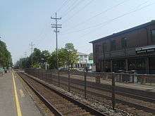
NJ Transit train service is offered from the Allenhurst station[94] on the North Jersey Coast Line, providing service to Newark Penn Station, Secaucus Junction and New York Penn Station, as well as Hoboken Terminal.[95] The station has been listed on the National Register of Historic Places since 1980.[96]
New Jersey Transit offers local bus transportation on the 837 route.[97]
Climate
According to the Köppen climate classification system, Allenhurst, New Jersey has a humid subtropical climate (Cfa). Cfa climates are characterized by all months having an average mean temperature > 32.0 °F (> 0.0 °C), at least four months with an average mean temperature ≥ 50.0 °F (≥ 10.0 °C), at least one month with an average mean temperature ≥ 71.6 °F (≥ 22.0 °C) and no significant precipitation difference between seasons. During the summer months at Allenhurst, a cooling afternoon sea breeze is present on most days, but episodes of extreme heat and humidity can occur with heat index values ≥ 95 °F (≥ 35 °C). During the winter months, episodes of extreme cold and wind can occur with wind chill values < 0 °F (< -18 °C). The plant hardiness zone at Allenhurst Beach is 7a with an average annual extreme minimum air temperature of 3.7 °F (-15.7 °C).[98] The average seasonal (November–April) snowfall total is 18 to 24 inches (46 to 61 cm) and the average snowiest month is February which corresponds with the annual peak in nor'easter activity.
| Climate data for Allenhurst Beach, NJ (1981-2010 Averages) | |||||||||||||
|---|---|---|---|---|---|---|---|---|---|---|---|---|---|
| Month | Jan | Feb | Mar | Apr | May | Jun | Jul | Aug | Sep | Oct | Nov | Dec | Year |
| Average high °F (°C) | 40.0 (4.4) |
42.6 (5.9) |
49.1 (9.5) |
58.6 (14.8) |
68.2 (20.1) |
77.4 (25.2) |
82.7 (28.2) |
81.6 (27.6) |
75.4 (24.1) |
65.0 (18.3) |
55.2 (12.9) |
45.1 (7.3) |
61.8 (16.6) |
| Daily mean °F (°C) | 32.5 (0.3) |
34.7 (1.5) |
40.9 (4.9) |
50.3 (10.2) |
59.9 (15.5) |
69.4 (20.8) |
74.9 (23.8) |
73.9 (23.3) |
67.4 (19.7) |
56.4 (13.6) |
47.3 (8.5) |
37.7 (3.2) |
53.9 (12.2) |
| Average low °F (°C) | 24.9 (−3.9) |
26.9 (−2.8) |
32.7 (0.4) |
41.9 (5.5) |
51.6 (10.9) |
61.3 (16.3) |
67.1 (19.5) |
66.2 (19.0) |
59.3 (15.2) |
47.8 (8.8) |
39.4 (4.1) |
30.3 (−0.9) |
45.9 (7.7) |
| Average precipitation inches (mm) | 3.62 (92) |
3.06 (78) |
3.90 (99) |
4.17 (106) |
3.87 (98) |
3.59 (91) |
4.69 (119) |
4.77 (121) |
3.65 (93) |
3.97 (101) |
3.84 (98) |
4.02 (102) |
47.15 (1,198) |
| Average relative humidity (%) | 64.6 | 61.7 | 60.5 | 62.1 | 66.0 | 70.0 | 69.9 | 71.2 | 71.3 | 69.4 | 67.3 | 65.3 | 66.6 |
| Average dew point °F (°C) | 21.9 (−5.6) |
22.9 (−5.1) |
28.3 (−2.1) |
37.8 (3.2) |
48.5 (9.2) |
59.2 (15.1) |
64.4 (18.0) |
64.0 (17.8) |
57.8 (14.3) |
46.5 (8.1) |
37.0 (2.8) |
27.1 (−2.7) |
43.0 (6.1) |
| Source: PRISM[99]</ref> | |||||||||||||
| Climate data for Sandy Hook, NJ Ocean Water Temperature (16 N Allenhurst) | |||||||||||||
|---|---|---|---|---|---|---|---|---|---|---|---|---|---|
| Month | Jan | Feb | Mar | Apr | May | Jun | Jul | Aug | Sep | Oct | Nov | Dec | Year |
| Daily mean °F (°C) | 37 (3) |
36 (2) |
40 (4) |
46 (8) |
55 (13) |
62 (17) |
69 (21) |
72 (22) |
68 (20) |
59 (15) |
51 (11) |
43 (6) |
53 (12) |
| Source: NOAA[100] | |||||||||||||
Ecology
According to the A. W. Kuchler U.S. potential natural vegetation types, Allenhurst, New Jersey would have an Appalachian Oak (104) vegetation type with an Eastern Hardwood Forest (25) vegetation form.[101]
Notable people
People who were born in, residents of, or otherwise closely associated with Allenhurst include:
- Bob Considine (1906–1975), author and columnist for The New York Times had a garage in Allenhurst[102]
- Dorothy Fields (1905–1974), librettist and lyricist, born in Allenhurst.[103]
- Abram Fitkin (1878–1933), investment banker, utilities operator and philanthropist who owned "Milestones" at 16-18 Corlies Avenue.[104][105]
- Alice Joyce (1890–1955), film actress known as The Madonna of the Screen had a summer home in Allenhurst.[106]
- Hoddy Mahon (1932-2011), head coach of the Seton Hall Pirates men's basketball team during the 1981–82 season.[107]
- James B. Murray (1920–2015), businessman and politician who served in the Virginia House of Delegates.[108]
References
- 2010 Census Gazetteer Files: New Jersey Places, United States Census Bureau. Accessed May 21, 2015.
- US Gazetteer files: 2010, 2000, and 1990, United States Census Bureau. Accessed September 4, 2014.
- 2012 New Jersey Legislative District Data Book, Rutgers University Edward J. Bloustein School of Planning and Public Policy, March 2013, p. 58.
- 2020 New Jersey Mayors Directory, New Jersey Department of Community Affairs. Accessed February 1, 2020.
- Borough Administration, Borough of Allenhurst. Accessed March 15, 2018.
- U.S. Geological Survey Geographic Names Information System: Borough of Allenhurst, Geographic Names Information System. Accessed March 4, 2013.
- DP-1 - Profile of General Population and Housing Characteristics: 2010 for Allenhurst borough, Monmouth County, New Jersey, United States Census Bureau. Accessed July 27, 2012.
- Municipalities Sorted by 2011-2020 Legislative District, New Jersey Department of State. Accessed February 1, 2020.
- Profile of General Demographic Characteristics: 2010 for Allenhurst borough Archived 2014-08-22 at the Wayback Machine, New Jersey Department of Labor and Workforce Development. Accessed July 27, 2012.
- Annual Estimates of the Resident Population for Minor Civil Divisions in New Jersey: April 1, 2010 to July 1, 2019, United States Census Bureau. Accessed May 21, 2020.
- GCT-PH1 Population, Housing Units, Area, and Density: 2010 - State -- County Subdivision from the 2010 Census Summary File 1 for New Jersey, United States Census Bureau. Accessed December 11, 2012.
- Look Up a ZIP Code for Allenhurst, NJ, United States Postal Service. Accessed July 27, 2012.
- ZIP Codes, State of New Jersey. Accessed August 22, 2013.
- Area Code Lookup - NPA NXX for Allenhurst, NJ, Area-Codes.com. Accessed September 17, 2013.
- U.S. Census website, United States Census Bureau. Accessed September 4, 2014.
- Geographic Codes Lookup for New Jersey, Missouri Census Data Center. Accessed July 27, 2012.
- US Board on Geographic Names, United States Geological Survey. Accessed September 4, 2014.
- Table 7. Population for the Counties and Municipalities in New Jersey: 1990, 2000 and 2010, New Jersey Department of Labor and Workforce Development, February 2011. Accessed July 27, 2012.
- Trust for Architectural Easements Supports Allenhurst Residential Historic District
- Snyder, John P. The Story of New Jersey's Civil Boundaries: 1606-1968, Bureau of Geology and Topography; Trenton, New Jersey; 1969. p. 177. Accessed July 27, 2012.
- Hutchinson, Viola L. The Origin of New Jersey Place Names, New Jersey Public Library Commission, May 1945. Accessed August 26, 2015.
- Staff. "Allenhurst Residential Historic District, Allenhurst, N.J.", Archirectural Ambler, Issue 13 / April 2010. Accessed July 27, 2012. "The most popular house styles were Colonial Revival and Queen Anne, but the Italian Renaissance Revival, Tudor Revival, Prairie, Mission, Craftsman and Shingle styles were also represented."
- Allenhurst Residential Historic District Archived 2011-01-19 at the Wayback Machine, Trust for Architectural Easements. Accessed July 27, 2012. "The style of houses is varied, and includes Queen Anne, Colonial Revival, Tudor Revival, Neo-Classical, Gothic Revival, Prairie, Mission, Shingle, Craftsman and Italian Renaissance."
- Stine, Don. "Allenhurst historic commission in place", Asbury Park Press, April 26, 1999. Accessed July 27, 2012. "The seven-member commission will serve in an advisory capacity to the Planning Board regarding demolition or renovation of historic homes in the borough."
- Staff. "Most Expensive Zipcodes 2006: #131 07711 - Allenhurst, NJ", Forbes, July 2006. Accessed November 10, 2008.
- Brennan, Morgan. "America's Most Expensive ZIP Codes 2012", Forbes, October 16, 2012. Accessed September 17, 2013.
- Hook, Jay. "World War I-Era Ordnance Found Along Jersey Shore", Two River Times, March 19, 2017. Accessed March 17, 2020. "'Unexploded ordnance are not uncommon at Gateway’s Sandy Hook Unit,' Gateway National Recreation Area’s superintendent Jen Nersesian said in a statement. 'Not only was Fort Hancock an active military base until 1974, but this site was also the proving ground of the U.S. Army from 1874 until 1919.'"
- Areas touching Allenhurst, MapIt. Accessed March 11, 2020.
- Regional Location Map, Monmouth County, New Jersey. Accessed March 11, 2020.
- New Jersey Municipal Boundaries, New Jersey Department of Transportation. Accessed November 15, 2019.
- Home Page, Deal Lake Commission. Accessed July 8, 2015. "The Deal Lake Commission was created by the seven Monmouth County, NJ towns that surround Deal Lake. The Commission was chartered in 1974 by the Borough of Allenhurst, City of Asbury Park, Borough of Deal, Borough of Interlaken, Village of Loch Arbour, Neptune Township, and Ocean Township."
- Census Estimates for New Jersey April 1, 2010 to July 1, 2019, United States Census Bureau. Accessed May 21, 2020.
- Compendium of censuses 1726-1905: together with the tabulated returns of 1905, New Jersey Department of State, 1906. Accessed August 22, 2013.
- Thirteenth Census of the United States, 1910: Population by Counties and Minor Civil Divisions, 1910, 1900, 1890, United States Census Bureau, p. 337. Accessed July 27, 2012.
- Fifteenth Census of the United States : 1930 - Population Volume I, United States Census Bureau, p. 717. Accessed July 27, 2012.
- New Jersey Resident Population by Municipality: 1930 - 1990, Workforce New Jersey Public Information Network. Accessed June 28, 2015.
- Census 2000 Profiles of Demographic / Social / Economic / Housing Characteristics for Allenhurst borough, New Jersey Archived 2014-08-09 at the Wayback Machine, United States Census Bureau. Accessed July 27, 2012.
- DP-1: Profile of General Demographic Characteristics: 2000 - Census 2000 Summary File 1 (SF 1) 100-Percent Data for Allenhurst borough, Monmouth County, New Jersey, United States Census Bureau. Accessed July 27, 2012.
- DP03: Selected Economic Characteristics from the 2006-2010 American Community Survey 5-Year Estimates for Allenhurst borough, Monmouth County, New Jersey, United States Census Bureau. Accessed June 21, 2012.
- Allenhurst Beach Club, Borough of Allenhurst. Accessed September 17, 2013.
- "The Commission Form of Municipal Government", p. 53. Accessed June 3, 2015.
- "Forms of Municipal Government in New Jersey", p. 8. Rutgers University Center for Government Studies. Accessed June 3, 2015.
- Inventory of Municipal Forms of Government in New Jersey, Rutgers University Center for Government Studies, July 1, 2011. Accessed November 18, 2019.
- Allenhurst Board of Commissioners, Borough of Allenhurst. Accessed March 17, 2020.
- 2019 Municipal User Friendly Budget, Borough of Allenhurst. Accessed February 19, 2020. As of date accessed, commissioners are incorrectly listed with term-end dates of December 31, 2020.
- Monmouth County Directory 2018, Monmouth County, New Jersey. Accessed March 17, 2020.
- May 10, 2016 Municipal Elections Official Results, Monmouth County, New Jersey, updated May 12, 2016. Accessed July 14, 2016.
- Reorganization Meeting Minutes May 24, 2016, Borough of Allenhurst. Accessed July 14, 2016. "Be it resolved, That the following newly designated and constituted departments are approved and assigned as shown: Department Of Public Affairs And Public Safety - Mayor Mclaughlin... Department Of Revenue And Finance - Deputy Mayor Mcloughlin... Dept. Of Public Works, Parks And Public Property - Comm. Bolan"
- Plan Components Report, New Jersey Redistricting Commission, December 23, 2011. Accessed February 1, 2020.
- 2019 New Jersey Citizen's Guide to Government, New Jersey League of Women Voters. Accessed October 30, 2019.
- Districts by Number for 2011-2020, New Jersey Legislature. Accessed January 6, 2013.
- Directory of Representatives: New Jersey, United States House of Representatives. Accessed January 3, 2019.
- Biography, Congressman Frank Pallone Jr. Accessed January 3, 2019. "Frank Pallone, Jr., was born in Long Branch, New Jersey, where he grew up and still resides."
- About Cory Booker, United States Senate. Accessed January 26, 2015. "He now owns a home and lives in Newark's Central Ward community."
- Biography of Bob Menendez, United States Senate, January 26, 2015. "He currently lives in Paramus and has two children, Alicia and Robert."
- Senators of the 116th Congress from New Jersey. United States Senate. Accessed April 17, 2019. "Booker, Cory A. - (D - NJ) Class II; Menendez, Robert - (D - NJ) Class I"
- Legislative Roster 2018-2019 Session, New Jersey Legislature. Accessed January 22, 2018.
- District 11 Legislators, New Jersey Legislature. Accessed January 22, 2018.
- Monmouth County Government, Monmouth County, New Jersey. Accessed February 18, 2018.
- Freeholder Thomas A. Arnone, Monmouth County, New Jersey. Accessed May 18, 2020.
- Freeholder Susan M. Kiley, Monmouth County, New Jersey. Accessed May 18, 2020.
- Freeholder Lillian G. Burry, Monmouth County, New Jersey. Accessed May 18, 2020.
- Freeholder John P. Curley, Monmouth County, New Jersey. Accessed May 18, 2020.
- Freeholder Patrick Impreveduto, Monmouth County, New Jersey. Accessed February 18, 2018.
- The Monmouth County Clerk, Monmouth County, New Jersey. Accessed May 18, 2020.
- Members List: Clerks, Constitutional Officers Association of New Jersey. Accessed May 18, 2020.
- About Sheriff Shaun Golden, Monmouth County Sheriff's Office. Accessed May 18, 2020.
- Members List: Sheriffs, Constitutional Officers Association of New Jersey. Accessed May 18, 2020.
- About the Surrogate, Monmouth County New Jersey. Accessed May 18, 2020.
- Members List: Surrogates, Constitutional Officers Association of New Jersey. Accessed May 18, 2020.
- Voter Registration Summary - Monmouth, New Jersey Department of State Division of Elections, March 23, 2011. Accessed December 2, 2012.
- "Presidential General Election Results - November 6, 2012 - Monmouth County" (PDF). New Jersey Department of Elections. March 15, 2013. Retrieved December 24, 2014.
- "Number of Registered Voters and Ballots Cast - November 6, 2012 - General Election Results - Monmouth County" (PDF). New Jersey Department of Elections. March 15, 2013. Retrieved December 24, 2014.
- 2008 Presidential General Election Results: Monmouth County, New Jersey Department of State Division of Elections, December 23, 2008. Accessed December 2, 2012.
- 2004 Presidential Election: Monmouth County, New Jersey Department of State Division of Elections, December 13, 2004. Accessed December 2, 2012.
- "Governor - Monmouth County" (PDF). New Jersey Department of Elections. January 29, 2014. Retrieved December 24, 2014.
- "Number of Registered Voters and Ballots Cast - November 5, 2013 - General Election Results - Monmouth County" (PDF). New Jersey Department of Elections. January 29, 2014. Retrieved December 24, 2014.
- 2009 Governor: Monmouth County Archived 2012-10-17 at the Wayback Machine, New Jersey Department of State Division of Elections, December 31, 2009. Accessed December 2, 2012.
- 13 Non-Operating School Districts Eliminated, New Jersey Department of Education press release dated July 1, 2009. Accessed December 25, 2009.
- In The Matter Of The Petition Of The Board Of Education Of The Borough Of Allenhurst, Monmouth County, For Authorization To Sever A Sending-Receiving Relationship With The Board Of Education Of The City Of Asbury Park, Monmouth County, And To Enter Into A Sending-Receiving Relationship With The Board Of Education Of The Borough Of West Long Branch, Monmouth County, And The Board Of Education Of The Shore Regional High School District, Monmouth County., New Jersey Department of Education, July 20, 2017. "It Is Ordered on this 20th day of July, 2017 that – pursuant to N.J.S.A. 18A:38-13 and N.J.A.C. 6A:3-6.1 – Allenhurst’s application for authorization to sever its sending-receiving relationship with Asbury Park, and enter into sending-receiving relationships with West Long Branch and Shore Regional, as set forth in its petition of appeal, is Approved, thereby terminating the sending-receiving relationship between Allenhurst and Asbury Park, and establishing sending-receiving relationships with West Long Branch and Shore Regional, which will permit Allenhurst students to attend school in these two districts."
- Stine, Don. "Allenhurst Ends Sending-Receiving Relationship with Asbury Park School District", The Coaster, August 7, 2017. "Allenhurst is following in the footsteps of its two neighboring towns and will begin to send its students to West Long Branch Elementary School and to Shore Regional High School on a per-pupil tuition basis. Board of Education President Larry O’Rourke said that Allenhurst school board officials saw Interlaken and Loch Arbour recently make the same move with permission of state Acting-Commissioner of Education Kimberly Harrington.... O’Rourke said Allenhurst has about 38 school-age children and that some may be able to start attending their new schools this September but he added that no contracts with the two schools have yet been signed."
- District information for West Long Branch School District, National Center for Education Statistics. Accessed April 1, 2020.
- School Data for the West Long Branch Public Schools, National Center for Education Statistics. Accessed April 1, 2020.
- Betty McElmon Elementary School, West Long Branch School District. Accessed June 1, 2020.
- Frank Antonides School, West Long Branch School District. Accessed June 1, 2020.
- County School List S-W, Monmouth County, New Jersey. Accessed June 1, 2020.
- New Jersey School Directory for the West Long Branch Public Schools, New Jersey Department of Education. Accessed December 29, 2016.
- Shore Regional High School District 2015 Report Card Narrative, New Jersey Department of Education. Accessed March 11, 2020. "Shore Regional High School, located in West Long Branch, Monmouth County New Jersey, is a comprehensive secondary school that proudly serves the communities of Monmouth Beach, Oceanport, Sea Bright, and West Long Branch. The beautiful ten-acre campus is situated on the banks of Franklin Lake in the borough of West Long Branch."
- Walter, Kenny. "SRHS $15.7M budget calls for flat tax levy; School taxes decrease for three of four sending towns", The Hub, April 4, 2013. Accessed January 28, 2017. "Three of the four sending districts that comprise the Shore Regional High School District — Oceanport, Monmouth Beach and West Long Branch — will pay less in taxes for the 2013-14 school year. Taxes will increase, however, for property owners in Sea Bright, which will pay a higher percentage of the regional school budget."
- School data for Shore Regional High School, National Center for Education Statistics. Accessed April 1, 2020.
- About Us, Academy Charter High School. Accessed August 27, 2013. "Academy Charter High School is a free public high school for residents of Allenhurst, Asbury Park, Avon, Belmar, Bradley Beach, Deal, Interlaken, and Lake Como."
- Mullen, Shannon; Shields, Nancy; and Matheson, Kathy. "Crime, school solutions costly as city seeks rebirth; High school improving, but not enough, many say", Asbury Park Press, January 27, 2005. Accessed August 28, 2013. "It was the day of the charter school's annual lottery, when names of applicants are drawn at random to fill the last remaining slots in next fall's freshman class. Academy Charter, now in its seventh year, is free to students in Asbury Park and the seven nearby towns that are sending districts for Asbury Park High School: Allenhurst, Avon, Belmar, Bradley Beach, Deal, Interlaken and Lake Como, formerly South Belmar."
- Monmouth County Mileage by Municipality and Jurisdiction, New Jersey Department of Transportation, May 2010. Accessed July 18, 2014.
- Allenhurst station, NJ Transit. Accessed December 1, 2014.
- North Jersey Coast Line, NJ Transit. Accessed December 1, 2014.
- New Jersey - Monmouth County, National Register of Historic Places. Accessed August 5, 2012.
- Monmouth County Bus / Rail connections, NJ Transit, backed up by the Internet Archive as of July 26, 2010. Accessed August 5, 2012.
- "USDA Interactive Plant Hardiness Map". United States Department of Agriculture. Retrieved August 1, 2019.
- Time Series Values for Individual Locations, PRISM Climate Group Oregon State University. Accessed March 18, 2020.
- Water Temperature Table of All Coastal Regions, National Oceanic and Atmospheric Administration. Accessed March 18, 2020.
- U.S. Potential Natural Vegetation, Original Kuchler Types, v2.0 (Spatially Adjusted to Correct Geometric Distortions), Data Basin. Accessed March 18, 2020.
- Bishop, Jim. "First gentlemen of press", Reading Eagle, May 4, 1981. Accessed January 31, 2011.
- Klein, Alvin; and Emblen, Mary L. "New Jersey Guide", The New York Times, October 4, 1992. Accessed July 27, 2012. "That's how Dorothy Fields, born in Allenhurst in 1905, is described in the notes on the original cast album of "Sweet Charity," the 1966 musical for which she wrote the lyrics."
- Staff. "Salsbury-Fitkin", The New York Times, June 15, 1927. Accessed August 22, 2013.
- "Landmark Burns at Allenhurst", Red Bank Register (December 1, 1960):1; "Fitkin Sells Again", Time (magazine) (June 15, 1931):50
- Alice Where Have you Been?, Photoplay magazine, May 1924, p. 72 ff.
- "Former Men's Basketball Coach Hoddy Mahon Passes Away", Seton Hall Pirates men's basketball. Accessed November 1, 2017. "Former Seton Hall men's basketball coach Horace J. "Hoddy" Mahon of Allenhurst passed away peacefully on Friday, Nov. 25, 2011 at his home."
- "Murray, James Brady", The Daily Progress, January 4, 2015. Accessed June 2, 2020. "Jim Murray was born in Allenhurst, New Jersey, on the Fourth of July, 1920 and raised in New York City."
External links
| Wikimedia Commons has media related to Allenhurst, New Jersey. |
- Allenhurst website
- West Long Branch Public Schools
- West Long Branch Public Schools's 2015–16 School Report Card from the New Jersey Department of Education
- West Long Branch Public Schools, National Center for Education Statistics
- Shore Regional High School
| Preceded by Deal |
Beaches of New Jersey | Succeeded by Loch Arbour |

Places adjacent to Allenhurst, New Jersey | ||||||||||
|---|---|---|---|---|---|---|---|---|---|---|
| ||||||||||
| Authority control |
|
|---|