Smithburg, New Jersey
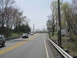
Smithburg is an unincorporated community located where the municipal boundaries of Freehold, Manalapan and Millstone townships intersect in Monmouth County, New Jersey, United States.[2][3] County Route 527 and Monmouth Road (County Routes 537/524) pass through the center of the quaint village of Smithburg.
Smithburg, New Jersey | |
|---|---|
 | |
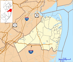 Smithburg, New Jersey Location of Smithburg in Monmouth County Inset: Location of county within the state of New Jersey 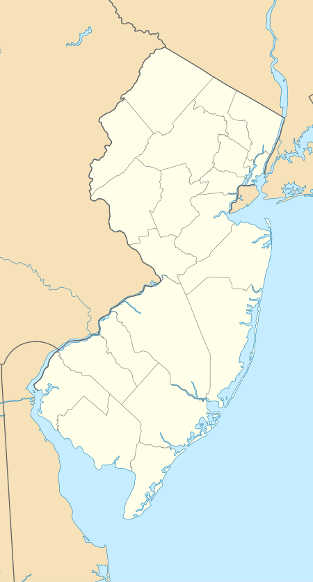 Smithburg, New Jersey Smithburg, New Jersey (New Jersey)  Smithburg, New Jersey Smithburg, New Jersey (the United States) | |
| Coordinates: 40°12′32″N 74°21′11″W | |
| Country | |
| State | |
| County | Monmouth |
| Township | Freehold, Manalapan and Millstone |
| Elevation | 171 ft (52 m) |
| Time zone | UTC-5 (Eastern (EST)) |
| • Summer (DST) | UTC-4 (EDT) |
| Area code(s) | 732/848 |
| GNIS feature ID | 880663[1] |
History
In 1684, the 2nd Deputy Governor of East Jersey Gawen Lawrie instituted "The Burlington Path", a stagecoach route meant to connect Burlington, the Capital of West Jersey, and Perth Amboy, the Capital of East Jersey.[4] Much of modern day Monmouth Road (County Route 537) coincides in general direction and trajectory with this historic stagecoach route. By the mid 18th century, one of the stagecoach stops listed on the route was the Smithburg Tavern, suggesting that the community had already been rather established by this point.
The Smithburg Tavern was the birthplace of New Jersey politician Joel Parker, a prominent "War Democrat", whom would later in life serve two nonconsecutive terms as the 20th Governor of New Jersey; one term from 1863-1866, and another term from 1872-1875. Parker died on January 2, 1888, in Philadelphia[5] and was buried in nearby Maplewood Cemetery, within the center of Freehold Township, New Jersey. His burial place also happens to be located right along the historic "Burlington Path" on what is now West Main Street (County Route 537), adjacent to the Freehold Raceway Mall.
The historically preserved Monmouth Battlefield and, along with, the historic villages of Clarksburg[6] and West Freehold[7] are a short distance away.
References
- "Smithburg". Geographic Names Information System. United States Geological Survey.
- Locality Search, State of New Jersey. Accessed March 4, 2015.
- Google (March 4, 2015). "Smithburg, Freehold Township, New Jersey" (Map). Google Maps. Google. Retrieved March 4, 2015.
- , Freehold Township Heritage Society: 'History of the Burlington Path'. Accessed June 9, 2020.
- "Joel Parker Dead. Stricken With Paralysis While Visiting Friends". The New York Times. January 2, 1888. Retrieved March 10, 2010.
Ex-Gov. Joel Parker of New-Jersey, while visiting friends at 1019 Mount Vernon-street, this city, yesterday, was stricken with paralysis and died at 1 o'clock this morning.
- National Register of Historic Places. Accessed July 23, 2008.
- Freehold Township Heritage Society: 'History of the Village of West Freehold'. Accessed June 9, 2020.
