Wellington, British Columbia
Wellington is the name of a north Nanaimo, British Columbia neighbourhood, which was once the town of Wellington. The community was named for Arthur Wellesley, 1st Duke of Wellington.[1]
Wellington | |
|---|---|
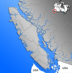 Location of Wellington within the Nanaimo District on Vancouver Island | |
| Coordinates: 49°12′28″N 124°00′55″W | |
| Country | |
| Province | |
| Region | Vancouver Island |
| Regional district | Nanaimo Regional District |
| Elevation | 115 m (377 ft) |
| Population (2006) | |
| • Total | 3,935 (Diver Lake) |
| • Density | 988.1/km2 (2,559/sq mi) |
| Time zone | UTC-8 (PST) |
| Website | http://www.wellingtonbc.ca |
Since amalgamation with Nanaimo, Wellington District is often referred to as "North Nanaimo" with the former townsites collectively keeping the neighbourhood name of "Wellington".
History
Wellington is located in a shared portion of the traditional territories of the Sneneymuxw and Nanoose First Nations. Both nations are Coast Salish and use the Halkomelem language. WIth their heavy seaworthy canoes, both groups were highly mobile traders and many would have used Chinook Jargon as a trading language.
Early photographs of Europeans standing for photo-ops in the distinctive Salish canoes on Long Lake show that the local First Nations peoples and the Europeans coexisted in the Wellington area.
Prior to 1869, a small number of settlers had established farms around Diver Lake, Long Lake, and Brannen Lake. The neighbourhood had a saloon and was connected to Nanaimo by a trail. With extensive marshes and lakes, the area was frequented by Nanaimo residents for fishing and hunting.
In 1869, Robert Dunsmuir discovered a thin surface seam coal in the roots of a fallen tree while visiting Diver Lake. Dunsmuir was a coal miner with a keen interest in operating his own mine and immediately investigated the coal seam. By 1871, Dunsmuir had discovered the Wellington coal seam which ran beneath his initial discovery. Once Dunsmuir determined the coal was of good quality and of significant quantity, he established a company so that he could get a land grant for the area. This first grant covered most of what is today known as the Wellington Land District. Initially the town grew up along the crest of land which is now Jingle Pot Road.
By 1871, Dunsmuir had the new mine producing coal, and a company village had sprung up to provide labour for the Wellington Colliery. Wellington grew fast, and by 1874 the school in Wellington had 90 pupils. The Wellington Mines were successful and were soon outproducing the more established Vancouver Coal Company of Nanaimo. By the 1890s the town, with 5,000 residents, was the second largest city on Vancouver Island (after Victoria, the capital).
To move the coal, a railway was built between the Wellington mines and the company docks at Departure Bay. Money from the Wellington coal and the railway experience from the Wellington Colliery railway enabled Robert Dunsmuir to become the successful bidder for the contract to build the railway on Vancouver Island, a railway which was promised as part of British Columbia's terms for joining confederation. Ten months after the E & N Railway was completed, Wellington became the northern terminus. On completion of the railway, Wellington's town centre moved to the ridge running parallel to the railway and overlooking Long Lake. This road is on the west side of the railway tracks and is still called Wellington Road.
In 1896, James Dunsmuir, Robert Dunsmuir's son, agreed to relinquish company control of some of the company's lands, and an official Wellington townsite was surveyed and established between the east side of the railway and Long Lake. The streets of the town were named after important figures or places in the Duke of Wellington's career. The first street, parallel to the present E&N tracks, is Corunna Avenue named after the Spanish town where Wellington's troops escaped back to England and where they later disembarked to begin the campaign against Napoleon. The next street to the north is Victoria Avenue named after Queen Victoria, and the next is Wellesley Avenue, as the Duke of Wellington's surname was Wellesley, Fourth from the tracks is Apsley Avenue, named after the Duke's home in London. At the time of amalgamation with the city of Nanaimo, an original blueprint map was in the possession of the then Wellington secretary and was given to the city. The map also showed two more planned avenues: Waterloo Avenue, in honour of the battle where Wellington defeated Napoleon, and Napoleon Avenue.
The Dunsmuirs were industrialists and they mined the coal seam as fast as they could, controlling every aspect of their business as much as possible, including the sale of the coal through a San Francisco office. By 1898, due either to family feuds, economics, or easier prospects including those newly discovered in Extension, the Wellington Mines were scheduled to be closed. As a mining town the closure of the mine was devastating. To add to the town's misery, James Dunsmuir ordered the company buildings to be dismantled and moved to Ladysmith by cart or rail. To keep from abandoning the town which had made them rich and powerful, the Dunsmuir's had the E and N Railway move its works yard from Victoria to Wellington. The following year, in 1899, many of the town's key building burned in a great fire. The opera house and many other buildings were destroyed.
After the fire, the town continued on as a rural town until WWII, at which time Nanaimo started to grow so that Wellington became a bedroom community for many Nanaimo residents.
In the 1960s, the Wellington Improvement District amalgamated with the City of Nanaimo. Since amalgamation with Nanaimo, Wellington District is often referred to as "North Nanaimo" with only the former town site areas keeping the neighbourhood name of "Wellington".
In July 1968, almost 100 years after coal was discovered in the area, the last Wellington neighbourhood mine ceased operations with the closure of the Carruthers slopes of the Wellington #9 Mine. From 1949 until July 28 1968, Bob Carruthers, the last surviving active coal miner on Vancouver Island, worked the tailings off Jingle Pot Road and what is now Landmark Crescent. Carruthers used two Shetland ponies to bring up the coal cars to the surface until both died. In 1968, Carruthers closed the mine and retired. Another mine, the Loudon #6 mine also known as the Loudon-Wakelem Slopes, had closed when Willam Wakelem retired in 1964.
Modern day
Today's Wellington neighbourhood is often referred to as Diver Lake, Long Lake, Wellington, Rutherford, or North Nanaimo. Its lakes provide fishing and recreation, while its heritage as an old town has resulted in a very diverse neighbourhood which includes residential, commercial, and industrial land. It is flanked by Nanaimo North Town Centre (formerly Rutherford Mall), Long Lake, and Country Club Mall to the north, Beban Community Center Complex to the south-east, farms to the west, and the Mostar/Boban industrial area to the northwest.
There are two schools in the area, Mount Benson Elementary, which is now closed, and Wellington Secondary.
Demographics
| Canada 2006 Census[2] | |||
|---|---|---|---|
| Wellington | Nanaimo | British Columbia | |
| Median age | 37.1 years | 43.3 years | 40.8 years |
| Under 15 years old | 21.1% | 16% | 17% |
| Over 65 years old | 13% | 17% | 15% |
The Wellington neighbourhood population and demographics can be approximated by using the figures for the Diver Lake Census Tract which covers the largest portion of the Wellington neighbourhood. The actual population of the Wellington neighbourhood would be slightly higher if the portions of the neighbourhood not included in the Census Tract were included. Population growth from the 2001 to 2006 was 8.1% vs 7.8% and 5.3% for the City of Nanaimo and Province of British Columbia.
References
- "Wellington". BC Geographical Names.
- Statistics Canada (July 25, 2006). "Wellington-Diver Lake Census Tract". 2006 Census. Canada. Retrieved 2009-03-16.