Ula, Muğla
Ula is a district as well as the center town of the same district in Muğla Province in the Aegean region of Turkey in south-west Anatolia. Its name reflects the ancient town of Ula in ancient Caria, whose site is conjectured to be nearby.[3]
Ula | |
|---|---|
 Ula | |
| Coordinates: 37°06′13″N 28°24′53″E | |
| Country | Turkey |
| Province | Muğla |
| Government | |
| • Mayor | Ümit Karaaslan (DP) |
| • Kaymakam | Ali Yılmaz |
| Area | |
| • District | 424.53 km2 (163.91 sq mi) |
| Population (2012)[2] | |
| • Urban | 5,682 |
| • District | 23,410 |
| • District density | 55/km2 (140/sq mi) |
| Post code | 48640 |
| Website | www.ula.bel.tr |
The town of Ula is situated at a distance of only 14 km (9 mi) from the province seat of Muğla, a mile after a bifurcation on the road to Marmaris. It is notable for its old houses in the Turkish style and the vast forest region that extends to the south along the country road called Çiçekli after the town. The history of the inhabitants and the town, situated in ancient Caria, can be traced at least as far back as the dynasty of Menteşe.
The townships of Akyaka and Gökova, situated at a close distance to each other at the tip of the Gulf of Gökova, both of which are rising centers of international tourism and which possess their own municipalities depend Ula administratively. Aside from Akyaka and Gökova, Ula is the administrative seat having in its charge a total of twenty-three villages.
See also
References
- "Area of regions (including lakes), km²". Regional Statistics Database. Turkish Statistical Institute. 2002. Retrieved 2013-03-05.
- "Population of province/district centers and towns/villages by districts - 2012". Address Based Population Registration System (ABPRS) Database. Turkish Statistical Institute. Retrieved 2013-02-27.
- Lund University. Digital Atlas of the Roman Empire.
- Municipality of Ula District - General information on Ula, Muğla (in Turkish)
- Peter Benedict (1974). Ula : An Anatolian Town. Brill Publishers. ISBN 90-04-03882-5.
External links
| Wikimedia Commons has media related to Ula (Turkey) District. |
Ula, Muğla in Muğla Province of Turkey | |||||||||||||||||||||||||||
|---|---|---|---|---|---|---|---|---|---|---|---|---|---|---|---|---|---|---|---|---|---|---|---|---|---|---|---|
| Districts | 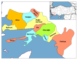 Districts of Muğla | ||||||||||||||||||||||||||
| |||||||||||||||||||||||||||
Metropolitan municipalities are bolded. | |||||||||||||||||||||||||||