Sri Muktsar Sahib district
Sri Muktsar Sahib district, colloquially known by the city's former name Muktsar; is one of the twenty-two districts in the Indian state of Punjab. Its capital, the city of Sri Muktsar Sahib, was renamed from Muktsar to Sri Muktsar Sahib, with the district subsequently the following suit.[1] The district itself was historically referred as Khidraane Di Dhaab. Several other prominent towns in the district include but are not limited to Malout, the largest town in Sri Muktsar Sahib by population; and Giddarbaha.
Sri Muktsar Sahib district | |
|---|---|
District | |
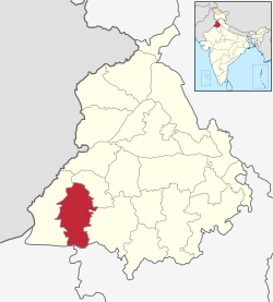 Location in Punjab, India | |
| Country | |
| State | Punjab |
| District | Sri Muktsar Sahib |
| Region of Punjab | Malwa |
| Headquarters | Sri Muktsar Sahib |
| Talukas | Sri Muktsar Sahib |
| Area | |
| • Total | 2,615 km2 (1,010 sq mi) |
| Elevation | 184 m (604 ft) |
| Population (2011) | |
| • Total | 901,896 |
| • Density | 348/km2 (900/sq mi) |
| Languages | |
| • Official | Punjabi (Gurmukhi) |
| • Regional | Punjabi |
| • Other | English, Hindi |
| Time zone | UTC+5:30 (IST) |
| PIN | 152026 |
| Telephone code | 01633 |
| Sex ratio | 1000/891 ♂/♀ |
| Literacy | 69% |
| Website | muktsar |
History
The Shri Muktsar Sahib district was created as a new district on 7 November 1995 by the separation of the Muktsar subdivision from the Faridkot district.[2]
The last battlefield of the tenth Sikh Guru, Shri Guru Gobind Singh, lies in the district's main city. The Battle of Muktsar, a major battle between the Mughals and the Sikhs, occurred in present-day Sri Muktsar Sahib during the year of 1705. The Gurudwara Tibbi Sahib was built to mark the battlefield.
The district has many historical Gurudwaras including the Darbar Sahib, the Shaheedi Gurudwara, and the Tibbi Sahib in the Shri Muktsar Sahib city proper, and several others in the district's respective villages.
The Mela Maghi fair is celebrated annually in January at the Sri Muktsar Sahib city proper in remembrance of the forty martyrs (librated ones).
Demographics
| Historical population | ||
|---|---|---|
| Year | Pop. | ±% p.a. |
| 1951 | 266,498 | — |
| 1961 | 382,776 | +3.69% |
| 1971 | 430,991 | +1.19% |
| 1981 | 547,394 | +2.42% |
| 1991 | 654,434 | +1.80% |
| 2001 | 777,493 | +1.74% |
| 2011 | 901,896 | +1.50% |
| source:[3] | ||
According to the 2011 census Sri Muktsar Sahib district has a total population of 901,896,[5] roughly equal to the nation of Fiji[6] or the US state of Delaware.[7] This gives it a ranking of 464th in India (out of a total of 640).[5] The district has a population density of 348 inhabitants per square kilometre (900/sq mi). Its population growth rate over the decade 2001-2011 was 16.1%. It has a sex ratio of 895 females for every 1000 males and a literacy rate of 66.8%.[5]
The principal Jatt Sikh clans are Sidhu, Brar, Sandhu, Sekhon, Buttar, Gill, Maan, Bhullar, Aulakh, Virk, Dhaliwal, Dhillon.
See also
References
- Prabhjot Singh (31 January 2010). "Muktsar is now Sri Muktsar Sahib". The Tribune, Chandigarh. Retrieved 23 January 2012.
- http://www.censusindia.gov.in/2011census/dchb/0310_PART_B_DCHB_MUKTSAR.pdf
- Decadal Variation In Population Since 1901
- http://www.census2011.co.in/census/district/597-muktsar.html
- "District Census 2011". www.census2011.co.in. 2011. Retrieved 22 January 2012.
- US Directorate of Intelligence. "Country Comparison:Population". Retrieved 1 October 2011.
Fiji 883,125 July 2011 est.
- "2010 Resident Population Data". U.S. Census Bureau. Archived from the original on 19 October 2013. Retrieved 30 September 2011.
Delaware 897,934
External links
| Wikimedia Commons has media related to Sri Muktsar Sahib district. |
Places adjacent to Sri Muktsar Sahib district | ||||||||||
|---|---|---|---|---|---|---|---|---|---|---|
| ||||||||||
