Firozpur district
Firozpur district, also known as Firojpur district, is one of the twenty-two districts in the state of Punjab, India. Firozpur district comprises an area of 2,190 km2 (850 sq mi).
Firozpur district Firojpur district | |
|---|---|
District | |
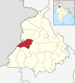 Location in Punjab, India | |
| Coordinates: 30°56′24″N 74°37′12″E | |
| Country | |
| State | Punjab |
| Founded by | Firoz Shah Tughlag |
| Named for | Firoz Shah Tughlaq |
| Headquarters | Firozpur |
| Area | |
| • Total | 2,190 km2 (850 sq mi) |
| Area rank | 230th |
| Population (2011)[‡] | |
| • Total | 2,029,074 |
| • Density | 930/km2 (2,400/sq mi) |
| Languages | |
| • Official | Punjabi |
| Time zone | UTC+5:30 (IST) |
| Literacy | 69.80% |
| No. of villages | 639 |
| Lok Sabha constituency | 1 |
| Vidhan Sabha constituency | 4 |
| Website | www |
Firozpur (Firojpur) is the capital city of the district. It is situated inside ten gates—Amritsari Gate, Wansi Gate, Makhu Gate, Zira Gate, Bagdadi Gate, Mori Gate, Delhi Gate, Magjani Gate, Multani Gate, and Kasuri Gate.
Demographics
According to the 2011 census the undivided Firozpur district had a population of 2,029,074.[1] This gives it a ranking of 230th in India (out of a total of 640). The district has a population density of 380 inhabitants per square kilometre (980/sq mi). Its population growth rate over the decade 2001–2011 was 16.08%. Firozpur has a sex ratio of 893 females for every 1000 males, and a literacy rate of 69.8%. (This data is before the creation of Fazilka district).
Administration
The district is administratively into the following tehsils:[1]
- Firozpur
- Zira
- Guru Har Sahai
List of Sub-Tehsils of Firozpur
- Makhu
- Talwandi Bhai
- Mamdot
Blocks of district Firozpur
- Firozpur
- Ghall Khurd
- Guru Har Sahai
- Makhu
- Mamdot
- Zira
Vidhan Sabha Seats in Firozpur
- Firozpur
- Firozpur Rural
- Guru Har Sahai
- Zira
References
External links
- "District Ferozepur". Retrieved 18 October 2007.
Places adjacent to Firozpur district | ||||||||||
|---|---|---|---|---|---|---|---|---|---|---|
| ||||||||||
