Senador Amaral
Senador Amaral is the second highest city in Brazil (1,505 m (4,938 ft)),[1] reaching near 1,620 m (5,310 ft) in some parts in the northern areas, nearly the Ponte Segura district, the highest point is an unnamed mount in Bom Repouso border at approximately 1660m above sea level. It is located in the Mantiqueira Mountains, south of Minas Gerais state. It is a small city, with a population of 5071 inhabitants and approximately 2980 people living in the urban area. Has not asphalt and mobile phone signal in the municipality before 2007. Only Cambuí access, MG-295 is asphalted.
Senador Amaral | |
|---|---|
Municipality and town | |
 Flag  Seal | |
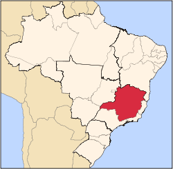
 Senador Amaral Location in Brazil | |
| Coordinates: 22°35′S 46°11′W | |
| Country | |
| Region | Southeast |
| State | Minas Gerais |
| Mesoregion | Sul/Sudoeste de Minas |
| Time zone | UTC -3 |
Climate
Senador Amaral has status of Estância Climática because your cold climate, has an average annual temperature of 18.2 °C (64.8 °F), and in winter's nights temperatures of around 0 to 6 °C (32 to 43 °F) and with a record low of −5 °C (23 °F).
Distances
Some distances from surrounding and major cities:
- 18.2 km (11.3 mi) from Cambuí (and the federal highway BR-381)
- 38.4 km (23.9 mi) from Camanducaia
- 63.8 km (39.6 mi) from Extrema
- 95.2 km (59.2 mi) from Bragança Paulista
- 25 km (16 mi) from Munhoz
- 19 km (12 mi) from Bom Repouso
- 67.6 km (42.0 mi) from Pouso Alegre
- 105 km (65 mi) from Campos do Jordão
- 168 km (104 mi) from Campinas
- 170 km (110 mi) from Poços de Caldas
- 167 km (104 mi) from Três Corações
- 249 km (155 mi) from Resende
- 409 km (254 mi) from Rio de Janeiro
- 458 km (285 mi) from Belo Horizonte
- 171 km (106 mi) from São Paulo.
See also
Footnotes
- The highest is Campos do Jordão at 1,628 m (5,341 ft)
External links
- senadoramaral.mg.gov.br (in Portuguese)
- bussolanet.com.br (in Portuguese)
Capital: Belo Horizonte | |||||||||||||||||||||||||
|  | ||||||||||||||||||||||||
|
| |||||||||||||||||||||||||
| |||||||||||||||||||||||||
| |||||||||||||||||||||||||
| |||||||||||||||||||||||||
| |||||||||||||||||||||||||
| |||||||||||||||||||||||||
| |||||||||||||||||||||||||
| |||||||||||||||||||||||||
| |||||||||||||||||||||||||
| |||||||||||||||||||||||||