Santa Vitória, Minas Gerais
Santa Vitória is a municipality in the west of the Brazilian state of Minas Gerais. As of 2010, the population was 18,157. It became a municipality in 1948.
União de Minas | |
|---|---|
 Coat of arms | |
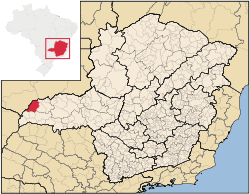 Location of the municipality in Minas Gerais | |
| Coordinates: 18°50′20″S 50°7′15″W | |
| Country | Brazil |
| State | Minas Gerais |
| Mesoregion | Triângulo Mineiro e Alto Paranaíba |
| Microregion | Ituiutaba |
| Founded | 31 May 1948 |
| Government | |
| • Prefect | Antonio Celso Andrade Domingues |
| Area | |
| • Total | 3,021 km2 (1,166 sq mi) |
| Elevation | 498 m (1,634 ft) |
| Population (2010) | |
| • Total | 18,157 |
| • Density | 6.0/km2 (16/sq mi) |
| Time zone | UTC−3 (BRST) |
| • Summer (DST) | UTC−2 (BRDT) |
Santa Vitória is located at an elevation of 498 meters just south of the great reservoir Barragem de São Simão in the Triângulo Mineiro. It belongs to the statistical microregion of Ituiutaba. Neighboring municipalities are São Simão, União de Minas, Limeira do Oeste, Campina Verde and Gurinhatã.
History
Settlement began in the beginning of the nineteenth century with the cattle ranch called São Jerônimo. The region was occupied by the Caiapó Indians who were dominated and expelled. The region was covered by forests and malaria was endemic. The first church appeared in 1904, followed by the cemetery in 1905. Santa Vitória belonged to the municipality of Ituiutaba, becoming a separate municipality in 1948.[1]
Economy
The most important economic activities are cattle raising, commerce and agriculture. The GDP in 2005 was R$56,025,000. Santa Vitória is in the top tier of municipalities in the state with regard to economic and social development. It is in a region of good soils, adequate rainfall, and abundance of surface water. As of 2007 there was 01 banking agency in the town. There was a small retail commerce serving the surrounding area of cattle and agricultural lands. In the rural area there were 963 establishments occupying about 1,500 persons. 311 of the farms had tractors. There were 1,720 automobiles in all of the municipality. There were 211,000 head of cattle in 2006. The crops with a planted area of more than 100 hectares were rice, sugarcane, soybeans (2,800 ha.) and corn. [2]
Cattle production is important with a large herd. Cattle are raised for meat and milk. 18 producers specialize in milk production. In 2006 there were 23,000 dairy cattle. There is also a substantial swine industry.[3]
Health and education
In the health sector there were 9 clinics and one hospital with 37 beds. In the educational sector there were 12 primary schools and 2 middle schools.[2]
- Municipal Human Development Index: 0.759 (2000)
- State ranking: 214 out of 853 municipalities as of 2000
- National ranking: 1,604 out of 5,138 municipalities as of 2000