Boa Esperança, Minas Gerais
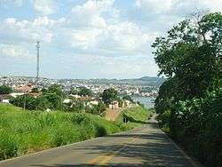
Boa Esperança is a Brazilian municipality from the state of Minas Gerais. The municipality is located by the Serra da Boa Esperança, which became celebrated through song that brings its name, compounded by Lamartine Babo and performed by several singers. Across its territory passes Rio Grande, important to the development of the region. The economy of Boa Esperança is based on coffee plantations and tourism.
Good Hope Boa Esperança | |
|---|---|
 | |
 Flag  Coat of arms | |
| Nickname(s): Furnas City | |
| Motto(s): Uma cidade de todos (A City for All) | |
 Location of Boa Esperança within the State of Minas Gerais | |
 Good Hope Location of Boa Esperança within Brazil | |
| Coordinates: 21°05′24″S 45°33′57″W | |
| Country | Brazil |
| State | Minas Gerais |
| Mesoregion | South and southeast of Minas |
| Microregion | Varginha |
| Government | |
| • Mayor | Antonio Carlos Vilela (2013–2016) (PT) |
| Area | |
| • Total | 860.669 km2 (332.306 sq mi) |
| Elevation | 775 m (2,543 ft) |
| Population (2010[2]) | |
| • Total | 38,509 |
| • Density | 45/km2 (120/sq mi) |
| Demonyms | Esperansense, Dorense |
| Time zone | UTC-3 (BRT) |
| • Summer (DST) | UTC-2 (BRST) |
| Website | boaesperanca.mg.gov.br |
History
The municipality of Boa Esperança (English: Good Hope) came up with gold rush of the late 19th century. The first settlement was established in 1778, and in 1804 it was called 'Dores do Pântano (English: Pain Swamp). In 1814 started the construction of the Church, and at that time arose the first coffee plantations, which marked a phase of wealth and progress for the parish. In 1866 the parish was elevated by provincial law to the status of village. On 15 November 1868 the seat of local government was built and the village was elevated by Provincial Law No. 1611 to the status of municipality. In 1957–1958, with the construction of the Furnas Dam and subsequently of the Furnas Lake, the town began to grow throughout tourism.
Geography, climate, and environment
Boa Esperança is located in the southern-tropical part of Brazil, at 21 degrees, 5 minutes, 24 second south, and 45 degrees, 33 minutes, 57 seconds west, at an altitude of 775 metres (2,543 ft), in the internal part of the State of Minas Gerais. It covers an area of 860.669 square kilometres (332.306 sq mi).[1]
- Climate
Situated on the southern outskirts of the tropical zone and, under the influence of the high elevation of the region, the climate type is tropical mesothermal with an average annual rainfall of about 1,500 millimetres (59 in). The annual temperature is 19 °C (66 °F). Summer and spring are the hottest seasons with a maximum daily temperature ranging from 25 to 29 °C (77 to 84 °F). November, December, and January are the warmest months reaching 36–37 °C (97–99 °F) and with a minimum temperature of 9–10 °C (48–50 °F).
- Rivers
Grande River, Paraná River, and some of their tributaries receive water by the Furnas Dam, which surrounds the city.
- Fauna
Boa Esperança is home to several species of birds such as darter, heron, Roadside Hawk, moorhen, lapwing, Jabir, kingfisher, and grassquit.
Among the mammals in the area there are capybara, brocket deer, monkey, fox, otter, paca, agouti, megabat, skunk, and others. Some of these species may have migrated from other areas.
- Flora
In this area there are forests and araucarias rich in vegetation, including mimosa, cedrus, cinnamomum, sassafras, manilkara bidentata, morus, Hymenaea courbaril, copaiba, Swietenia macrophylla, and Balfourodendron riedelianum. In riparian forests there are croton, inga, and pine. Scattered trees, shrubs and sub-shrubs present Annona crassiflora, Stryphnodendron adstringens, Stenocalyx dysentericus, Tabebuia ochracea, Kielmeyera coriacea.
Demography
Its population in 2010 was 38,509 inhabitants.[2]
Government and politics
- Mayor: Antonio Carlos Vilela (Workers' Party) (2013–2016)
Economy
Boa Esperança is asn agro-pastoral Municipality. It produces grain, rice, garlic, potato, bean, maize, sugarcane, cassava, soybean, tomato, several species of fruit, and coffee. Coffee is the main product and it has a good level of production. It is consumed domestically and exported to other countries. Livestock, domestic pig, and poultry are some of the oldest economic activities in the area. Trade, the "royalties" paid by Furnas Central Electric, and tourism are among the main activities of the tertiary sector.
Transport
- BR-369 highway
- MG-167
Education
Health
Culture
Sports
Twin cities
References
- IBGE (10 October 2002). "Área Territorial Brasileira – Consulta por Município – Resultados" [Brazilian Territorial Area - Browse by Municipality - Results] (in Portuguese).
- "Censo Populacional 2010" [Population Census 2010]. Censo Populacional 2010 (in Portuguese). IBGE. 29 November 2010. Archived from the original on 2011-05-16.
External links
- Official website (in Portuguese)
- BoaEsperança.com.br (in Portuguese)
- Câmara Municipal de Boa Esperança [Municipality of Boa Esperança] (in Portuguese)
- Censo 2010 at IBGE
- Hino do município de Boa Esperança [Anthem of Boa Esperança Municipality] (in Portuguese) at Wikisource