Bicas
Bicas is a Brazilian municipality in the state of Minas Gerais. As of 2004 its population is estimated to be 13.590 inhabitants.
Bicas | |
|---|---|
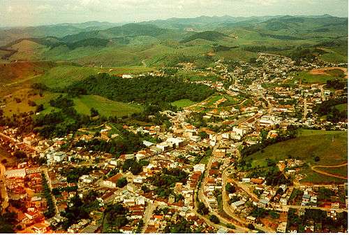 View of Bicas | |
 Flag  Seal | |
 Location in Brazil | |
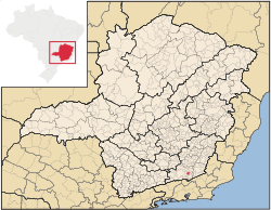
 Bicas Location in Brazil | |
| Coordinates: 21°43′30″S 43°03′32″W | |
| Country | |
| Region | Southeast |
| State | Minas Gerais |
| Mesoregion | Zona da Mata |
| Microregion | Juiz de Fora |
| Founded | September 7th, 1923 |
| Government | |
| • Mayor | Geraldo Magela Longo dos Santos |
| Area | |
| • Total | 139,538 km2 (53,876 sq mi) |
| Elevation | 600.0 m (1,968.5 ft) |
| Population (2010)[2] | |
| • Total | 13,653 |
| Time zone | UTC-3 (BRT) |
| • Summer (DST) | UTC-2 (BRST) |
| HDI (2000) | 0.799 |
| Website | Bicas, Minas Gerais |
History
Initially a breakpoint for salesmen in the 18th century, Bicas obtained its independence from the city of Guarará in 1923. It was an attraction point for Italian immigrants and also other nationalities.
Until the 1970s, Bicas had a full-working train station and an active RFFSA (the extinct state railroad company) branch for repairing wagons. All this structure was dismantled and today the train station exists only as a historic site. Currently, Bicas has an economy based on commerce, agriculture and farming.
Annual Farming Expositions, with bull-riding and rodeos, cattle commerce and local products - typically in the last week of July of every year - are a tradition of several cities in Zona da Mata, and the Farming Exposition of Bicas is one of the most famous, attracting thousands of tourists from several parts of the country.

Notable people
- Danilo Football player
Joselio Vieira (Oxford PhD in Physical Chemist) born September 1967. Inventor of first 100% cocoa fruit chocolate
Aerial photos
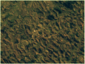 Satellite photo, 1993-06-24, real colour.
 Satellite photo, 1993-06-24, real colour, sharpened to show smaller roads and details.
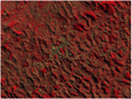 Satellite photo, 1993-06-24, highlighting dense wood covering (bright red), grass (brown) and buildings (green)
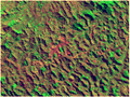 Satellite photo, 1993-06-24, strongly contrasting dense wood covering (green), grass (brown), buildings (purple) and naked land areas (orange)
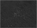 Satellite photo, 1993-06-24, showing buildings and roads (light grey)
References
- "Área territorial oficial" [Official Territorial Area] (in Portuguese). Brazilian Institute of Geography and Statistics (IBGE). 2002-10-10. Retrieved 2010-12-05.
- "Censo Populacional 2010" [Population Census 2010] (in Portuguese). Brazilian Institute of Geography and Statistics (IBGE). 2010-11-29. Archived from the original on May 16, 2011. Retrieved 2010-12-11.
| Wikimedia Commons has media related to Bicas. |