Sawran Subdistrict, Aleppo Governorate
Sawran Subdistrict (Arabic: ناحية صوران, romanized: nāḥiyah Sawran) is a subdistrict of Azaz District in northwestern Aleppo Governorate of northern Syria, on the border with Turkey. The administrative centre is the town of Sawran. Neighbouring subdistricts are Azaz Subdistrict to the west, Akhtarin to the east and Mare' to the south. To the north is the Kilis Province of Turkey.
Sawran Subdistrict ناحية صوران | |
|---|---|
 Location of Sawran Subdistrict within Aleppo Governorate | |
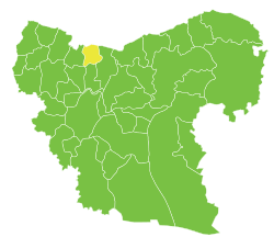
 Sawran Subdistrict Location in Syria | |
| Coordinates (Sawran): 36.6036°N 37.2131°E | |
| Country | |
| Governorate | Aleppo |
| District | Azaz District |
| Seat | Sawran |
| Area | |
| • Total | 167.32 km2 (64.60 sq mi) |
| Population (2004)[1] | 30,032 |
| Geocode | SY020405 |
At the 2004 census, the subdistrict had a population of 30,032.[1]
Cities, towns and villages
| PCode | Name | Population |
|---|---|---|
| C1664 | Sawran | 6,988 |
| C1667 | Ihtaimlat | 6,764 |
| N/A | al-Yamamah | 3,547 |
| C1672 | Kafra | 2,859 |
| C1659 | Duwaybiq | 1,862 |
| C1665 | Rael | 1,750 |
| C1668 | Odaya | 1,564 |
| C1663 | Baraghida | 995 |
| C1658 | Zayzafun | 820 |
| C1660 | Shweirin | 695 |
| C1669 | al-Bil | 563 |
| C1657 | al-Yaarubiyah | 552 |
| C1661 | Hawar Kilis | 438 |
| C1666 | az-Zahiriyah | 194 |
| C1670 | Murayghil | 157 |
| C1671 | Kafr Barja | 126 |
| C1673 | Kafr Shoush | 95 |
| C1662 | al-Judaydah | 63 |
References
- "2004 Census Data for Nahiya Sawran" (in Arabic). Syrian Central Bureau of Statistics. Retrieved 15 October 2015. Also available in English: UN OCHA. "2004 Census Data". Humanitarian Data Exchange. Archived from the original on 8 December 2015. Retrieved 4 December 2015.
Capital: Aleppo | ||||||||||||||||||||
|  | |||||||||||||||||||
|
| ||||||||||||||||||||
| ||||||||||||||||||||
| ||||||||||||||||||||
| ||||||||||||||||||||
| ||||||||||||||||||||
| ||||||||||||||||||||
| ||||||||||||||||||||
This article is issued from Wikipedia. The text is licensed under Creative Commons - Attribution - Sharealike. Additional terms may apply for the media files.