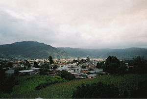
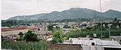
San Marcos, Guatemala
San Marcos (elevation: 7,868 feet (2,398 meters) is a city and municipality in Guatemala. It is the capital of the department of San Marcos. The municipality has a population of 47,063 (2018 census).

San Marcos | |
|---|---|
Municipality | |
 | |
 Flag | |
| Nickname(s): Marquesa de La Ensenada | |
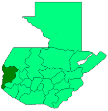
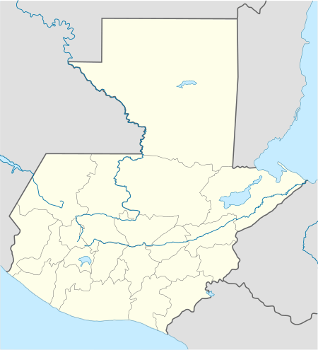 San Marcos Location in Guatemala | |
| Coordinates: 14°57′55″N 91°47′45″W | |
| Country | |
| Department | |
| Area | |
| • Municipality | 46 sq mi (119 km2) |
| Elevation | 7,867 ft (2,398 m) |
| Population (2018 census)[1] | |
| • Municipality | 47,063 |
| • Density | 1,000/sq mi (400/km2) |
| • Urban | 47,063 |
| Climate | Cwb |
History
1897 Quetzaltenango Revolt
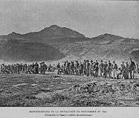
In September 1897, after the failure of both the interoceanic railroad and the Central American Expo and the deep economic crisis that Guatemala was facing after the plummeting of both coffee and silver international prices, the people of Quetzaltenango raised in arms against the decision of president José María Reina Barrios to extend his presidential term until 1902.[lower-alpha 1] A group of rebels, among them a former Secretary of Reina Barrios's cabinet -Próspero Morales-, began to combat on 7 September 1897 attacking San Marcos; after several battles and some gains in Ocos, Coatepeque and Colomba the rebels were definitely defeated on 4 October 1897. As a result, on 23 October 1897, San Pedro Sacatepéquez became the capital of San Marcos Department.[3]
20th century
In 1903 the eruption of the Santa María volcano in the neighboring department of Quetzaltenango was responsible for the destruction of the twin towns of San Marcos and San Pedro Sacatepéquez.[5] The towns were rebuilt and on 16 December 1935, during the presidency of general Jorge Ubico, it was annexed to San Pedro Sacatepéquez forming the municipality of La Unión San Marcos. However, this system did not work and La Unión San Marcos was broken apart on 20 July 1945, but San Pedro Sacatepéquez lost the capital of San Marcos Department to the municipality of San Marcos.[6]
21st century
Towards the end of the 20th century San Marcos became a hot spot for drug trafficking in Central America, and one of the top lords was Juan Chamalé Ortiz, who was heavily involved in cocaine trafficking, and was accused by US authorities of helping to move over 40 tons of cocaine through Central America en route to the United States. Ortiz worked with local fishermen to smuggle cocaine in small fishing boats and may have also commissioned semi-submersibles to transport the drug. Ortiz also controlled a major opium poppy producing area, the San Marcos Department, where he was a popular local figure. He owned at least ten estates in his area of operations, centered in San Marcos city, and provided numerous jobs, in addition to cultivating local support by throwing parties and sponsoring beauty contests.[7]
San Marcos is one of the most important regions in Guatemala given its proximity to the highlands, Mexico and to the Pacific Ocean coast, where most of the drugs coming from South America land. Ortiz exerted influence over local politicians and police in the region, and relied on a powerful local support network to conduct his business. He is thought to have worked out a deal that made him the Sinaloa Cartel's top transporter, helping the Mexican group move drugs that arrived via Pacific routes. Ortiz Chamalé was captured in 2011 in Quetzaltenango and extradited to the United States in 2014 where he was sentenced to 262 months in jail; when Ortiz was arrested in 2011, locals protested to demand his release.[7]
Sports
The city is home of the football club Deportivo Marquense who play in Guatemala's Premier League in the Estadio Marquesa de la Ensenada.[8]
Gallery
 1940s
1940s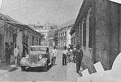 1940s
1940s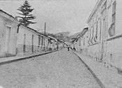 1940s
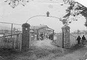
1940s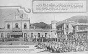 President general Jorge Ubico visit in 1940.
.jpg) Mayan Palace
Mayan Palace
Climate
San Marcos has subtropical highland climate, according to the Köppen climate classification (climate type Cwb).
| Climate data for San Marcos | |||||||||||||
|---|---|---|---|---|---|---|---|---|---|---|---|---|---|
| Month | Jan | Feb | Mar | Apr | May | Jun | Jul | Aug | Sep | Oct | Nov | Dec | Year |
| Average high °C (°F) | 17.4 (63.3) |
17.8 (64.0) |
19.4 (66.9) |
20.3 (68.5) |
20.5 (68.9) |
19.7 (67.5) |
19.6 (67.3) |
20.1 (68.2) |
19.6 (67.3) |
18.8 (65.8) |
18.3 (64.9) |
17.8 (64.0) |
19.1 (66.4) |
| Daily mean °C (°F) | 10.0 (50.0) |
10.3 (50.5) |
11.8 (53.2) |
13.3 (55.9) |
14.8 (58.6) |
14.8 (58.6) |
14.5 (58.1) |
14.4 (57.9) |
14.5 (58.1) |
13.6 (56.5) |
11.9 (53.4) |
11.0 (51.8) |
12.9 (55.2) |
| Average low °C (°F) | 2.6 (36.7) |
2.8 (37.0) |
4.2 (39.6) |
6.4 (43.5) |
9.1 (48.4) |
9.9 (49.8) |
9.5 (49.1) |
8.7 (47.7) |
9.5 (49.1) |
8.5 (47.3) |
5.6 (42.1) |
4.2 (39.6) |
6.8 (44.2) |
| Average precipitation mm (inches) | 7 (0.3) |
6 (0.2) |
28 (1.1) |
70 (2.8) |
237 (9.3) |
352 (13.9) |
269 (10.6) |
301 (11.9) |
321 (12.6) |
227 (8.9) |
20 (0.8) |
15 (0.6) |
1,853 (73) |
| Source: Climate-Data.org[9] | |||||||||||||
Geographic location
San Marcos is completely surrounded by municipalities of San Marcos Department:
Places adjacent to San Marcos, Guatemala | |
|---|---|
See also
- Justo Rufino Barrios
- San Marcos Department
Notes and references
Notes
- Back then, the Panama Canal had not been built yet and Reina Barrios had high hopes on getting international investors interested in the interoceanic railroad, which was the main event for the Central American Expo; unfortunately, due to the economic crisis, and bad budgeting, the government could not complete the railroad and after the failure of the Expo, it had to take drastic austerity measures, that included closing schools.[4]
References
- Citypopulation.de Population of departments and municipalities in Guatemala
- Citypopulation.de Population of cities & towns in Guatemala
- La Ilustración del Pacífico (15 March 1898). "La revolución de septiembre". La Ilustración del Pacífico (in Spanish). Guatemala: Siguere, Guirola y Cía. II (38): 206–208.CS1 maint: ref=harv (link)
- Arévalo Martínez, Rafael (1945). ¡Ecce Pericles! (in Spanish). Guatemala: Tipografía Nacional.CS1 maint: ref=harv (link)
- Hernández, Gonzalo; Martinez, Mildred (2004). "San Marcos: La capital de la hospitalidad" (PDF) (in Spanish). Guatemala: Prensa Libre. Archived from the original (PDF) on 2011-07-15. Retrieved 2011-01-14.CS1 maint: ref=harv (link)
- "Historia del municipio de San Marcos". Municipalidad de San Marcos (in Spanish). Archived from the original on 5 October 2013. Retrieved 17 July 2015.CS1 maint: ref=harv (link)
- "Juan Chamalé profile". Insight crime. Archived from the original on September 13, 2015. Retrieved 12 September 2015.CS1 maint: ref=harv (link)
- Stadiums in Guatemala - World Stadiums
- "Climate: San Marcos". Climate-Data.org. Retrieved 11 September 2015.
- SEGEPLAN. "Municipios del departamento de San Marcos". Secretaría General de Planificación (in Spanish). Archived from the original on 10 July 2015.CS1 maint: ref=harv (link)
External links

| Authority control |
|
|---|