San Antonio Sacatepéquez
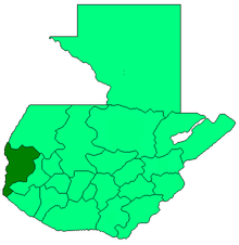
San Antonio Sacatepéquez (Spanish pronunciation: [san anˈtonjo sakateˈpekes]) is a municipality in the San Marcos department of Guatemala.
San Antonio Sacatepéquez | |
|---|---|
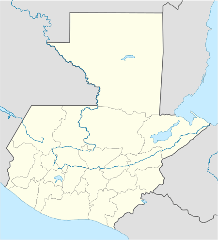 San Antonio Sacatepéquez Location in Guatemala | |
| Coordinates: 14°58′N 91°44′W | |
| Country | |
| Department | |
| Government | |
| • Mayor (2012-2020) | Willian Fuentes[1] (Partido Patriota) |
| Time zone | GMT -6 |
| Climate | Cwb |
Communities
| Location | # | Name |
|---|---|---|
| Villages | 1 | Las Barrancas |
| 2 | San Isidro Ixcolochi | |
| 3 | Candelaria Siquival | |
| 4 | Santa Rita | |
| 5 | Santa Irene | |
| 6 | San Miguel de Los Altos | |
| 7 | Santa Rosa de Lima | |
| 8 | San José Granados | |
| 9 | San Rafael Sacatepéquez | |
| 10 | Santo Domingo | |
| Settlements | 1 | La Felicidad |
| 2 | Vista Hermosa | |
| 3 | San Francisco | |
| 4 | Siete Tambores | |
| 5 | Nueva Jerusalén | |
| 6 | Potrerillos | |
| 7 | Canchegua | |
| 8 | El Mirador | |
| 9 | San Ramón | |
| 10 | Tojchiná | |
| 11 | Las Escobas |
Climate
San Antonio Sacatepéqueztiene clima templado (Köppen:Cwb).
| Climate data for San Antonio Sacatepéquez | |||||||||||||
|---|---|---|---|---|---|---|---|---|---|---|---|---|---|
| Month | Jan | Feb | Mar | Apr | May | Jun | Jul | Aug | Sep | Oct | Nov | Dec | Year |
| Average high °C (°F) | 17.3 (63.1) |
17.8 (64.0) |
19.4 (66.9) |
20.4 (68.7) |
20.3 (68.5) |
19.5 (67.1) |
19.4 (66.9) |
19.9 (67.8) |
19.4 (66.9) |
18.6 (65.5) |
18.2 (64.8) |
17.6 (63.7) |
19.0 (66.2) |
| Daily mean °C (°F) | 9.8 (49.6) |
10.2 (50.4) |
11.8 (53.2) |
13.4 (56.1) |
14.5 (58.1) |
14.5 (58.1) |
14.4 (57.9) |
14.2 (57.6) |
14.4 (57.9) |
13.5 (56.3) |
11.8 (53.2) |
10.8 (51.4) |
12.8 (55.0) |
| Average low °C (°F) | 2.4 (36.3) |
2.7 (36.9) |
4.2 (39.6) |
6.4 (43.5) |
8.8 (47.8) |
9.6 (49.3) |
9.4 (48.9) |
8.5 (47.3) |
9.4 (48.9) |
8.4 (47.1) |
5.5 (41.9) |
4.1 (39.4) |
6.6 (43.9) |
| Average precipitation mm (inches) | 5 (0.2) |
5 (0.2) |
23 (0.9) |
61 (2.4) |
210 (8.3) |
305 (12.0) |
230 (9.1) |
252 (9.9) |
290 (11.4) |
201 (7.9) |
21 (0.8) |
12 (0.5) |
1,615 (63.6) |
| Source: Climate-Data.org[3] | |||||||||||||
Geographic location
San Antonio Sacatepéquez is located 9 km SE of San Marcos.
Places adjacent to San Antonio Sacatepéquez | ||||||||||
|---|---|---|---|---|---|---|---|---|---|---|
| ||||||||||
References
- "San Marcos elige autoridades municipales". Prensa Libre (in Spanish). Guatemala. 8 September 2015. Retrieved 8 September 2015.CS1 maint: ref=harv (link)
- http://sanantonio.mancuerna.org/index.php?option=com_content&view=article&id=5&Itemid=2
- "Climate: San Antonio Sacatepéquez". Climate-Data.org. Retrieved 5 September 2015.
- SEGEPLAN. "Municipios del departamento de San Marcos". Secretaría General de Planificación (in Spanish). Archived from the original on 10 July 2015.CS1 maint: ref=harv (link)
This article is issued from Wikipedia. The text is licensed under Creative Commons - Attribution - Sharealike. Additional terms may apply for the media files.