El Tumbador
El Tumbador is a town and municipality in the San Marcos department of Guatemala. The population is mostly of Mam people, who speak their own language. It was founded in 1878.
El Tumbador | |
|---|---|
Municipality | |
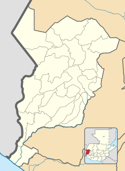 El Tumbador Location in San Marcos Department, Guatemala 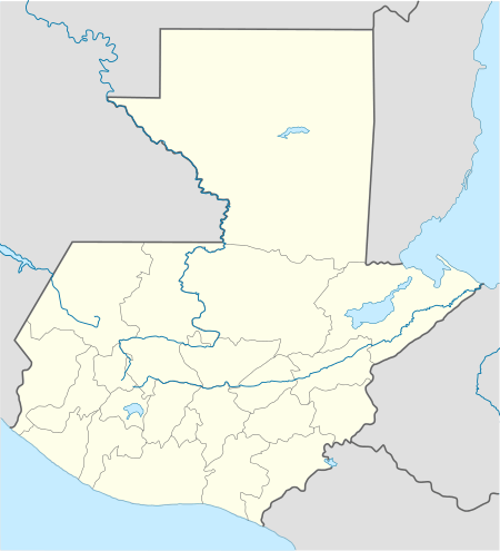 El Tumbador El Tumbador (Guatemala) | |
| Coordinates: 14°52′00″N 91°56′00″W | |
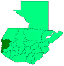
| Country | |
| Department | |
| Government | |
| • Mayor | Augusto Echeverría[1] (LIDER) |
| Area | |
| • Municipality | 166 km2 (64 sq mi) |
| Population (2018 census)[2] | |
| • Municipality | 44,395 |
| • Density | 270/km2 (690/sq mi) |
| • Urban | 8,856 |
| Climate | Am |
The main source of income is agriculture—farming and animal husbandry. People produce mostly coffee, but also sugarcane, beans, cassava, fruits and spices—cardamom and macadamia. Cattle, horses, sheep and goats are bred in the area as well.
El Tumbador gave its name to the Belgian Non-governmental organization Tumbador vzw that used to support a project in the municipality.
Climate
El Tumbador has tropical climate (Köppen: Am).
| Climate data for El Tumbador | |||||||||||||
|---|---|---|---|---|---|---|---|---|---|---|---|---|---|
| Month | Jan | Feb | Mar | Apr | May | Jun | Jul | Aug | Sep | Oct | Nov | Dec | Year |
| Average high °C (°F) | 28.7 (83.7) |
29.0 (84.2) |
29.9 (85.8) |
30.0 (86.0) |
29.6 (85.3) |
28.4 (83.1) |
29.0 (84.2) |
29.2 (84.6) |
28.3 (82.9) |
28.3 (82.9) |
28.4 (83.1) |
28.6 (83.5) |
29.0 (84.1) |
| Daily mean °C (°F) | 22.6 (72.7) |
22.9 (73.2) |
23.6 (74.5) |
24.0 (75.2) |
23.9 (75.0) |
23.2 (73.8) |
23.4 (74.1) |
23.5 (74.3) |
23.1 (73.6) |
23.1 (73.6) |
22.9 (73.2) |
22.8 (73.0) |
23.3 (73.9) |
| Average low °C (°F) | 16.6 (61.9) |
16.8 (62.2) |
17.3 (63.1) |
18.1 (64.6) |
18.3 (64.9) |
18.0 (64.4) |
17.8 (64.0) |
17.9 (64.2) |
17.9 (64.2) |
17.9 (64.2) |
17.5 (63.5) |
17.0 (62.6) |
17.6 (63.7) |
| Average precipitation mm (inches) | 47 (1.9) |
58 (2.3) |
121 (4.8) |
260 (10.2) |
536 (21.1) |
724 (28.5) |
513 (20.2) |
543 (21.4) |
747 (29.4) |
618 (24.3) |
187 (7.4) |
76 (3.0) |
4,430 (174.5) |
| Source: Climate-Data.org[3] | |||||||||||||
Geographic location
It is surrounded by San Marcos Department municipalities:
Places adjacent to El Tumbador | ||||||||||
|---|---|---|---|---|---|---|---|---|---|---|
| ||||||||||
See also

References
- "San Marcos elige autoridades municipales". Prensa Libre (in Spanish). Guatemala. 8 September 2015. Retrieved 8 September 2015.CS1 maint: ref=harv (link)
- Citypopulation.de Population of departments and municipalities in Guatemala
- "Climate: El Tumbador". Climate-Data.org. Retrieved 5 September 2015.
- SEGEPLAN. "Municipios del departamento de San Marcos". Secretaría General de Planificación (in Spanish). Archived from the original on 10 July 2015.CS1 maint: ref=harv (link)
External links
This article is issued from Wikipedia. The text is licensed under Creative Commons - Attribution - Sharealike. Additional terms may apply for the media files.