Saint-Martin-d'Entraunes
Saint-Martin-d'Entraunes is a commune in the Alpes-Maritimes department in southeastern France. It is located in the middle stretches of the Var valley, situated at the limits of the Mercantour National Park.[2]
Saint-Martin-d'Entraunes | |
|---|---|
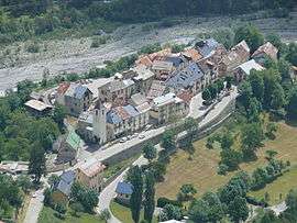 A view of the village from the road to the Col des Champs | |
 Coat of arms | |
Location of Saint-Martin-d'Entraunes 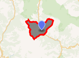
| |
 Saint-Martin-d'Entraunes  Saint-Martin-d'Entraunes | |
| Coordinates: 44°08′34″N 6°45′46″E | |
| Country | France |
| Region | Provence-Alpes-Côte d'Azur |
| Department | Alpes-Maritimes |
| Arrondissement | Nice |
| Canton | Vence |
| Intercommunality | Cians Var |
| Government | |
| • Mayor (2008–2014) | Bertrand Leflon |
| Area 1 | 40.05 km2 (15.46 sq mi) |
| Population (2017-01-01)[1] | 142 |
| • Density | 3.5/km2 (9.2/sq mi) |
| Time zone | UTC+01:00 (CET) |
| • Summer (DST) | UTC+02:00 (CEST) |
| INSEE/Postal code | 06125 /06470 |
| Elevation | 968–2,742 m (3,176–8,996 ft) (avg. 1,050 m or 3,440 ft) |
| 1 French Land Register data, which excludes lakes, ponds, glaciers > 1 km2 (0.386 sq mi or 247 acres) and river estuaries. | |
Population
| Historical population | ||
|---|---|---|
| Year | Pop. | ±% |
| 1962 | 167 | — |
| 1968 | 172 | +3.0% |
| 1975 | 115 | −33.1% |
| 1982 | 113 | −1.7% |
| 1990 | 113 | +0.0% |
| 1999 | 88 | −22.1% |
| 2008 | 84 | −4.5% |
In popular culture
It was included in the 2014 racing game Forza Horizon 2.
References
- "Populations légales 2017". INSEE. Retrieved 6 January 2020.
- "Saint-Martin-d'Entraunes, Alpes Maritimes, France". www.provenceweb.fr. Retrieved 2018-08-15.
| Wikimedia Commons has media related to Saint-Martin-d'Entraunes. |
This article is issued from Wikipedia. The text is licensed under Creative Commons - Attribution - Sharealike. Additional terms may apply for the media files.