Aspremont, Alpes-Maritimes
Aspremont is a commune in the Alpes-Maritimes department in the Provence-Alpes-Côte d'Azur region of south-eastern France.
Aspremont | |
|---|---|
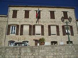 Aspremont Town Hall | |
.svg.png) Coat of arms | |
Location of Aspremont 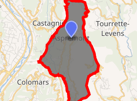
| |
 Aspremont  Aspremont | |
| Coordinates: 43°47′03″N 7°14′42″E | |
| Country | France |
| Region | Provence-Alpes-Côte d'Azur |
| Department | Alpes-Maritimes |
| Arrondissement | Nice |
| Canton | Tourrette-Levens |
| Intercommunality | Métropole Nice Côte d'Azur |
| Government | |
| • Mayor (2014-2020) | Alexandre Ferretti |
| Area 1 | 9.44 km2 (3.64 sq mi) |
| Population (2017-01-01)[1] | 2,187 |
| • Density | 230/km2 (600/sq mi) |
| Time zone | UTC+01:00 (CET) |
| • Summer (DST) | UTC+02:00 (CEST) |
| INSEE/Postal code | 06006 /06790 |
| Elevation | 100–855 m (328–2,805 ft) (avg. 530 m or 1,740 ft) |
| 1 French Land Register data, which excludes lakes, ponds, glaciers > 1 km2 (0.386 sq mi or 247 acres) and river estuaries. | |
The inhabitants of the commune are known as Aspremontois or Aspremontoises.[2]
Geography
Aspremont is located some 10 km north of Nice and 5 km east of Carros. Access to the commune is by road M414 (Route de Nice) from Nice in the south, by the M14 road from Saint-Blaise in the north, and by the M719 from Tourrette-Levens in the east. Apart from the village there are the towns of Les Salettes, La Plaine, La Valliere, and La Prairie near the village and Les Templiers, Bassac, Cabanes Bletonnieres, and Gibeste in the south. The commune is rugged and heavily forested in the west and east.[3]
The Magnan river rises near the village and flows south through the heart of the commune then to the Mediterranean Sea in the south-west of Nice.[3]
Aspremont is one of sixteen villages grouped together by the Métropole Nice Côte d'Azur tourist department as the Route des Villages Perchés (Route of Perched Villages). The others are: Carros, Castagniers, Coaraze, Colomars, Duranus, Èze, Falicon, La Gaude, Lantosque, Levens, La Roquette-sur-Var, Saint-Blaise, Saint-Jeannet, Tourrette-Levens and Utelle.[4]
Neighbouring communes and villages[3]
Places adjacent to Aspremont, Alpes-Maritimes | |
|---|---|
History
After the abandonment of the Aspremont-le-Vieux site in 1426, a fortified village was built in concentric circles at the foot of Mont-Chauve on a hill overlooking a path between the Var and the Paillon de Tourrette Valley. Soil and sunshine favoured the cultivation of vines, olives, and fruit trees, particularly fig trees. There was production of wine and olive oil in the county until the end of the 19th century.
In 1874 Aspremont had its land area divided to create the new communes of Colomars and Castagniers.
Heraldry
Arms of Aspremont |
Blazon: Argent, an eagle of Gules preying on a mount of 3 hillocks of Sable issuant in base, surmounted by a mullet of Azure. |
Administration
List of Successive Mayors[5]
| From | To | Name | Party | Position |
|---|---|---|---|---|
| 1981 | Léon Astraudo | |||
| 1981 | 2001 | Honoré Trastour | ||
| 2001 | Current | Alexandre Ferretti | DVD |
(Not all data is known)
Population
| Historical population | ||
|---|---|---|
| Year | Pop. | ±% |
| 2014 | 2,034 | — |
| 2006 | 2,072 | +1.9% |
| 2007 | 2,106 | +1.6% |
| 2008 | 2,139 | +1.6% |
| 2009 | 2,173 | +1.6% |
| 2010 | 2,187 | +0.6% |
| 2011 | 2,195 | +0.4% |
| 2012 | 2,179 | −0.7% |
| 2013 | 2,162 | −0.8% |
| 2014 | 2,146 | −0.7% |
| 2015 | 2,139 | −0.3% |
| 2016 | 2,144 | +0.2% |
Sites and monuments
- Fort of Mont Chauve of Aspremont (19th century)

- Ruins of the medieval village on Mont Cima
- The house where François-Xavier Maistre was born
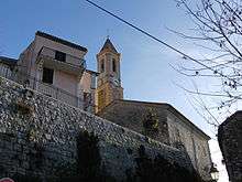
- Church of Saint-Jacques le Mejeur
- Chapel of Saint-Claude
- Chapel of Notre-Dame des Salettes
Notable people linked to the commune
- François-Xavier Maistre (1705-1789), President of the Senate of Savoy, father of Joseph de Maistre and Xavier de Maistre, was a native of Aspremont in the County of Nice.
- Magma, a musical group, has had a recording studio in the commune since 2010.[7]
Twin Towns

Notes and references
Notes
References
- "Populations légales 2017". INSEE. Retrieved 6 January 2020.
- Inhabitants of Alpes-Maritimes (in French)
- Google Maps
- "The route of perched villages" (PDF). Métropole Nice Côte d'Azur. 2013.
- List of Mayors of France (in French)
- Ministry of Culture, Mérimée IA06000009 Fort of Mont Chauve (in French)
- Blog of Philippe Dupuy (in French)
External links
| Wikimedia Commons has media related to Aspremont, Alpes-Maritimes. |
- Aspremont commune website (in French)
- Aspremont on the old IGN website (in French)
- Aspremont on Google Maps
- Aspremont on Géoportail, National Geographic Institute (IGN) website (in French)
- Aspremont on the 1750 Cassini Map
- Aspremont on the INSEE website (in French)
- INSEE (in French)
| Authority control |
|
|---|